Pumpkin Hill Creek Preserve State Park Trail
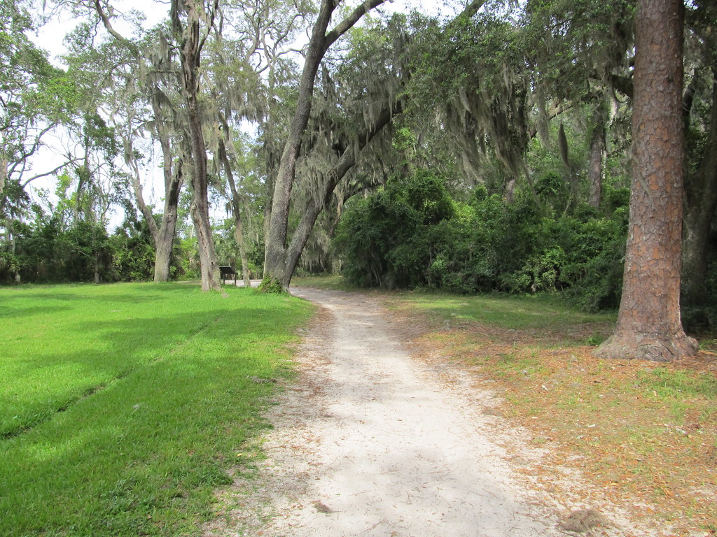
 Photo: KirkOls, CC BY 2.0 (via Flickr)
At a glance
Pumpkin Hill Creek Preserve State Park Trail is a moderate out-and-back hike in Florida, about 2 miles from the town of Cedar Point. The route is roughly 8 miles long, with a total elevation gain of about 195 feet, and it is rated moderate. The trail's low point sits at about 13 feet, and the high point is about 44 feet, with the steepest stretch coming around the half-mile mark at about 3%. Spring and fall are the most comfortable times to go. Typical averages from a nearby weather station show April highs around 77°F and October highs around 80°F, while July and August average about 90°F with the most wet days of the year. The hike takes about 3 hours. Several other trails start close by, including the Main Trail about 0.1 mile away, the Deer Run Trail about 0.4 mile away and the Turkey Trot Trail about 0.7 mile away. The Timucuan Trail System is about 2 miles off.
- round trip
- 4.1 mi
- climb
- 195 ft
- high point
- 44 ft
- route
- Out and back
- time
- About 1.5 hours
- best months
- Oct–May
Near: Cedar Point, Florida · 2 mi
Best time to visit Pumpkin Hill Creek Preserve State Park Trail
Best months: October–May. Best months have typical highs of 55–85 °F, lows of 30 °F or warmer (32 °F where the station doesn't record snow), at most one snowy day and no more than 12 wet days.
Jan
64°
47°
9 wet
Feb
66°
49°
8 wet
Mar
71°
54°
9 wet
Apr
77°
60°
7 wet
May
83°
68°
8 wet
Jun
88°
73°
12 wet
Jul
90°
75°
13 wet
Aug
89°
75°
14 wet
Sep
86°
73°
12 wet
Oct
80°
66°
10 wet
Nov
72°
57°
8 wet
Dec
66°
50°
9 wet
Typical high / low (°F) and days with rain or snow, 1991–2020. Measured at Mayport Pilot Stn, FL, 6.1 mi away at 16 ft. This station doesn't record snowfall. Source: NOAA NCEI U.S. Climate Normals 1991–2020.
Been here? Tell people how it was.
- Main TrailHikingPhoto: KirkOls, CC BY 2.0 (via Flickr)0.1 mi
- Deer Run TrailHiking0.4 mi
- Turkey Trot TrailHiking0.7 mi
- Cedar Point Preserve TrailHiking0.9 mi
 Hammock TrailHikingPhoto: Rob Bixby, CC BY 2.0 (via Flickr)1.7 mi
- Timucuan Trail SystemHiking2 mi
- Flatwoods TrailHikingPhoto: Rob Bixby, CC BY 2.0 (via Flickr)2.1 mi
- Big Talbot Island State Park TrailHiking3.1 mi
- Hammock TrailHikingPhoto: Rob Bixby, CC BY 2.0 (via Flickr)~3 min drive
- Timucuan Trail SystemHiking~3 min drive
- Piney Loop TrailHikingPhoto: Rob Bixby, CC BY 2.0 (via Flickr)~3 min drive
- Big Talbot Island State Park TrailHiking~5 min drive
- Flatwoods TrailHikingPhoto: Rob Bixby, CC BY 2.0 (via Flickr)~4 min drive
- River Glen SidewalkHiking~23 min drive
 Big Talbot Island State Park Hiking TrailHikingPhoto: gary_leavens, CC BY-SA 2.0 (via Wikimedia Commons)~6 min drive
- East Coast Greenway - Duval County CorridorHikingPhoto: gary_leavens, CC BY-SA 2.0 (via Wikimedia Commons)~7 min drive
 Lae Loop TrailHikingPhoto: gary_leavens, CC BY-SA 2.0 (via Flickr)~7 min drive
 TIMU-FOCA-Hammock TrailHikingPhoto: Ken Lund, CC BY-SA 2.0 (via Flickr)~9 min drive
Conditions and forecast
Daily highs and lows, wind and the chance of precipitation at Start for the next 7 days, from the Open-Meteo model.
Ask about this place
Questions about Pumpkin Hill Creek Preserve State Park Trail: conditions, access, timing. Answers say when something isn't known.
Map and trail data © OpenStreetMap contributors
