Fanny Bay
- 1.0 mi
- round trip
- 59 ft
- climb
- 158 ft
- high point
- Out and back
- route
- Oct–May
- best months
Is Fanny Bay open right now?
Closure in the area
There's a closure order in National Forests in Florida. It doesn't name Fanny Bay, so check the source for the area it covers.
Travel Management & Off-Highway Vehicle (OHV) Program
Agency closure covering National Forests in Florida · USFS · National Forests in Florida
Fire Restrictions in Effect for Ocala National Forest
Agency alert covering National Forests in Florida · USFS · National Forests in Florida
As of · Source: USFS · National Forests in Florida. Agencies don't list every closure — check before you go.
Fanny Bay is a short, easy hike in the Osceola Ranger District of the National Forests in Florida, managed by the Forest Service. The trail is about a mile long and is an out-and-back route with almost no elevation change, so it works well as a quick outing or a stop on the way to another destination. The trail is on natural ground, and it is not open to bikes or horses. The climb is flat, with the high point at about 158 feet and the low at about 149 feet. The steepest stretch is a small rise of about 3% at roughly 0.13 miles in. Spring and fall are the most comfortable times to go. Typical averages from a nearby weather station in Lake City show April and October highs around 79°F with lows in the mid-50s and only about seven or eight wet days a month. Summer is hotter and wetter, with July highs near 90°F and about 16 wet days. Ocean Pond Campground is about 2 miles away, and The Landing is about 3 miles away. The Us 90 Connector hike is about 3.7 miles off, and Wiggins Campground is about 6.9 miles away.
Best time to go · Oct–May
Best time to visit Fanny Bay
Best months: October–May. Best months have typical highs of 55–85 °F, lows of 30 °F or warmer (32 °F where the station doesn't record snow), at most one snowy day and no more than 12 wet days.
Jan
63° / 41°
11 wet
Feb
67° / 44°
9 wet
Mar
73° / 49°
9 wet
Apr
79° / 54°
7 wet
May
85° / 62°
8 wet
Jun
88° / 68°
14 wet
Jul
90° / 70°
16 wet
Aug
89° / 70°
16 wet
Sep
86° / 67°
12 wet
Oct
79° / 59°
8 wet
Nov
71° / 49°
8 wet
Dec
66° / 44°
10 wet
Typical high / low (°F) and days with rain or snow, 1991–2020. Measured at Lake City 2 E, FL, 12.2 mi away at 195 ft. Source: NOAA NCEI U.S. Climate Normals 1991–2020.
Keep exploring — more trails worth the drive
 Photo: pseabolt, CC BY 3.0 (via Wikimedia Commons)
Chesser Island Boardwalk
~59 min drive
0.67-mile out-and-back boardwalk trail in Georgia with 34 ft elevation gain.
HIKE
GREEN HORSE TRAIL
~19 min drive
35.44-mile out-and-back trail in Florida with 1,152 ft elevation gain/loss
HIKE
Camp Blanding Roadwalk
~1h 7m drive
5.27-mile out-and-back trail in Florida with 377 ft elevation gain.
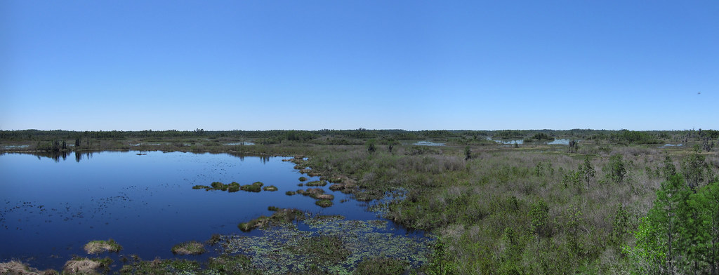 Photo: cm195902, CC BY 2.0 (via Flickr)
Deerstand Trail
~59 min drive
0.47-mile out-and-back trail in Georgia with 128 ft max elevation.
HIKE
Old Alachua Trail
~59 min drive
11.28-mile out-and-back trail in Florida with 132 ft elevation gain.
HIKE
Sr 21 Path (Keystone Heights to Mike Roess Gold Head Branch Sp)
~1h 8m drive
5.99-mile out-and-back trail in Florida with 88 ft elevation gain.
Photo: cm195902, CC BY 2.0 (via Flickr)Chesser Island Homestead Nature Trail
~60 min drive
0.79-mile loop trail in Georgia managed by the U.S. Fish and Wildlife Service.
HIKE
San Felasco Hammock Preserve State Park Trail
~1h 5m drive
15.89-mile out-and-back trail in San Felasco Hammock Preserve State Park, Florida
HIKE
Woods Ferry Conservation Area Trail
~57 min drive
7.76-mile out-and-back trail in Florida with 949 ft elevation gain
 Photo: pseabolt, CC BY 3.0 (via Wikimedia Commons)
Canal Diggers Trail
~1h 3m drive
0.63-mile out-and-back trail in Georgia with 10 ft of elevation gain.


