Bessies Falls
- 9,304 ft
- elevation
- Forest Service
- managed by
- May–Sep
- best months
Is Bessies Falls open right now?
Alert in the area
The Forest Service lists 6 alerts for White River National Forest.
FSR 286, Radical Hill, is closed due to washouts and unsafe conditions
Agency alert covering White River National Forest · USFS · White River National Forest
Limited parking at Snowmass Creek Trailhead
Agency alert covering White River National Forest · USFS · White River National Forest
Grizzly Creek Trail Closure
Agency alert covering White River National Forest · Order 2026-02 · USFS · White River National Forest
Ruedi Marina Day Use area Dump Station is CLOSED
Agency alert covering White River National Forest · USFS · White River National Forest
Asbestos safety closure - Camp Hale
Agency alert covering White River National Forest · USFS · White River National Forest
As of · Source: USFS · White River National Forest. Agencies don't list every closure — check before you go.
Bessies Falls is a waterfall in the Flat Tops Wilderness, part of the Blanco Ranger District of White River National Forest in western Colorado. The Forest Service manages the land, and the nearest town is Carbonate, about 18 miles away. The falls sit at roughly 9,300 feet. Summer is the most comfortable time to visit. Typical averages from the nearby Yampa weather station show July highs around 79°F with lows near 46°F, and the falls sit higher than that station, so expect it to run a little cooler. Several mountain biking trails start close by, including Big Fish, Himes Peak and Boulder Lake, all within about a mile. For an overnight stay, Himes Peak Campground is about 2 miles away.
- Elevation
- 9,304 ft
- Land manager
- Forest Service
Elevation from USGS 3D Elevation Program terrain data (about 10 m resolution).
- Big FishMountain biking0.4 mi
- Himes PeakMountain biking0.7 mi
 Boulder LakeMountain bikingPhoto: Jeffrey Beall, CC BY 4.0 (via Wikimedia Commons)0.9 mi
- Himes Peak CampgroundCamping1.9 mi
- Trappers Lake/Shephards Rim CampgroundCamping2 mi
- Shepherds Rim CampgroundCamping2 mi
- Lake Of The WoodsLake fishing2 mi
 North Fork White RiverCanoeingPhoto: Jeffrey Beall, CC BY 4.0 (via Wikimedia Commons)4.2 mi
Source: Roamze catalog (indexable pages within 10 miles, PostGIS distance)
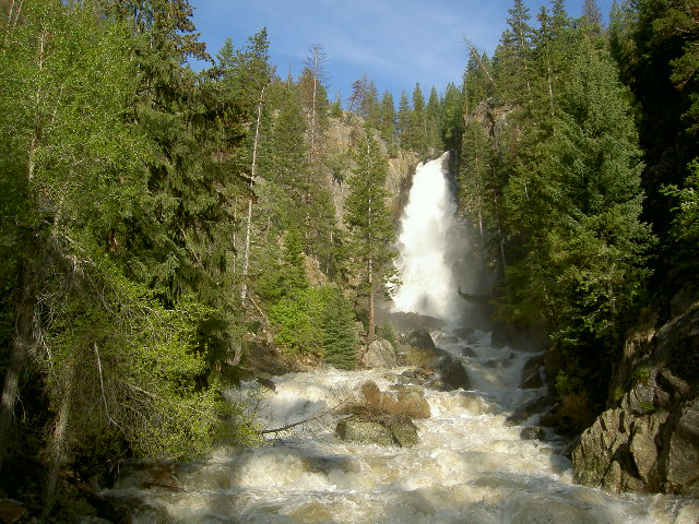 Fish Creek FallsWaterfall · ~1h 13m drivePhoto: Roy Brumback, CC BY-SA 3.0 (via Wikimedia Commons)
- South Fork FallsWaterfall · ~22 min drive
- Bridal Veil FallsWaterfall · ~48 min drive
- Rifle FallsWaterfall · ~54 min drive
- Morgan Creek FallsWaterfall · ~1h 5m drive
- Whitnach FallsWaterfall · ~1h 18m drive
- East Middle Fork FallsWaterfall · ~1h 24m drive
- East Fork FallsWaterfall · ~1h 25m drive
Best time to visit Bessies Falls
Best months: May–September. Best months have typical highs of 55–85 °F, lows of 30 °F or warmer (32 °F where the station doesn't record snow), at most one snowy day and no more than 12 wet days.
Jan
32° / 7°
12 wet
Feb
34° / 9°
11 wet
Mar
43° / 17°
10 wet
Apr
52° / 24°
11 wet
May
62° / 33°
10 wet
Jun
74° / 40°
8 wet
Jul
79° / 46°
10 wet
Aug
77° / 45°
11 wet
Sep
70° / 37°
9 wet
Oct
57° / 27°
8 wet
Nov
42° / 17°
9 wet
Dec
32° / 8°
11 wet
Typical high / low (°F) and days with rain or snow, 1991–2020. Measured at Yampa, CO, 22.3 mi away at 7,857 ft. The station sits about 1,400 ft lower than this place, so expect it a little cooler here. This station doesn't record snowfall. Source: NOAA NCEI U.S. Climate Normals 1991–2020.

