Corkscrew Camping Area
Campground
Campground · 2.3 mi from the trail
 Photo: Murray Foubister, CC BY-SA 2.0 (via Wikimedia Commons)
Closure in the area
There's a closure order in Grand Mesa, Uncompahgre and Gunnison National Forests. It doesn't name Abrams Mountain, so check the source for the area it covers (2 listed).
Gold Mountain Wildfire Roads and Trails Closure Order v 4.0
Agency closure covering Grand Mesa, Uncompahgre and Gunnison National Forests · USFS · Grand Mesa, Uncompahgre and Gunnison National Forests
Ophir Pass Road Closure
Agency closure covering Grand Mesa, Uncompahgre and Gunnison National Forests · USFS · Grand Mesa, Uncompahgre and Gunnison National Forests
Potter Basin Road Closure Order
Agency alert covering Grand Mesa, Uncompahgre and Gunnison National Forests · USFS · Grand Mesa, Uncompahgre and Gunnison National Forests
Beaver Park Road Closure Order
Agency alert covering Grand Mesa, Uncompahgre and Gunnison National Forests · USFS · Grand Mesa, Uncompahgre and Gunnison National Forests
TERMINATION OF ORDER - FIRE RESTRICTIONS
Agency alert covering Grand Mesa, Uncompahgre and Gunnison National Forests · USFS · Grand Mesa, Uncompahgre and Gunnison National Forests
As of · Source: USFS · Grand Mesa, Uncompahgre and Gunnison National Forests. Agencies don't list every closure — check before you go.
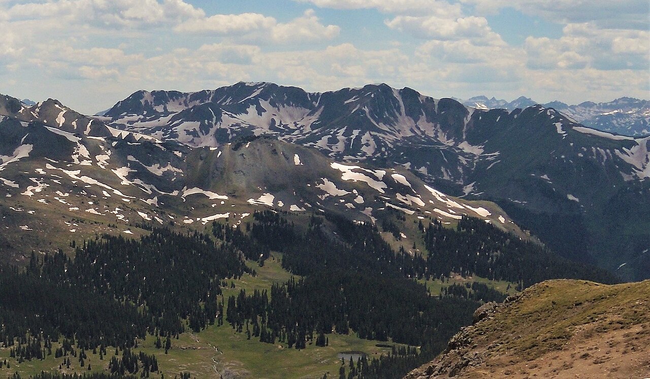
Abrams Mountain is a summit of about 12,806 feet in Ouray County, Colorado, within the Ouray Ranger District of the Grand Mesa, Uncompahgre and Gunnison National Forests. The Forest Service manages the land, and the nearest town is Ouray, about 5 miles away. The closest neighbors are the Albany Loop Trail and the Hayden hike, both about a mile away, and the Waterfall Wall climbing area at roughly 1.4 miles. For an overnight base, Corkscrew Camping Area sits about 2.3 miles off.
Corkscrew Camping Area
Campground
Smuggler Union Tramhouse
Attraction
Places © OpenStreetMap contributors
More in TellurideDaily highs and lows, wind and the chance of precipitation at the summit for the next 7 days, from the Open-Meteo model.
Elevation from USGS 3D Elevation Program terrain data (about 10 m resolution).
We don't know of a mapped trail or route to the summit of Abrams Mountain. Plan the approach with local maps, a guidebook or a local guide, and check conditions before you go.
12,806 ft (3,903 m).
We don't know of a mapped trail or route to the summit. Plan the approach with local maps, a guidebook or a local guide.



 Albany Loop TrailHikingPhoto: Sandy Horvath-Dori from Grand Junction, CO, USA, CC BY 2.0 (via Wikimedia Commons)1.2 miHaydenHikingPhoto: Sandy Horvath-Dori from Grand Junction, CO, USA, CC BY 2.0 (via Wikimedia Commons)1.2 mi
 Waterfall WallRock climbingPhoto: iagoarchangel, CC BY-SA 2.0 (via Flickr)1.4 mi
 Animas RiverCanoeingPhoto: Clyde frogg, CC BY-SA 3.0 (via Wikimedia Commons)9.2 mi
Source: Roamze catalog (indexable pages within 10 miles, PostGIS distance)
Tuttle MountainSummit · ~4 min drivePhoto: Kimon Berlin, CC BY-SA 2.0 (via Wikimedia Commons)Brown MountainSummit · ~5 min drivePhoto: SFC H, CC BY 3.0 (via Wikimedia Commons)Engineer MountainSummit · ~5 min drivePhoto: Larry Lamsa, CC BY 2.0 (via Wikimedia Commons)Darley MountainSummit · ~5 min drivePhoto: JohnHirth, CC BY-SA 3.0 (via Wikimedia Commons) Emery PeakSummit · ~9 min drivePhoto: Grayskullduggery, CC BY-SA 2.0 (via Wikimedia Commons)
 United States MountainSummit · ~9 min drivePhoto: Larry Lamsa, CC BY 2.0 (via Wikimedia Commons)
 Gravel MountainSummit · ~9 min drivePhoto: Kyle Harmon, CC BY 2.0 (via Wikimedia Commons)
 Twin PeaksSummit · ~9 min drivePhoto: Person-with-No Name, CC BY 2.0 (via Wikimedia Commons)
 Cinnamon MountainSummit · ~10 min drivePhoto: robert thigpen, CC BY-SA 2.0 (via Wikimedia Commons)
 Wood MountainSummit · ~10 min drivePhoto: Eggbones, CC BY-SA 4.0 (via Wikimedia Commons)
Also worth it near here
Albany Loop TrailHiking · ~2 min drivePhoto: Sandy Horvath-Dori from Grand Junction, CO, USA, CC BY 2.0 (via Wikimedia Commons)Waterfall WallRock climbing · ~2 min drivePhoto: iagoarchangel, CC BY-SA 2.0 (via Flickr) Iron FenCross-country skiing · ~3 min drivePhoto: Sandy Horvath-Dori from Grand Junction, CO, USA, CC BY 2.0 (via Wikimedia Commons)
 Bear Creek-South ForkMountain biking · ~5 min drivePhoto: robert thigpen from diboll, texas, CC BY-SA 2.0 (via Wikimedia Commons)
