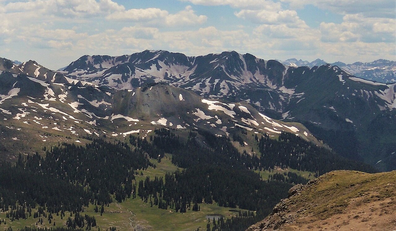
Million Dollar Highway Free Campsite
Campground
Campground · 0.8 mi from the trail
 Photo: Sandy Horvath-Dori from Grand Junction, CO, USA, CC BY 2.0 (via Wikimedia Commons)
Closure in the area
There's a closure order in Grand Mesa, Uncompahgre and Gunnison National Forests. It doesn't name Colorado Boy, so check the source for the area it covers (2 listed).
Gold Mountain Wildfire Roads and Trails Closure Order v 4.0
Agency closure covering Grand Mesa, Uncompahgre and Gunnison National Forests · USFS · Grand Mesa, Uncompahgre and Gunnison National Forests
Ophir Pass Road Closure
Agency closure covering Grand Mesa, Uncompahgre and Gunnison National Forests · USFS · Grand Mesa, Uncompahgre and Gunnison National Forests
TERMINATION OF ORDER - FIRE RESTRICTIONS
Agency alert covering Grand Mesa, Uncompahgre and Gunnison National Forests · USFS · Grand Mesa, Uncompahgre and Gunnison National Forests
Dallas Area Closure order
Agency alert covering Grand Mesa, Uncompahgre and Gunnison National Forests · USFS · Grand Mesa, Uncompahgre and Gunnison National Forests
Island Lake Road Closure
Agency alert covering Grand Mesa, Uncompahgre and Gunnison National Forests · USFS · Grand Mesa, Uncompahgre and Gunnison National Forests
As of · Source: USFS · Grand Mesa, Uncompahgre and Gunnison National Forests. Agencies don't list every closure — check before you go.
Colorado Boy is a cross-country ski route in the Ouray Ranger District of the Grand Mesa, Uncompahgre and Gunnison National Forests in Colorado. It is a short, moderate outing of about a third of a mile, with a total elevation gain of 63 feet, and it sits at around 10,000 feet, making it an easy addition to a day on the snow. The route rises from a low point of 9,926 feet to a high of 10,017 feet. The steepest part comes early, at about 9% grade, but the climb is gentle overall. Winter is the natural season for skiing here. Typical averages from a nearby weather station in Silverton, at a lower elevation, put January highs around 34°F with lows near -6°F, while June and July run warmer, with highs in the low 70s. South Pipeline is just 0.1 mile away, and Silver Belle is 0.3 mile off. For camping, the Million Dollar Highway Free Campsite is 0.8 mile away, and Waterfall Wall, a climbing area, is about 3.8 miles out.
Million Dollar Highway Free Campsite
Campground
Colorado Boy Southwest Pub
Restaurant
Smuggler Union Tramhouse
Attraction
Places © OpenStreetMap contributors
More in TellurideNot on Roamze yet. Their page has how to reach them.
No month here meets our mild-weather rule. Best months have typical highs of 55–85 °F, lows of 30 °F or warmer (32 °F where the station doesn't record snow), at most one snowy day and no more than 12 wet days.
Jan
34° / -6°
9 wet
Feb
36° / -3°
9 wet
Mar
43° / 6°
10 wet
Apr
48° / 17°
9 wet
May
58° / 25°
9 wet
Jun
70° / 31°
7 wet
Jul
75° / 38°
13 wet
Aug
72° / 37°
15 wet
Sep
66° / 30°
12 wet
Oct
55° / 20°
9 wet
Nov
43° / 7°
8 wet
Dec
34° / -5°
9 wet
Typical high / low (°F) and days with rain or snow, 1991–2020. Measured at Silverton, CO, 8.3 mi away at 9,285 ft. The station sits about 700 ft lower than this place, so expect it a little cooler here. This station doesn't record snowfall. Source: NOAA NCEI U.S. Climate Normals 1991–2020.
Photo: Sandy Horvath-Dori from Grand Junction, CO, USA, CC BY 2.0 (via Wikimedia Commons)Silver Belle
Next door
0.82-mile route in Colorado with 480 ft of elevation gain.
 Photo: Sandy Horvath-Dori from Grand Junction, CO, USA, CC BY 2.0 (via Wikimedia Commons)
Saratoga
~2 min drive
0.76-mile cross-country ski trail in Colorado with 378 ft of elevation gain.
 Photo: Zach Dischner, CC BY 2.0 (via Wikimedia Commons)
Silverton Mountain
~7 min drive
Silverton Mountain in Colorado has 1 advanced downhill run with 714 ft vertical.
 Photo: Ken Lund from Reno, Nevada, USA, CC BY-SA 2.0 (via Wikimedia Commons)
Silver Pick Road
~31 min drive
Gentle 2.18-mile road-based ski tour in Colorado backcountry.
SKI
P Lake Ski Mid Meadow Loop 2
~21 min drive
0.54-mile out-and-back ski out-and-back at P Lake with 65 ft of elevation gain.
Photo: Sandy Horvath-Dori from Grand Junction, CO, USA, CC BY 2.0 (via Wikimedia Commons)North Pipeline
Next door
North Pipeline is a 0.68-mile route in Colorado with 831 feet of elevation gain.
 Photo: Ken Lund from Reno, Nevada, USA, CC BY-SA 2.0 (via Wikimedia Commons)
Uncompahgre River Walk
~14 min drive
1.32-mile route in Colorado with 180 ft of elevation gain.
 Photo: Murray Foubister, CC BY-SA 2.0 (via Wikimedia Commons)
Telluride Ski Area
~14 min drive
Telluride Ski Area in Colorado has 20 lifts and 107 runs, 18 easy, 41 intermediate, 24 advanced, 23 expert, 3,891 ft vertical drop.
SKI
P Lake Ski Start Loop Outer
~21 min drive
0.36-mile loop ski start with 24 ft gain in Colorado.
Photo: Sandy Horvath-Dori from Grand Junction, CO, USA, CC BY 2.0 (via Wikimedia Commons)Corkscrew Gulch Road
~2 min drive
0.28-mile route in Colorado with 386 ft of elevation gain.
Also worth it near here
Map and trail data © OpenStreetMap contributors