Granite Gulch Campground
Campground
Campground · 2.3 mi from the trail
Caution today
Agency alerts are in effect for this area; weather is good · USFS, OpenWeather · checked just now
Alert in the area
The Forest Service lists 4 alerts for Canyon Lakes Ranger District.
Salt Cabin Prescribed (RX) Fire Closure
Agency alert covering Canyon Lakes Ranger District · Order 02-10-05-26-11 · USFS · Canyon Lakes Ranger District
Fire Restrictions
Agency alert covering Arapaho and Roosevelt National Forests · USFS · Arapaho and Roosevelt National Forests
West Crystal A - Mechanical Fuelbreak Area and Road Closure
Agency alert covering Canyon Lakes Ranger District · Order 02-10-05-26-04 · USFS · Canyon Lakes Ranger District
Cameron Peak Fire Road Closures
Agency alert covering Canyon Lakes Ranger District · Order 02-10-05-26-01 · USFS · Canyon Lakes Ranger District
As of · Source: USFS · Canyon Lakes Ranger District. Agencies don't list every closure — check before you go.
Irvin Loop is a short, flat mountain biking loop of about 0.27 miles in the Canyon Lakes Ranger District of the Arapaho and Roosevelt National Forests in Colorado. The Forest Service manages the land, and the route is a loop that rises about 54 feet from its low point at 8,545 feet to a high point at 8,625 feet. The trail is essentially flat, with a total gain of 54 feet and a total loss of 56 feet. The steepest part of the route comes at about 0.07 miles in, with a grade of 6 percent. The elevation change is small, so the ride works well as a quick stop or a warm-up. Summer is the most comfortable time to ride. Typical averages from a nearby weather station at Allenspark run to highs of about 74°F in July and 73°F in August, with lows in the low 40s. The Irvin Homestead is about 0.1 miles away, and the Walker Homestead Trail is about 0.6 miles away. Climbers can head to Big Elk Meadows - Boulders, about 3.5 miles off, and paddlers can find North Saint Vrain Creek about 6.7 miles away.
Granite Gulch Campground
Campground
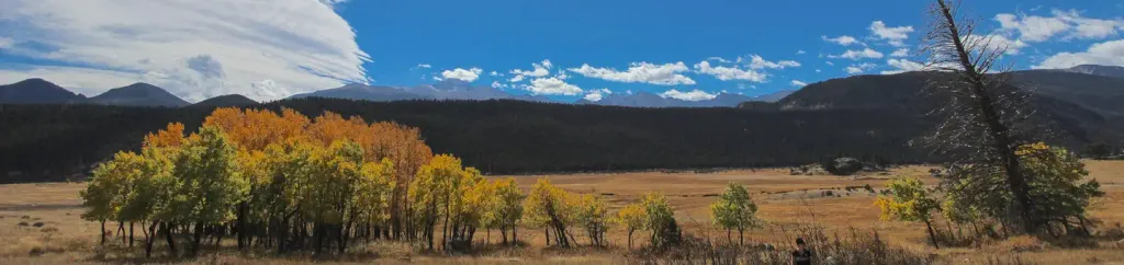
 If it rainsMatt Golon, CC BY-SA 3.0 · Wikimedia Commons
Places © OpenStreetMap contributors, Places © Overture Maps Foundation · Photos: Matt Golon, CC BY-SA 3.0 (commons)
More in Estes Park North Saint Vrain CreekCanoeingPhoto: Hogs555, CC BY-SA 3.0 (via Wikimedia Commons)6.7 mi
 Rocky Mountain National Park Glacier Basin CampgroundCampingPhoto: Recreation.gov (RIDB) / public domain8.2 mi
Source: Roamze catalog (indexable pages within 10 miles, PostGIS distance)
 Bright ExtensionMountain biking · ~12 min drivePhoto: Bradley Furlow, CC BY-SA 4.0 (via Wikimedia Commons)
 Deer RidgeMountain biking · ~12 min drivePhoto: Dustin Delatore whosdustin, CC0 (via Wikimedia Commons)BrightMountain biking · ~13 min drivePhoto: Bradley Furlow, CC BY-SA 4.0 (via Wikimedia Commons)South Sheep MtnMountain biking · ~13 min drivePhoto: Bradley Furlow, CC BY-SA 4.0 (via Wikimedia Commons)Fox CreekMountain biking · ~15 min drivePhoto: Dustin Delatore whosdustin, CC0 (via Wikimedia Commons)Lazy H Horse Trail NetMountain biking · ~15 min drivePhoto: Dustin Delatore whosdustin, CC0 (via Wikimedia Commons)
Best months: May–September. Best months have typical highs of 55–85 °F, lows of 30 °F or warmer (32 °F where the station doesn't record snow), at most one snowy day and no more than 12 wet days.
Jan
32° / 14°
Feb
35° / 15°
Mar
42° / 20°
Apr
46° / 23°
May
56° / 32°
Jun
69° / 38°
Jul
74° / 44°
Aug
73° / 43°
Sep
66° / 36°
Oct
52° / 29°
Nov
41° / 20°
Dec
33° / 14°
Typical high / low (°F) and days with rain or snow, 1991–2020. Measured at Allenspark 3nw, CO, 7.3 mi away at 8,500 ft. This station doesn't record snowfall. Source: NOAA NCEI U.S. Climate Normals 1991–2020.
Map and trail data © OpenStreetMap contributors


