
Broadmoor Outfitters
Mountain Biking business nearby (~9 mi away) — hasn't claimed their Roamze page yet
1.11-mile out-and-back trail in Colorado with 175 ft of elevation gain.
Alert in the area
The Forest Service lists 11 alerts for Pike and San Isabel National Forests.
FSR 286, Radical Hill, is closed due to washouts and unsafe conditions
Agency alert covering Pike and San Isabel National Forests · USFS · Pike and San Isabel National Forests
Interlaken Hotel Tree Hazards
Agency alert covering Pike and San Isabel National Forests · USFS · Pike and San Isabel National Forests
Sharpe Fire Update
Agency alert covering Pike and San Isabel National Forests · USFS · Pike and San Isabel National Forests
Turquoise Lake Road (County Road 4) Closure
Agency alert covering Pike and San Isabel National Forests · USFS · Pike and San Isabel National Forests
Waldo Canyon Burn Area Closure
Agency alert covering Pikes Peak Ranger District · Order 02-12-09-24-07 · USFS · Pikes Peak Ranger District
As of · Source: USFS · Pike and San Isabel National Forests. Agencies don't list every closure — check before you go.
Best months: May–June and September. Best months have typical highs of 55–85 °F, lows of 30 °F or warmer (32 °F where the station doesn't record snow), at most one snowy day and no more than 12 wet days.
Jan
39° / 13°
5 wet
Feb
39° / 14°
6 wet
Mar
45° / 20°
7 wet
Apr
50° / 26°
8 wet
May
59° / 33°
10 wet
Jun
70° / 42°
11 wet
Jul
74° / 46°
16 wet
Aug
72° / 45°
16 wet
Sep
66° / 39°
9 wet
Oct
56° / 30°
6 wet
Nov
46° / 19°
5 wet
Dec
39° / 13°
5 wet
Typical high / low (°F) and days with rain or snow, 1991–2020. Measured at Ruxton Park, CO, 1.4 mi away at 9,060 ft. We don't have this place's elevation, so higher spots nearby can run cooler. This station doesn't record snowfall. Source: NOAA NCEI U.S. Climate Normals 1991–2020.
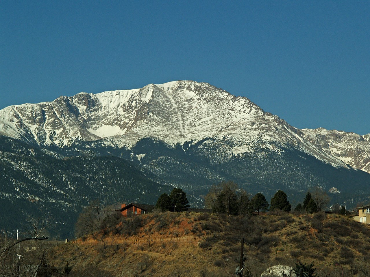
Mt. View is a 1.11-mile out-and-back trail in Colorado managed by the Forest Service. The route gains 175 feet of elevation.
 Photo: CaroleHenson, CC BY-SA 3.0 (via Wikimedia Commons)
Intemann Trail
~10 min drive
1.17-mile route in Red Rock Canyon Open Space with 1,027 ft elevation gain
Photo: CaroleHenson, CC BY-SA 3.0 (via Wikimedia Commons)Parallel Trail
~10 min drive
0.90-mile trail in Red Rock Canyon Open Space, 394 ft elevation gain
Photo: CaroleHenson, CC BY-SA 3.0 (via Wikimedia Commons)Garbage Chute
~10 min drive
0.88-mile trail in Red Rock Canyon Open Space, Colorado with 225 ft of elevation gain.
Barr
~1 min drive
Barr is an 8.07-mile trail in Colorado with 5,155 ft of elevation gain.
Lake Moraine
~2 min drive
4.51-mile trail in Colorado's Trails near 38.9°N 105.0°W trail system
Bottomless Pit
~3 min drive
1.67-mile trail near 38.9°N 105.0°W with 1,436 ft elevation gain
Severy Creek
~4 min drive
Severy Creek is a 1.26-mile trail in Colorado gaining 1354 ft of elevation.
forest service trail 701
~5 min drive
0.89-mile out-and-back trail with 158 ft elevation gain near Lake Moraine, Colorado
Pikes Peak West Summit
~5 min drive
0.97-mile trail near 38.9°N 105.0°W with 957 ft of elevation gain
Ghost Town Hollow
~5 min drive
0.40-mile trail near 38.9°N 105.0°W with 241 ft elevation gain
Outfitters and businesses. They haven’t set up their Roamze page yet.
Broadmoor Outfitters
Mountain Biking business nearby (~9 mi away) — hasn't claimed their Roamze page yet
