Bobcat Campground (Campground 2)
Campground
Campground · 0.5 mi from the trail
Caution at last check
Agency alerts are in effect for this area; weather is good · USFS, OpenWeather · checked 17 h ago
Alert in the area
The Forest Service lists 4 alerts for Canyon Lakes Ranger District.
Salt Cabin Prescribed (RX) Fire Closure
Agency alert covering Canyon Lakes Ranger District · Order 02-10-05-26-11 · USFS · Canyon Lakes Ranger District
Fire Restrictions
Agency alert covering Arapaho and Roosevelt National Forests · USFS · Arapaho and Roosevelt National Forests
West Crystal A - Mechanical Fuelbreak Area and Road Closure
Agency alert covering Canyon Lakes Ranger District · Order 02-10-05-26-04 · USFS · Canyon Lakes Ranger District
Cameron Peak Fire Road Closures
Agency alert covering Canyon Lakes Ranger District · Order 02-10-05-26-01 · USFS · Canyon Lakes Ranger District
As of · Source: USFS · Canyon Lakes Ranger District. Agencies don't list every closure — check before you go.
Moose Meadow Trail is a short mountain biking route in Colorado, set on county land within the Canyon Lakes Ranger District of the Arapaho and Roosevelt National Forests. The trail is about a mile long, with a low point of 8,308 feet and a high of 8,499 feet, and it gains about 184 feet of elevation. The steepest stretch comes at about 0.47 miles in, with an 8% grade. Summer is the most comfortable time to ride. Typical averages from a nearby weather station at Allenspark, at about 8,500 feet, show July highs around 74°F with lows near 44°F, while winter highs stay around freezing. Dogs are allowed on a leash. The Homestead Meadows Connector Trail starts just 0.1 mile away, and the Limber Pine Trail is about 0.2 mile off. Climbers can head to BLM Boulder, about 3 miles away, and Rocky Mountain National Park Glacier Basin Campground is roughly 7 miles away.
Bobcat Campground (Campground 2)
Campground
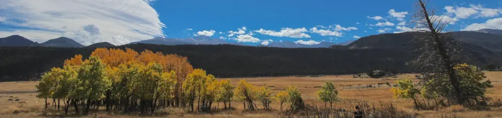
 If it rainsMatt Golon, CC BY-SA 3.0 · Wikimedia Commons
Places © OpenStreetMap contributors, Places © Overture Maps Foundation · Photos: Matt Golon, CC BY-SA 3.0 (commons)
More in Estes Park Limber Pine TrailHikingPhoto: Jesse James — CC BY 2.0 (via Flickr)0.2 mi
 Prospect MountainRock climbingPhoto: Rojer, CC BY 2.0 (via Flickr)3.2 mi
 Rocky Mountain National Park Glacier Basin CampgroundCampingPhoto: Recreation.gov (RIDB) / public domain6.8 mi
 North Saint Vrain CreekCanoeingPhoto: Hogs555, CC BY-SA 3.0 (via Wikimedia Commons)8.1 mi
Source: Roamze catalog (indexable pages within 10 miles, PostGIS distance)
 Deer RidgeMountain biking · ~13 min drivePhoto: Dustin Delatore whosdustin, CC0 (via Wikimedia Commons)
 Bright ExtensionMountain biking · ~14 min drivePhoto: Bradley Furlow, CC BY-SA 4.0 (via Wikimedia Commons)BrightMountain biking · ~15 min drivePhoto: Bradley Furlow, CC BY-SA 4.0 (via Wikimedia Commons)South Sheep MtnMountain biking · ~15 min drivePhoto: Bradley Furlow, CC BY-SA 4.0 (via Wikimedia Commons)Fox CreekMountain biking · ~16 min drivePhoto: Dustin Delatore whosdustin, CC0 (via Wikimedia Commons)Lazy H Horse Trail NetMountain biking · ~16 min drivePhoto: Dustin Delatore whosdustin, CC0 (via Wikimedia Commons)
Best months: May–September. Best months have typical highs of 55–85 °F, lows of 30 °F or warmer (32 °F where the station doesn't record snow), at most one snowy day and no more than 12 wet days.
Jan
32° / 14°
Feb
35° / 15°
Mar
42° / 20°
Apr
46° / 23°
May
56° / 32°
Jun
69° / 38°
Jul
74° / 44°
Aug
73° / 43°
Sep
66° / 36°
Oct
52° / 29°
Nov
41° / 20°
Dec
33° / 14°
Typical high / low (°F) and days with rain or snow, 1991–2020. Measured at Allenspark 3nw, CO, 7.8 mi away at 8,500 ft. This station doesn't record snowfall. Source: NOAA NCEI U.S. Climate Normals 1991–2020.
Map and trail data © OpenStreetMap contributors

