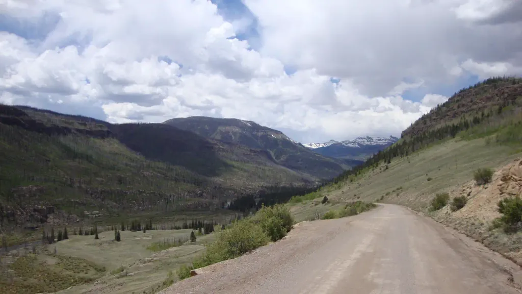
Weminuche
 Photo: JustTooLazy, CC BY 2.0 (via Flickr)
- 10.4 mi
- round trip
- 1,240 ft
- climb
- 10,658 ft
- high point
- Out and back
- route
- Jun–Jul, Sep
- best months
Weminuche is a hard hike in Colorado's Weminuche Wilderness, part of the Divide Ranger District of the Rio Grande National Forest. The route is an out-and-back of about 10.4 miles, with a total elevation gain of 1,240 feet, from a low point of 9,333 feet to a high of 10,658 feet. The trail is on natural surface and allows horses. Summer is the most comfortable time to go. Typical averages from a nearby weather station at Rio Grande Reservoir, which sits about 1,200 feet lower, show July highs around 76°F with lows near 42°F, while winter brings highs in the mid-30s and regular snow days from December through March. The Thirty Mile Trailhead #814 parking area is the starting point, and the trail is open year-round. Nearby, the Rio Grande Pyramid and Grizzly Creek hikes are each about 0.6 miles away, Thirty Mile campground is 0.8 miles off, and the Rio Grande Reservoir Boating Site is about a mile away.
- Rio Grande PyramidHikingPhoto: JustTooLazy, CC BY 2.0 (via Flickr)0.6 mi
- Grizzly CreekHikingPhoto: JustTooLazy, CC BY 2.0 (via Flickr)0.6 mi
- Thirty MileCamping0.8 mi
- Rio Grande Reservoir Boating SiteLake fishing1 mi
 30 Mile Horse TrailHikingPhoto: JustTooLazy, CC BY 2.0 (via Flickr)1.4 mi
 River HillCampingPhoto: Recreation.gov (RIDB) / public domain2.2 mi
- Road Canyon CampgroundCamping4.9 mi
- Ute CreekCanoeing5.7 mi
Source: Roamze catalog (indexable pages within 10 miles, PostGIS distance)
Best time to visit Weminuche
Best months: June–July and September. Best months have typical highs of 55–85 °F, lows of 30 °F or warmer (32 °F where the station doesn't record snow), at most one snowy day and no more than 12 wet days.
Jan
34° / -4°
4 wet · 4 snow
Feb
37° / -2°
4 wet · 4 snow
Mar
43° / 9°
5 wet · 5 snow
Apr
50° / 20°
6 wet · 5 snow
May
60° / 29°
5 wet · 2 snow
Jun
71° / 36°
5 wet
Jul
76° / 42°
11 wet
Aug
73° / 41°
13 wet
Sep
68° / 35°
9 wet
Oct
58° / 25°
6 wet · 2 snow
Nov
44° / 12°
4 wet · 3 snow
Dec
34° / -3°
4 wet · 3 snow
Typical high / low (°F) and days with rain or snow, 1991–2020. Measured at Rio Grande Rsvr, CO, 0.3 mi away at 9,492 ft. The station sits about 1,200 ft lower than this place, so expect it a little cooler here. Source: NOAA NCEI U.S. Climate Normals 1991–2020.
