Rock Point Overlook
 Photo: NPS / public domain
- 0.2 mi
- round trip
- 212 ft
- climb
- 8,063 ft
- high point
- Out and back
- route
- May–Oct
- best months
Is Rock Point Overlook open right now?
Alert in the area
The National Park Service lists an alert for Black Canyon of the Gunnison National Park.
No Water Available in Park
Park alert covering Black Canyon of the Gunnison National Park · NPS · Black Canyon of the Gunnison National Park
As of · Source: NPS · Black Canyon of the Gunnison National Park. Agencies don't list every closure — check before you go.
Rock Point Overlook is a short, easy hike in Black Canyon of the Gunnison National Park in Colorado, managed by the National Park Service. The route is about 0.19 miles long, with a total elevation gain of 212 feet, and it takes about half an hour to complete. The trail starts at a low point of about 7,864 feet and climbs to a high point of about 8,063 feet. It is a quick stop rather than a full-day outing, and it works well as a short addition to a visit to the park's North Rim. Summer is the most comfortable time to go. Typical averages from a nearby weather station show July highs around 82°F with lows near 53°F, while winter highs stay in the mid-30s. The North Rim Routes climbing area and The Painted Wall are both about half a mile away. Pulpit Rock Overlook is about 0.6 miles off, and North Rim Campground is about 0.9 miles away.
Local outfitters
- Cedar Creek RV Park and Lodging10 mi away
- Peak Mountain Guides38 mi away
Not on Roamze yet. Their page has how to reach them.
Best time to go · May–Oct
Best time to visit Rock Point Overlook
Best months: May–October. Best months have typical highs of 55–85 °F, lows of 30 °F or warmer (32 °F where the station doesn't record snow), at most one snowy day and no more than 12 wet days.
Jan
37° / 13°
Feb
40° / 16°
Mar
49° / 23°
Apr
56° / 29°
May
66° / 38°
Jun
76° / 46°
Jul
82° / 53°
Aug
81° / 52°
Sep
72° / 44°
Oct
60° / 33°
Nov
47° / 23°
Dec
36° / 13°
Typical high / low (°F) and days with rain or snow, 1991–2020. Measured at Black Canyon Of The Gunnison, CO, 1.5 mi away at 8,151 ft. This station doesn't record snowfall. Source: NOAA NCEI U.S. Climate Normals 1991–2020.
Keep exploring — more trails worth the drive
HIKE
Devil's Lookout Overlook
Next door
The walk to the overlook is 607 yards on an unpaved trail.
HIKE
Pulpit Rock Overlook
Next door
The walk to the overlook is 134 yards on an unpaved trail.
 Photo: Frans-Banja Mulder, CC BY 3.0 (via Wikimedia Commons)
Chasm View Trail
~2 min drive
0.48-mile loop in Colorado with 1,088 ft gain and loss.
HIKE
Deep Creek Trail
~13 min drive
10.26-mile out-and-back trail in Colorado with 2,289 ft elevation gain.
HIKE
Cross Fissures Overlook
Next door
The walk to the overlook is 357 yards on an unpaved trail.
HIKE
Painted Wall Overlook
~2 min drive
This overlook features the tallest cliff in Colorado, the Painted Wall. From river to rim, the Painted Wall is 2,250 feet tall. The walk to the overlook is 200 yards on an unpaved trail.
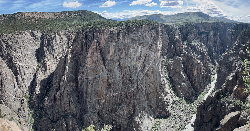 Photo: joannapoe, CC BY-SA 2.0 (via Flickr)
North Vista Trail
~2 min drive
6.64-mile out-and-back trail in Colorado with 2,192 ft elevation gain and loss.
HIKE
Balanced Rock Overlook
Next door
The short walk to the overlook is on an unpaved trail.
HIKE
Cedar Point Overlook
~2 min drive
The walk to the overlook is 303 yards on an unpaved surface, Guideposts describe the various plants along the way.
 Photo: stevelyon, CC BY-SA 2.0 (via Flickr)
Rim Rock Nature Trail
~4 min drive
1.68-mile out-and-back hike in Colorado with 445 ft elevation gain
Also worth it near here


