Red Rocks-Nighthorse Trail
- 4.7 mi
- round trip
- 2,071 ft
- climb
- 6,865 ft
- high point
- Out and back
- route
- Apr–Jun, Aug–Oct
- best months
Red Rocks-Nighthorse Trail is a 9.4-mile out-and-back hike on Bureau of Land Management land in Colorado's Uncompahgre Field Office. It starts at the Ute Trailhead, crosses a steady climb from 6,535 feet to a high point of 6,865 feet, and returns the same way, with a total elevation gain and loss of 2,071 feet. The trail is rated moderate, and the steepest stretch comes at about 2 miles, with a 17% grade. Summer is the most comfortable time to go. Typical averages from a nearby weather station run from highs near 68°F in May to about 86°F in July, while winter brings highs in the mid-30s and regular snow days from November through April. The trail pairs easily with other outings in the area. The Ute Trail lies less than a mile away, and the Gunnison Gorge Wilderness Float is about 1.8 miles off. Duncan Trail and the Chukar campground are both within about 4.5 miles.
Local outfitters
- Cedar Creek RV Park and Lodging14 mi away
- RV Ranch at Grand Junction43 mi away
Not on Roamze yet. Their page has how to reach them.
- Ute TrailHiking0.9 mi
- Gunnison Gorge Wilderness FloatCanoeing1.8 mi
- Duncan TrailHiking2.4 mi
- Bobcat TrailHiking3.7 mi
- ChukarCamping4.5 mi
- Chukar TrailHiking5 mi
- Peach Valley OHV AreaCamping6.2 mi
- Cottonwood Grove CampgroundCamping6.6 mi
Source: Roamze catalog (indexable pages within 10 miles, PostGIS distance)
 West River TrailHiking · ~12 min drivePhoto: SymphonicPoet, CC BY 2.0 (via Flickr)
- Dragon Point OverlookHiking · ~18 min drive
 Chasm View TrailHiking · ~18 min drivePhoto: Frans-Banja Mulder, CC BY 3.0 (via Wikimedia Commons)
- Ute TrailHiking · ~1 min drive
- Red Rocks-Nighthorse TrailHiking · ~4 min drive
- Cedar Point OverlookHiking · ~18 min drive
- Sunset View Overlook at Black CanyonHiking · ~18 min drive
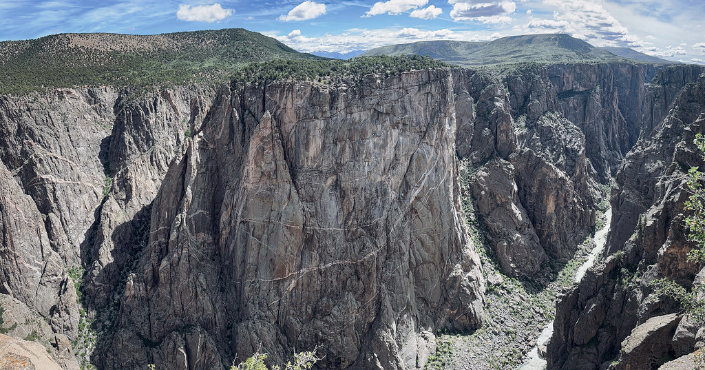 North Vista TrailHiking · ~19 min drivePhoto: joannapoe, CC BY-SA 2.0 (via Flickr)
- Sidewinder TrailHiking · ~9 min drive
- Painted Wall OverlookHiking · ~18 min drive
Also worth it near here
Best time to visit Red Rocks-Nighthorse Trail
Best months: April–June and August–October. Best months have typical highs of 55–85 °F, lows of 30 °F or warmer (32 °F where the station doesn't record snow), at most one snowy day and no more than 12 wet days.
Jan
36° / 19°
6 wet · 5 snow
Feb
40° / 22°
6 wet · 4 snow
Mar
50° / 29°
5 wet · 3 snow
Apr
58° / 35°
6 wet · 1 snow
May
68° / 44°
6 wet
Jun
79° / 53°
4 wet
Jul
86° / 59°
7 wet
Aug
83° / 57°
8 wet
Sep
74° / 49°
7 wet
Oct
61° / 38°
7 wet
Nov
47° / 28°
4 wet · 2 snow
Dec
37° / 19°
6 wet · 5 snow
Typical high / low (°F) and days with rain or snow, 1991–2020. Measured at Cedaredge 3e, CO, 15.4 mi away at 6,838 ft. Source: NOAA NCEI U.S. Climate Normals 1991–2020.


Map and trail data © OpenStreetMap contributors
