Denver West/Central City KOA
Campground
Campground · 1.1 mi from the trail
Quartz Valley Trail is an easy out-and-back hike of about 1.2 miles on Bureau of Land Management land within the Royal Gorge Field Office in Colorado. The trail climbs from about 8,500 feet to a high point of 8,586 feet, with a total elevation gain of 288 feet over the round trip. The climb is front-loaded, with the steepest section at about 0.2 miles from the start, where the grade reaches about 6%. Summer is the most comfortable time to go. Typical averages from the nearby Coal Creek Canyon weather station put July highs around 73°F with lows near 48°F, while winter highs there sit in the low 30s. The hike takes about half an hour. Claim Jumper, a mountain biking route, is about 0.3 miles away and Paymaster is about 0.4 miles away. Climbers can head to The Ameristar, about 0.7 miles off, and Columbine Campground is about 2 miles away for an overnight stay.
Denver West/Central City KOA
Campground
 If it rainsUser:Magicpiano, CC BY-SA 4.0 · Wikimedia Commons
Historic house-museum in Georgetown, Colorado, United States
Places © OpenStreetMap contributors, Places © Overture Maps Foundation · Photos: User:Magicpiano, CC BY-SA 4.0 (commons)
More in Idaho SpringsNot on Roamze yet. Their page has how to reach them.
 Clear CreekCanoeingPhoto: Ken Gallager at en.wikipedia, Public domain (via Wikimedia Commons)7.1 mi
Source: Roamze catalog (indexable pages within 10 miles, PostGIS distance)
 Summit TrailHiking · ~1 min drivePhoto: Tony Webster — CC BY 2.0 (via Flickr)
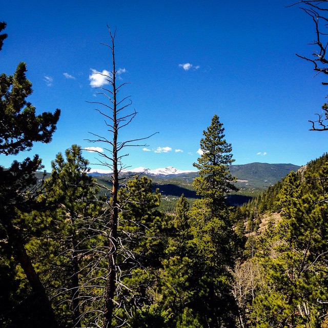 Blue Grouse TrailHiking · ~8 min drivePhoto: jackieflynt, CC BY-SA 2.0 (via Flickr)
 Black Bear TrailHiking · ~9 min drivePhoto: Brian from California Desert, United States, CC BY 2.0 (via Wikimedia Commons)
 Mount BancroftHiking · ~12 min drivePhoto: Greg Younger from Parker, Colorado, USA, USA, CC BY-SA 2.0 (via Wikimedia Commons)Millsite TrailHiking · ~1 min drivePhoto: Tony Webster — CC BY 2.0 (via Flickr)
 Snowshoe Hare TrailHiking · ~11 min drivePhoto: Josh Gross — CC BY 2.0 (via Flickr)Coyote TrailHiking · ~9 min drivePhoto: Tony Webster — CC BY 2.0 (via Flickr)Mule Deer TrailHiking · ~8 min drivePhoto: Tony Webster — CC BY 2.0 (via Flickr)Mountain Lion TrailHiking · ~13 min drivePhoto: Tony Webster — CC BY 2.0 (via Flickr)Beaver TrailHiking · ~10 min drivePhoto: Brian from California Desert, United States, CC BY 2.0 (via Wikimedia Commons)
Best months: September. Best months have typical highs of 55–85 °F, lows of 30 °F or warmer (32 °F where the station doesn't record snow), at most one snowy day and no more than 12 wet days.
Jan
33° / 16°
10 wet
Feb
34° / 15°
10 wet
Mar
41° / 20°
11 wet
Apr
46° / 24°
13 wet
May
55° / 33°
14 wet
Jun
67° / 41°
13 wet
Jul
73° / 48°
14 wet
Aug
71° / 46°
15 wet
Sep
64° / 39°
10 wet
Oct
52° / 30°
8 wet
Nov
41° / 21°
8 wet
Dec
33° / 15°
9 wet
Typical high / low (°F) and days with rain or snow, 1991–2020. Measured at Coal Creek Canyon, CO, 9.2 mi away at 8,950 ft. This station doesn't record snowfall. Source: NOAA NCEI U.S. Climate Normals 1991–2020.
Map and trail data © OpenStreetMap contributors
