HM1
Campground
Campground · 5.6 mi from the trail
Alert in the area
The Forest Service lists 4 alerts for Canyon Lakes Ranger District.
Salt Cabin Prescribed (RX) Fire Closure
Agency alert covering Canyon Lakes Ranger District · Order 02-10-05-26-11 · USFS · Canyon Lakes Ranger District
Fire Restrictions
Agency alert covering Arapaho and Roosevelt National Forests · USFS · Arapaho and Roosevelt National Forests
West Crystal A - Mechanical Fuelbreak Area and Road Closure
Agency alert covering Canyon Lakes Ranger District · Order 02-10-05-26-04 · USFS · Canyon Lakes Ranger District
Cameron Peak Fire Road Closures
Agency alert covering Canyon Lakes Ranger District · Order 02-10-05-26-01 · USFS · Canyon Lakes Ranger District
As of · Source: USFS · Canyon Lakes Ranger District. Agencies don't list every closure — check before you go.
Powerline Trail is a short, easy hike in Colorado's Canyon Lakes Ranger District, part of the Arapaho and Roosevelt National Forests. The trail runs about 1.3 miles out and back, starting at roughly 6,529 feet and reaching a high point of 6,829 feet. That makes it a compact climb of about 380 feet one way, with the steepest stretch at the beginning, where the grade reaches about 19 percent. Summer is the most comfortable time to go. Typical averages from a nearby weather station show July highs around 79°F and lows near 56°F, while September cools to about 70°F by day and 47°F at night. The station sits several hundred feet lower than the trail, so temperatures on the route run a little cooler. Several other routes lie within a short drive. Ginny Trail and on the rocks trail are both about 0.6 miles away, and Jug Trail is about 1.6 miles off. Paddlers can head to the Cache la Poudre River, roughly 2.8 miles away.
HM1
Campground
Almost East Gemstone Peak
Viewpoint
Places © OpenStreetMap contributors
More in Estes ParkNot on Roamze yet. Their page has how to reach them.
 Cache la Poudre RiverCanoeingPhoto: Wusel007, CC BY-SA 3.0 (via Wikimedia Commons)2.8 mi
 Big Thompson RiverCanoeingPhoto: Wusel007, CC BY-SA 3.0 (via Wikimedia Commons)8.4 mi
Source: Roamze catalog (indexable pages within 10 miles, PostGIS distance)
 Grouse Hollow TrailHiking · ~8 min drivePhoto: cogdogblog, CC BY 2.0 (via Wikimedia Commons)
 The Monastery TrailHiking · ~8 min drivePhoto: mbeldyk, CC BY-SA 2.0 (via Flickr)
 Herrington TrailHiking · ~11 min drivePhoto: Timothy Sipkens, CC0 (via Wikimedia Commons)Horsetooth Falls TrailHiking · ~10 min drivePhoto: Timothy Sipkens, CC0 (via Wikimedia Commons)
 Indian Summer TrailHiking · ~11 min drivePhoto: Greg Younger from Fort Collins, USA, CC BY-SA 2.0 (via Wikimedia Commons)Horsetooth Rock TrailHiking · ~10 min drivePhoto: Timothy Sipkens, CC0 (via Wikimedia Commons)
 Rim Rock TrailHiking · ~12 min drivePhoto: Mountain Roamer, CC BY-SA 2.0 (via Flickr)
 Sullivan Gulch TrailHiking · ~11 min drivePhoto: jamieotterbein, CC BY-SA 2.0 (via Flickr)
 Inlet Bay TrailHiking · ~12 min drivePhoto: gregor_y, CC BY-SA 2.0 (via Flickr)
Also worth it near here
Cache la Poudre RiverCanoeing · ~5 min drivePhoto: Wusel007, CC BY-SA 3.0 (via Wikimedia Commons) HorsesheadRock climbing · ~7 min drivePhoto: jamieotterbein, CC BY-SA 2.0 (via Flickr)
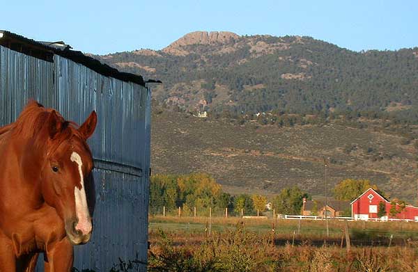 Horsetooth MountainSummit · ~10 min drivePhoto: Matthew Trump (talk) (Uploads)
Uploaded by Decumanus at en.wikipedia, CC BY-SA 3.0 (via Wikimedia Commons)
Best months: May–October. Best months have typical highs of 55–85 °F, lows of 30 °F or warmer (32 °F where the station doesn't record snow), at most one snowy day and no more than 12 wet days.
Jan
40° / 21°
5 wet
Feb
40° / 20°
6 wet
Mar
47° / 26°
8 wet
Apr
51° / 30°
10 wet
May
60° / 39°
12 wet
Jun
72° / 49°
11 wet
Jul
79° / 56°
11 wet
Aug
78° / 55°
11 wet
Sep
70° / 47°
8 wet
Oct
57° / 36°
7 wet
Nov
47° / 28°
6 wet
Dec
40° / 20°
6 wet
Typical high / low (°F) and days with rain or snow, 1991–2020. Measured at Buckhorn Mtn 1 E, CO, 9.3 mi away at 7,400 ft. The station sits about 600 ft higher than this place, so expect it a little warmer here. This station doesn't record snowfall. Source: NOAA NCEI U.S. Climate Normals 1991–2020.
Map and trail data © OpenStreetMap contributors
