Boundary Creek campsite 1
Campground
Campground · 0.1 mi from the trail
Caution today
Agency alerts are in effect for this area; weather is good · USFS, OpenWeather · checked just now
Closure in the area
There's a closure order in Rocky Mountain National Park. It doesn't name North Fork Trail, so check the source for the area it covers.
Trail Ridge Road is Closed to Through Travel for the Season
Park closure covering Rocky Mountain National Park · NPS · Rocky Mountain National Park
Salt Cabin Prescribed (RX) Fire Closure
Agency alert covering Canyon Lakes Ranger District · Order 02-10-05-26-11 · USFS · Canyon Lakes Ranger District
Fire Restrictions
Agency alert covering Arapaho and Roosevelt National Forests · USFS · Arapaho and Roosevelt National Forests
West Crystal A - Mechanical Fuelbreak Area and Road Closure
Agency alert covering Canyon Lakes Ranger District · Order 02-10-05-26-04 · USFS · Canyon Lakes Ranger District
Cameron Peak Fire Road Closures
Agency alert covering Canyon Lakes Ranger District · Order 02-10-05-26-01 · USFS · Canyon Lakes Ranger District
As of · Source: NPS · Rocky Mountain National Park. Agencies don't list every closure — check before you go.
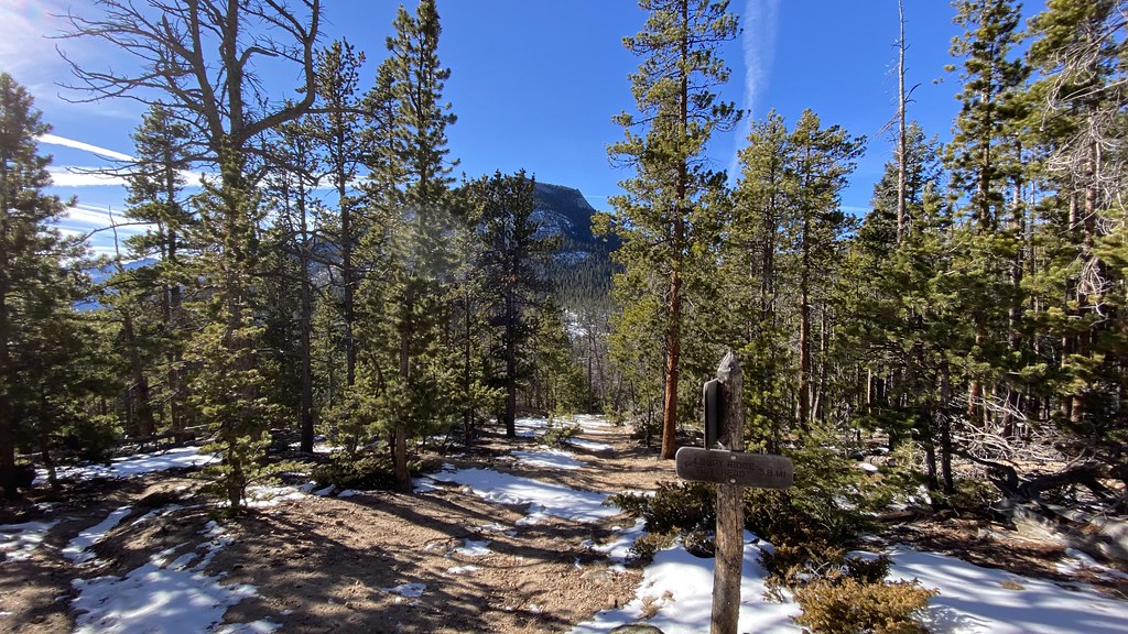
North Fork Trail is a 5.1-mile hike in Colorado's Rocky Mountain National Park, within the Comanche Peak Wilderness and the Rocky Mountain National Park Wilderness. It runs on land managed by the National Park Service, and the route gains about 800 feet of elevation. The trail is rated easy. Summer is the most comfortable time to go. Typical averages from a nearby weather station show July highs around 74°F with lows near 43°F, while winter highs stay near freezing. The station sits at about 9,520 feet, so temperatures on the trail may run somewhat cooler. The hike takes about two hours. The North Boundary Trail and Bulwark Ridge both lie within a mile and a half. Paddlers can head to the North Fork Big Thompson River, about 2.7 miles away, and climbers can find Second Pew and Pulpit Rock Massif roughly 4.4 miles off.
Boundary Creek campsite 1
Campground
Almost East Gemstone Peak
Viewpoint
Places © OpenStreetMap contributors, Places © Overture Maps Foundation
More in Estes ParkNot on Roamze yet. Their page has how to reach them.
 North Fork Big Thompson RiverCanoeingPhoto: Unknown author, Public domain (via Wikimedia Commons)2.7 mi
Source: Roamze catalog (indexable pages within 10 miles, PostGIS distance)
 Ridge TrailHiking · ~5 min drivePhoto: Jesse James — CC BY 2.0 (via Flickr)
 North BoundaryHiking · ~8 min drivePhoto: lamblukas, CC BY 2.0 (via Flickr)
 Black Canyon TrailHiking · ~10 min drivePhoto: lamblukas, CC BY 2.0 (via Flickr)
 North Fox TrailHiking · ~6 min drivePhoto: christinejwarner, CC BY 2.0 (via Flickr)Crosier Mountain Rainbow TrailHiking · ~9 min drivePhoto: Jesse James — CC BY 2.0 (via Flickr)Cow Creek TrailHiking · ~8 min drivePhoto: lamblukas, CC BY 2.0 (via Flickr)
 Lumpy Ridge Climber AccessHiking · ~11 min drivePhoto: lamblukas, CC BY 2.0 (via Flickr)Cow Creek TrailHiking · ~8 min drivePhoto: Jesse James — CC BY 2.0 (via Flickr)
Best months: June and September. Best months have typical highs of 55–85 °F, lows of 30 °F or warmer (32 °F where the station doesn't record snow), at most one snowy day and no more than 12 wet days.
Jan
31° / 11°
9 wet
Feb
33° / 10°
9 wet
Mar
40° / 15°
10 wet
Apr
45° / 20°
10 wet
May
55° / 28°
10 wet
Jun
68° / 36°
10 wet
Jul
74° / 43°
13 wet
Aug
72° / 41°
14 wet
Sep
65° / 34°
10 wet
Oct
51° / 25°
8 wet
Nov
39° / 18°
9 wet
Dec
31° / 11°
9 wet
Typical high / low (°F) and days with rain or snow, 1991–2020. Measured at Hourglass Rsvr, CO, 8.5 mi away at 9,520 ft. We don't have this place's elevation, so higher spots nearby can run cooler. This station doesn't record snowfall. Source: NOAA NCEI U.S. Climate Normals 1991–2020.
Map and trail data © OpenStreetMap contributors
