Twin Peaks Campground
Campground
Campground · 4.5 mi from the trail
Closure in the area
There's a closure order in Leadville Ranger District. It doesn't name Middle Mountain, so check the source for the area it covers.
Willow Fire Area Closure
Agency closure covering Leadville Ranger District · Order 02-12-01-26-39 · USFS · Leadville Ranger District
FSR 286, Radical Hill, is closed due to washouts and unsafe conditions
Agency alert covering Pike and San Isabel National Forests · USFS · Pike and San Isabel National Forests
Interlaken Hotel and Annex Area closure
Agency alert covering Leadville Ranger District · Order 02-12-01-26-19 · USFS · Leadville Ranger District
Interlaken Hotel Tree Hazards
Agency alert covering Pike and San Isabel National Forests · USFS · Pike and San Isabel National Forests
Sharpe Fire Update
Agency alert covering Pike and San Isabel National Forests · USFS · Pike and San Isabel National Forests
As of · Source: USFS · Leadville Ranger District. Agencies don't list every closure — check before you go.
Middle Mountain is a 13.3-mile out-and-back hike in Colorado's Leadville Ranger District of the Pike and San Isabel National Forests, managed by the Forest Service. The route rises to a high point of 13,097 feet, with a total elevation gain of 3,740 feet over the course of the trip. It is an expert-level climb, and the round-trip distance and elevation figures make it a full-day commitment. The route is long and steep, and the climb is mirrored by the same amount of descent on the way back. Plan on about 6.5 hours for the trip. The high point sits at 13,097 feet, and the route passes within a short distance of Garfield Peak and La Plata Peak, which makes it easy to pair with another objective. Twin Peaks Campground and Parry Peak Campground are both within about 5 miles, and the Monitor Rock climbing area is about 2.9 miles away.
Twin Peaks Campground
Campground
 If it rainsLongled, CC BY-SA 3.0 · Wikimedia Commons
Historic frontier synagogue building
Places © OpenStreetMap contributors, Places © Overture Maps Foundation · Photos: Longled, CC BY-SA 3.0 (commons)
More in LeadvilleDaily highs and lows, wind and the chance of precipitation at the summit and route start for the next 7 days, from the Open-Meteo model.
Source: Roamze catalog (indexable pages within 10 miles, PostGIS distance)
 La Plata PeakHiking · ~3 min drivePhoto: kalestews, CC BY 2.0 (via Flickr)
 MOUNTAIN BOYHiking · ~4 min drivePhoto: Toshihiro Matsui, CC BY-SA 3.0 (via Wikimedia Commons)Deer MountainHiking · ~6 min drivePhoto: Toshihiro Matsui, CC BY-SA 3.0 (via Wikimedia Commons)
 Black Cloud TrailHiking · ~7 min drivePhoto: jl_2, CC BY-SA 2.0 (via Flickr)
 Black CloudHiking · ~7 min drivePhoto: jefftakespictures, CC BY 2.0 (via Flickr)
 North Fork Lake CreekHiking · ~8 min drivePhoto: markbyzewski, CC BY 2.0 (via Flickr)
 Mount BlaurockHiking · ~9 min drivePhoto: jonathan c. wheeler, CC BY-SA 3.0 (via Wikimedia Commons)
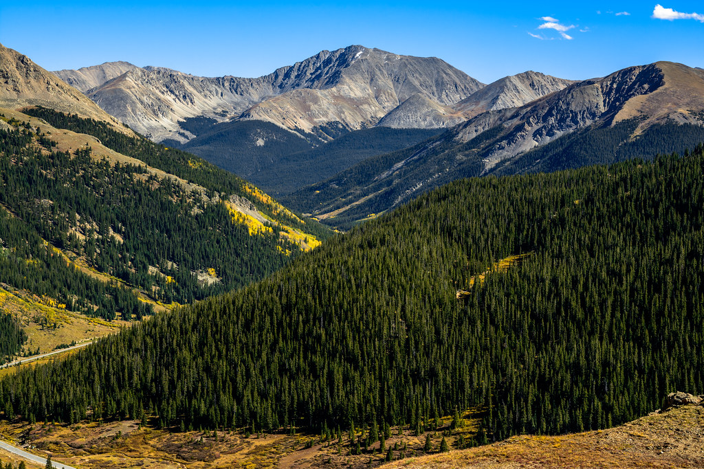 Independance Pass OverlookHiking · ~7 min drivePhoto: dconvertini, CC BY-SA 2.0 (via Flickr)
 Mount Massive Southwest SlopesHiking · ~11 min drivePhoto: Gaep13 at en.wikipedia), Public domain (via Wikimedia Commons)
About 13.3 mi round trip from La Plata Trailhead Parking.
About 3,740 ft of climbing round trip.
It is rated expert.
La Plata Trailhead Parking.
© openrouteservice.org by HeiGIT | Map data © OpenStreetMap contributors


