Government Trail
- 0.5 mi
- round trip
- 382 ft
- climb
- 8,334 ft
- high point
- Out and back
- route
- May–Sep
- best months
Government Trail is a short out-and-back hike in Colorado, about 2 miles from the town of Aspen. It is a low-effort outing, with a round-trip distance of roughly a mile and a total climb of about 380 feet, making it an easy way to spend half an hour outside town. The trail starts at an elevation of about 8,334 feet and reaches a high point of about 8,334 feet before descending back to the same level. The climb is rolling, with the steepest stretch coming early in the route, where the grade reaches about 17 percent at roughly a quarter mile. That makes the trail a simple walk rather than a significant climb, and it works well as a quick stop before or after a longer day in Aspen. Summer is the most comfortable time to visit. Typical averages from a nearby weather station in Aspen show July highs around 76°F with lows near 48°F, while winter highs stay around freezing. The trail sits close to several other places to explore. Buttermilk Access Road and Terral Wade Bridge, both about 0.3 miles away, offer cross-country skiing. Climbers can head to East Face, about 1.9 miles off, and paddlers can try Maroon Creek, about 2.4 miles away.
Go with a guide
- Mineral Belt Trail Guided WalkNexPM AI · $25 per person · 31 mi away
- Maroon Bells Guide and Outfitters2 mi away
 Buttermilk Access RoadCross-country skiingPhoto: Viktor Lapinskii, CC BY-SA 3.0 (via Wikimedia Commons)0.3 mi
- Terral Wade BridgeCross-country skiingPhoto: Viktor Lapinskii, CC BY-SA 3.0 (via Wikimedia Commons)0.3 mi
 East FaceRock climbingPhoto: David Leo Veksler, CC BY-SA 2.0 (via Flickr)1.9 mi
- Southwest TRRock climbingPhoto: David Leo Veksler, CC BY-SA 2.0 (via Flickr)1.9 mi
- Maroon CreekCanoeing2.4 mi
- Silver Bar CampgroundCamping3.5 mi
- Silver Bell CampgroundCamping3.8 mi
- Woody CreekCanoeing5.4 mi
Source: Roamze catalog (indexable pages within 10 miles, PostGIS distance)
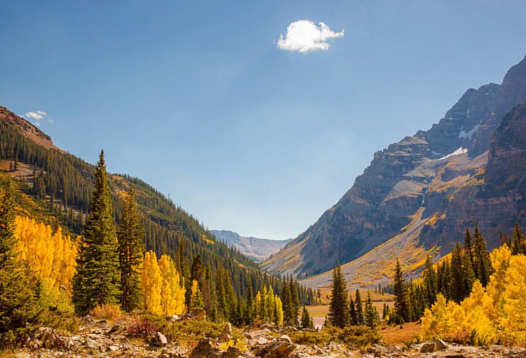 Maroon Gorge TrailHiking · Next doorPhoto: Peter Alfred Hess, CC BY 2.0 (via Flickr)
 Ajax TrailHiking · ~3 min drivePhoto: Frans-Banja Mulder, CC BY 3.0 (via Wikimedia Commons)
 Congo TrailHiking · ~4 min drivePhoto: randomduck, CC BY-SA 2.0 (via Flickr)
 Maroon Creek TrailHiking · Next doorPhoto: Christopher Michel, CC BY 2.0 (via Wikimedia Commons)
- SugarbowlHiking · ~3 min drive
 Maroon Gorge TrailHiking · Next doorPhoto: Cloudforest, CC BY 2.0 (via Flickr)
- Government TrailHiking · ~2 min drive
- Moore TrailHiking · Next doorPhoto: Cloudforest, CC BY 2.0 (via Flickr)
- Thunderbowl TrailHiking · ~1 min drivePhoto: Cloudforest, CC BY 2.0 (via Flickr)
- Trail near Red ButteHiking · ~1 min drivePhoto: Christopher Michel, CC BY 2.0 (via Wikimedia Commons)
Also worth it near here
- Buttermilk Access RoadCross-country skiing · Next doorPhoto: Viktor Lapinskii, CC BY-SA 3.0 (via Wikimedia Commons)
 ButtermilkDownhill skiing · ~1 min drivePhoto: Werdna, CC BY-SA 4.0 (via Wikimedia Commons)
- Top of the RockiesScenic drive · ~2 min drive
- East FaceRock climbing · ~3 min drivePhoto: David Leo Veksler, CC BY-SA 2.0 (via Flickr)
Best time to visit Government Trail
Best months: May–September. Best months have typical highs of 55–85 °F, lows of 30 °F or warmer (32 °F where the station doesn't record snow), at most one snowy day and no more than 12 wet days.
Jan
32° / 10°
13 wet
Feb
35° / 13°
12 wet
Mar
43° / 20°
12 wet
Apr
50° / 27°
12 wet
May
60° / 35°
11 wet
Jun
71° / 42°
8 wet
Jul
76° / 48°
11 wet
Aug
73° / 47°
12 wet
Sep
67° / 40°
10 wet
Oct
55° / 30°
9 wet
Nov
42° / 19°
10 wet
Dec
32° / 10°
12 wet
Typical high / low (°F) and days with rain or snow, 1991–2020. Measured at Aspen 1sw, CO, 1.2 mi away at 8,175 ft. This station doesn't record snowfall. Source: NOAA NCEI U.S. Climate Normals 1991–2020.
Map and trail data © OpenStreetMap contributors
