Crater Trail
- 0.4 mi
- round trip
- 296 ft
- climb
- 9,186 ft
- high point
- Out and back
- route
- Jun–Aug
- best months
Is Crater Trail open right now?
Alert in the area
The Forest Service lists 7 alerts for Pike and San Isabel National Forests.
FSR 286, Radical Hill, is closed due to washouts and unsafe conditions
Agency alert covering Pike and San Isabel National Forests · USFS · Pike and San Isabel National Forests
Interlaken Hotel Tree Hazards
Agency alert covering Pike and San Isabel National Forests · USFS · Pike and San Isabel National Forests
Sharpe Fire Update
Agency alert covering Pike and San Isabel National Forests · USFS · Pike and San Isabel National Forests
Turquoise Lake Road (County Road 4) Closure
Agency alert covering Pike and San Isabel National Forests · USFS · Pike and San Isabel National Forests
Food Storage Prohibitions on Pike-San Isabel National Forests
Agency alert covering Pike and San Isabel National Forests · Order 02-12-00-23-07 · USFS · Pike and San Isabel National Forests
As of · Source: USFS · Pike and San Isabel National Forests. Agencies don't list every closure — check before you go.
Crater Trail is a short, easy out-and-back hike in Colorado's Pike and San Isabel National Forests, within the Salida Ranger District. The Forest Service manages the land, and the trail starts at about 9,100 feet, rising to a high point of 9,186 feet before returning to the starting elevation. The total round-trip distance is about 0.8 miles, with a total gain and loss of about 296 feet. The trail is a quick outing, and the climb is gentle for most of the way. The steepest stretch comes at about 0.3 miles in, where the grade reaches about 24 percent. The trip takes roughly half an hour, so it works well as a short stop before or after exploring the surrounding area. Summer is the most comfortable time to go. Typical averages from a nearby weather station at a similar elevation show July highs around 76°F with lows near 41°F, while winter highs stay around freezing. Cottonwood, a hike about 1.3 miles away, and the Rhumba mountain biking trail, also about 1.3 miles off, are the closest options. Salida East campground and Four Seasons RV Park are both about 4.4 miles away.
Local outfitters
- Four Seasons RV Park4 mi away
- Black Bear Retreat9 mi away
Not on Roamze yet. Their page has how to reach them.
- CottonwoodHiking1.3 mi
- RhumbaMountain biking1.3 mi
- BeaswayMountain biking2 mi
 Salida EastCampingPhoto: Ken Lund from Reno, Nevada, USA, CC BY-SA 2.0 (via Wikimedia Commons)4.4 mi
- Four Seasons RV ParkCampingPhoto: Ken Lund from Reno, Nevada, USA, CC BY-SA 2.0 (via Wikimedia Commons)4.4 mi
- Riverside RV ParkCamping6 mi
- SouthRock climbing8.6 mi
- Hecla Junction NorthRock climbing9.3 mi
Source: Roamze catalog (indexable pages within 10 miles, PostGIS distance)
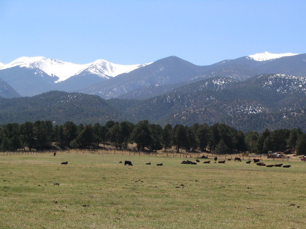 Dream On TrailHiking · ~6 min drivePhoto: Ken Lund, CC BY-SA 2.0 (via Flickr)
- Labyrinth TrailHiking · ~6 min drivePhoto: Ken Lund, CC BY-SA 2.0 (via Flickr)
- Bushnell PeakHiking · ~15 min drive
- Chicken Dinner TrailHiking · ~6 min drivePhoto: Ken Lund, CC BY-SA 2.0 (via Flickr)
 Pole Line TrailHiking · ~7 min drivePhoto: Ken Lund from Reno, Nevada, USA, CC BY-SA 2.0 (via Wikimedia Commons)
- Hunts PeakHiking · ~15 min drive
- CottonwoodHiking · ~2 min drive
- Dude Abides TrailHiking · ~5 min drive
- RhumbaHiking · ~2 min drive
- Hooligan TrailHiking · ~5 min drive
Best time to visit Crater Trail
Best months: June–August. Best months have typical highs of 55–85 °F, lows of 30 °F or warmer (32 °F where the station doesn't record snow), at most one snowy day and no more than 12 wet days.
Jan
32° / -4°
4 wet
Feb
34° / -1°
4 wet
Mar
42° / 10°
5 wet
Apr
49° / 19°
6 wet
May
59° / 27°
7 wet
Jun
70° / 34°
7 wet
Jul
76° / 41°
11 wet
Aug
73° / 39°
12 wet
Sep
67° / 30°
7 wet
Oct
55° / 19°
5 wet
Nov
42° / 9°
4 wet
Dec
32° / -2°
4 wet
Typical high / low (°F) and days with rain or snow, 1991–2020. Measured at Antero Rsvr, CO, 29.6 mi away at 8,939 ft. This station doesn't record snowfall. Source: NOAA NCEI U.S. Climate Normals 1991–2020.
Map and trail data © OpenStreetMap contributors
