Denver West/Central City KOA
Campground
Campground · 1.4 mi from the trail
Clear today
Weather is good · OpenWeather · checked just now
The Continental Trail is a short, easy out-and-back hike in Colorado, about 0.7 miles from the town of Central City. The route is roughly 0.6 miles long, with a total climb of about 313 feet and a high point of 8,638 feet. The trail starts at 8,638 feet and ends at the same elevation, so it works as a quick loop or a short stop on the way to something else. Summer is the most comfortable time to go. Typical averages from the nearby Coal Creek Canyon weather station show July highs around 73°F with lows near 48°F, while winter highs stay around 33°F. The Quartz Valley Trail and Claim Jumper mountain biking routes are both within half a mile. Climbers can head to Ameristar, The, about a mile away, and Columbine Campground is about 1.7 miles off.
Denver West/Central City KOA
Campground
 If it rainsUser:Magicpiano, CC BY-SA 4.0 · Wikimedia Commons
Historic house-museum in Georgetown, Colorado, United States
Places © OpenStreetMap contributors, Places © Overture Maps Foundation · Photos: User:Magicpiano, CC BY-SA 4.0 (commons)
More in Idaho SpringsNot on Roamze yet. Their page has how to reach them.
 Clear CreekCanoeingPhoto: Ken Gallager at en.wikipedia, Public domain (via Wikimedia Commons)7.3 mi
Source: Roamze catalog (indexable pages within 10 miles, PostGIS distance)
 Millsite TrailHiking · ~2 min drivePhoto: Tony Webster — CC BY 2.0 (via Flickr)
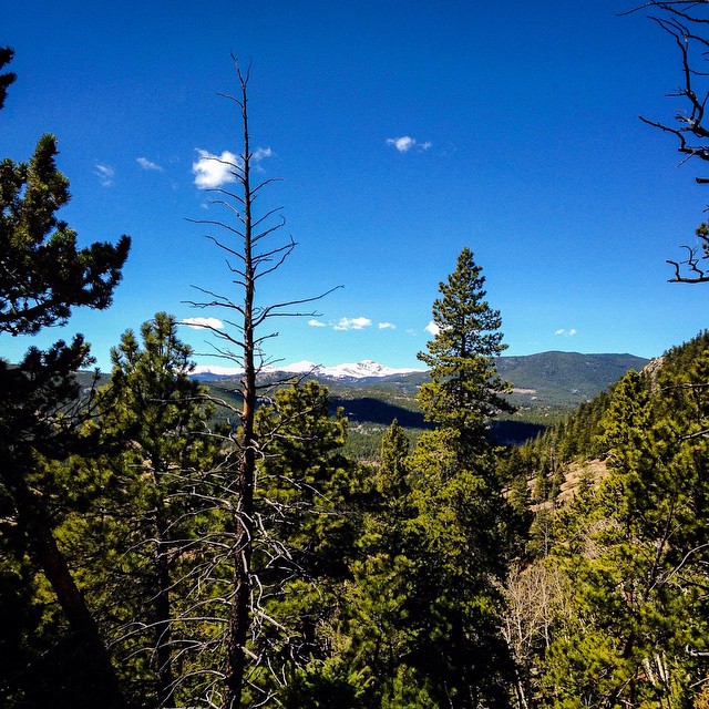 Blue Grouse TrailHiking · ~9 min drivePhoto: jackieflynt, CC BY-SA 2.0 (via Flickr)
 Black Bear TrailHiking · ~9 min drivePhoto: Brian from California Desert, United States, CC BY 2.0 (via Wikimedia Commons)
 Mount BancroftHiking · ~12 min drivePhoto: Greg Younger from Parker, Colorado, USA, USA, CC BY-SA 2.0 (via Wikimedia Commons)Summit TrailHiking · ~2 min drivePhoto: Tony Webster — CC BY 2.0 (via Flickr)
 Snowshoe Hare TrailHiking · ~12 min drivePhoto: Josh Gross — CC BY 2.0 (via Flickr)Coyote TrailHiking · ~9 min drivePhoto: Tony Webster — CC BY 2.0 (via Flickr)Mule Deer TrailHiking · ~8 min drivePhoto: Tony Webster — CC BY 2.0 (via Flickr)Mountain Lion TrailHiking · ~13 min drivePhoto: Tony Webster — CC BY 2.0 (via Flickr)Beaver TrailHiking · ~10 min drivePhoto: Brian from California Desert, United States, CC BY 2.0 (via Wikimedia Commons)
Best months: September. Best months have typical highs of 55–85 °F, lows of 30 °F or warmer (32 °F where the station doesn't record snow), at most one snowy day and no more than 12 wet days.
Jan
33° / 16°
10 wet
Feb
34° / 15°
10 wet
Mar
41° / 20°
11 wet
Apr
46° / 24°
13 wet
May
55° / 33°
14 wet
Jun
67° / 41°
13 wet
Jul
73° / 48°
14 wet
Aug
71° / 46°
15 wet
Sep
64° / 39°
10 wet
Oct
52° / 30°
8 wet
Nov
41° / 21°
8 wet
Dec
33° / 15°
9 wet
Typical high / low (°F) and days with rain or snow, 1991–2020. Measured at Coal Creek Canyon, CO, 9.2 mi away at 8,950 ft. This station doesn't record snowfall. Source: NOAA NCEI U.S. Climate Normals 1991–2020.
Map and trail data © OpenStreetMap contributors
