Aspen Meadows Campground
Campground
Campground · 2.6 mi from the trail
 Photo: supercraigtalbert, CC BY 2.0 (via Flickr)
Caution today
Agency alerts are in effect for this area; weather is good · USFS, OpenWeather · checked just now
Alert in the area
The Forest Service lists 3 alerts for Arapaho and Roosevelt National Forests.
Fire Restrictions
Agency alert covering Arapaho and Roosevelt National Forests · USFS · Arapaho and Roosevelt National Forests
Caribou Road Closure Order
Agency alert covering Boulder Ranger District · Order 02-10-01-26-04 · USFS · Boulder Ranger District
Raptor Nesting Area Closure - Boulder Ranger District
Agency alert covering Boulder Ranger District · Order 02-10-01-26-06 · USFS · Boulder Ranger District
As of · Source: USFS · Arapaho and Roosevelt National Forests. Agencies don't list every closure — check before you go.
Boiling Gulch is an out-and-back hike in the Boulder Ranger District of the Arapaho and Roosevelt National Forests in Colorado, managed by the Forest Service. The trail spans about 4.7 miles, starting at roughly 8,082 feet and reaching a high point of about 9,223 feet. The climb is moderate, with an elevation gain of about 12 feet one way, and the route is natural-surface. Bikes and horses are both allowed, so the trail works for riders and pack animals as well as hikers. It stays open year-round, and the nearest town is Boulder. Summer is the most comfortable time to go. Typical averages from the nearby Coal Creek Canyon weather station, at a similar elevation, show July highs around 73°F and lows near 48°F, while winter highs sit in the low 30s. Mount Thorodin, a hike about 0.8 miles away, and the climbing areas on Mt. Thorodin and Second Buttress, both within about 2 miles, are the closest neighbors. South Boulder Creek, a canoeing spot about 2.1 miles away, rounds out the options.
Aspen Meadows Campground
Campground
The Last Shot
Restaurant
 If it rainsMatt Golon, CC BY-SA 3.0 · Wikimedia Commons
Places © OpenStreetMap contributors · Photos: Matt Golon, CC BY-SA 3.0 (commons)
More in Idaho SpringsNot on Roamze yet. Their page has how to reach them.
 Second ButtressRock climbingPhoto: supercraigtalbert, CC BY 2.0 (via Flickr)1.8 miMt. ThorodinRock climbingPhoto: supercraigtalbert, CC BY 2.0 (via Flickr)1.9 mi
 South Boulder CreekCanoeingPhoto: Jeffrey Beall, CC BY 3.0 (via Wikimedia Commons)2.1 mi
 Snowshoe Hare TrailHikingPhoto: Josh Gross — CC BY 2.0 (via Flickr)2.6 mi
Source: Roamze catalog (indexable pages within 10 miles, PostGIS distance)
Snowshoe Hare TrailHiking · ~4 min drivePhoto: Josh Gross — CC BY 2.0 (via Flickr) Snowshoe Hare Connector To Mule Deer TrailHiking · ~5 min drivePhoto: jackieflynt, CC BY-SA 2.0 (via Flickr)
 Coyote TrailHiking · ~6 min drivePhoto: Tony Webster — CC BY 2.0 (via Flickr)Mountain Lion TrailHiking · ~6 min drivePhoto: Tony Webster — CC BY 2.0 (via Flickr)
 Raccoon TrailHiking · ~5 min drivePhoto: agahran, CC BY 2.0 (via Flickr)
 Black Bear TrailHiking · ~7 min drivePhoto: Brian from California Desert, United States, CC BY 2.0 (via Wikimedia Commons)
 Burro TrailHiking · ~7 min drivePhoto: Jesse James — CC BY 2.0 (via Flickr)Inlet TrailHiking · ~5 min drivePhoto: Josh Gross — CC BY 2.0 (via Flickr)Beaver TrailHiking · ~9 min drivePhoto: Brian from California Desert, United States, CC BY 2.0 (via Wikimedia Commons)
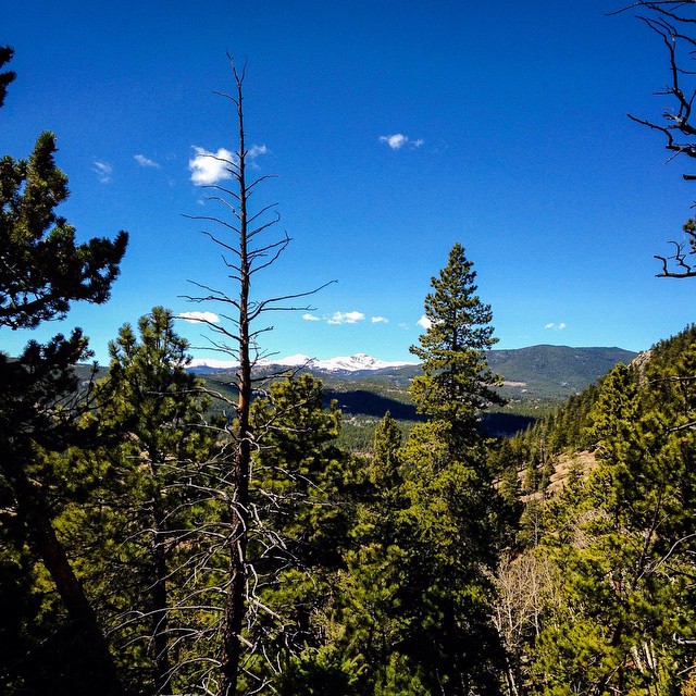 Blue Grouse TrailHiking · ~8 min drivePhoto: jackieflynt, CC BY-SA 2.0 (via Flickr)
Also worth it near here
 Thorodin MountainSummit · ~3 min drivePhoto: Craig Talbert, CC BY 2.0 (via Wikimedia Commons)Second ButtressRock climbing · ~3 min drivePhoto: supercraigtalbert, CC BY 2.0 (via Flickr)South Boulder CreekCanoeing · ~4 min drivePhoto: Jeffrey Beall, CC BY 3.0 (via Wikimedia Commons)
Best months: September. Best months have typical highs of 55–85 °F, lows of 30 °F or warmer (32 °F where the station doesn't record snow), at most one snowy day and no more than 12 wet days.
Jan
33° / 16°
10 wet
Feb
34° / 15°
10 wet
Mar
41° / 20°
11 wet
Apr
46° / 24°
13 wet
May
55° / 33°
14 wet
Jun
67° / 41°
13 wet
Jul
73° / 48°
14 wet
Aug
71° / 46°
15 wet
Sep
64° / 39°
10 wet
Oct
52° / 30°
8 wet
Nov
41° / 21°
8 wet
Dec
33° / 15°
9 wet
Typical high / low (°F) and days with rain or snow, 1991–2020. Measured at Coal Creek Canyon, CO, 1.5 mi away at 8,950 ft. This station doesn't record snowfall. Source: NOAA NCEI U.S. Climate Normals 1991–2020.
