Blue Loop Trail
- 0.7 mi
- round trip
- 249 ft
- climb
- 6,590 ft
- high point
- Out and back
- route
- Apr–Jun, Aug–Oct
- best months
Blue Loop Trail is an easy, short hike in Colorado's Ridgeline Open Space, a county-managed land unit. The trail is about 1.5 miles long, with a total elevation gain of about 250 feet, and it's set up as an out-and-back. The high point is about 6590 feet, and the steepest stretch comes near the start, with a grade of about 8 percent at around 0.2 miles in. Spring and fall are the most comfortable times to go. Typical averages from a nearby weather station in Castle Rock show September highs around 77°F with lows near 47°F, and October highs around 65°F with lows near 35°F. That station sits about 400 feet lower than the trail's high point, so temperatures up high run a little cooler. The trail is close to several other loops. Red Loop Trail is about 0.2 miles away and Yellow Loop Trail about 0.3 miles. Castle Rock, a climbing area, is about 2 miles off, and Yogi Bear's Jellystone Park Larkspur, a campground, is about 8 miles away.
Local outfitters
- Broadmoor Outfitters40 mi away
- Lostfork Basecamp42 mi away
Not on Roamze yet. Their page has how to reach them.
- Red Loop TrailHiking0.2 mi
- Yellow Loop TrailHiking0.3 mi
- Castle RockRock climbing2 mi
- Denver SouthRock climbing3.8 mi
 Yogi Bear's Jellystone Park LarkspurCampingPhoto: Jacob Montgomery, CC BY-SA 3.0 (via Wikimedia Commons)8 mi
- The Pinery Rv LotCamping8.9 mi
 Plum CreekCanoeingPhoto: Jeffrey Beall, CC BY 4.0 (via Wikimedia Commons)9.5 mi
 Cherry CreekCanoeingPhoto: Tim Kiser (w:User:Malepheasant), CC BY-SA 2.5 (via Wikimedia Commons)10 mi
Source: Roamze catalog (indexable pages within 10 miles, PostGIS distance)
 Gold Loop TrailHiking · ~1 min drivePhoto: glennharper, CC BY-SA 2.0 (via Flickr)
- Dawson Butte TrailHiking · ~10 min drive
- Gold Loop TrailHiking · ~2 min drivePhoto: glennharper, CC BY-SA 2.0 (via Flickr)
- Red Loop TrailHiking · ~2 min drivePhoto: glennharper, CC BY-SA 2.0 (via Flickr)
 Chuck's Loop TrailHiking · ~8 min drivePhoto: gregor_y, CC BY-SA 2.0 (via Flickr)
- Legacy TrailHiking · ~9 min drivePhoto: gregor_y, CC BY-SA 2.0 (via Flickr)
 Hidden Mesa - Mesa Rim LoopHiking · ~9 min drivePhoto: jaygannett, CC BY-SA 2.0 (via Flickr)
- Pleasant Pass TrailHiking · ~9 min drivePhoto: jaygannett, CC BY-SA 2.0 (via Flickr)
- Mitchell Creek Canyon TrailHiking · ~9 min drivePhoto: gregor_y, CC BY-SA 2.0 (via Flickr)
 Columbine Open Space North loopHiking · ~11 min drivePhoto: Patrick McKay, CC BY-SA 3.0 (via Wikimedia Commons)
Also worth it near here
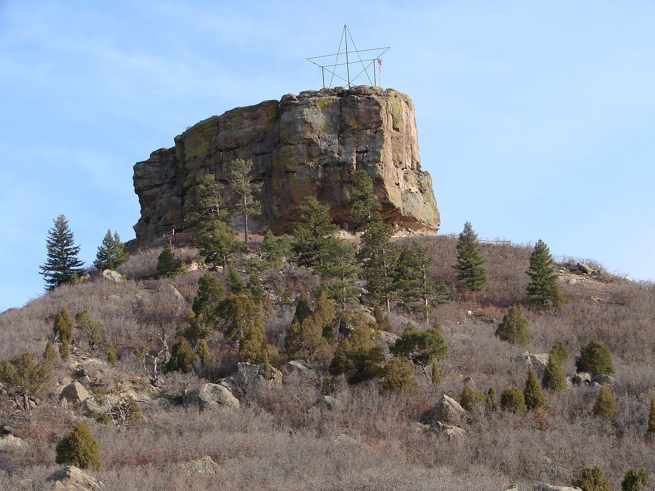 Castle RockSummit · ~4 min drivePhoto: Jeff Albright, CC BY-SA 3.0 (via Wikimedia Commons)
- Legacy Trail BoulderingRock climbing · ~9 min drivePhoto: gregor_y, CC BY-SA 2.0 (via Flickr)
- Yogi Bear's Jellystone Park LarkspurCamping · ~14 min drivePhoto: Jacob Montgomery, CC BY-SA 3.0 (via Wikimedia Commons)
Best time to visit Blue Loop Trail
Best months: April–June and August–October. Best months have typical highs of 55–85 °F, lows of 30 °F or warmer (32 °F where the station doesn't record snow), at most one snowy day and no more than 12 wet days.
Jan
46° / 18°
4 wet
Feb
47° / 20°
5 wet
Mar
54° / 27°
5 wet
Apr
59° / 33°
6 wet
May
68° / 42°
8 wet
Jun
80° / 50°
8 wet
Jul
86° / 56°
9 wet
Aug
84° / 55°
9 wet
Sep
77° / 47°
6 wet
Oct
65° / 35°
4 wet
Nov
54° / 26°
4 wet
Dec
46° / 18°
5 wet
Typical high / low (°F) and days with rain or snow, 1991–2020. Measured at Castle Rock, CO, 2.3 mi away at 6,185 ft. This station doesn't record snowfall. Source: NOAA NCEI U.S. Climate Normals 1991–2020.
Map and trail data © OpenStreetMap contributors
