Antones
- Jun–Aug
- best months
Is Antones open right now?
Alert in the area
The Forest Service lists 6 alerts for White River National Forest.
FSR 286, Radical Hill, is closed due to washouts and unsafe conditions
Agency alert covering White River National Forest · USFS · White River National Forest
Limited parking at Snowmass Creek Trailhead
Agency alert covering White River National Forest · USFS · White River National Forest
Grizzly Creek Trail Closure
Agency alert covering White River National Forest · Order 2026-02 · USFS · White River National Forest
Ruedi Marina Day Use area Dump Station is CLOSED
Agency alert covering White River National Forest · USFS · White River National Forest
Asbestos safety closure - Camp Hale
Agency alert covering White River National Forest · USFS · White River National Forest
As of · Source: USFS · White River National Forest. Agencies don't list every closure — check before you go.
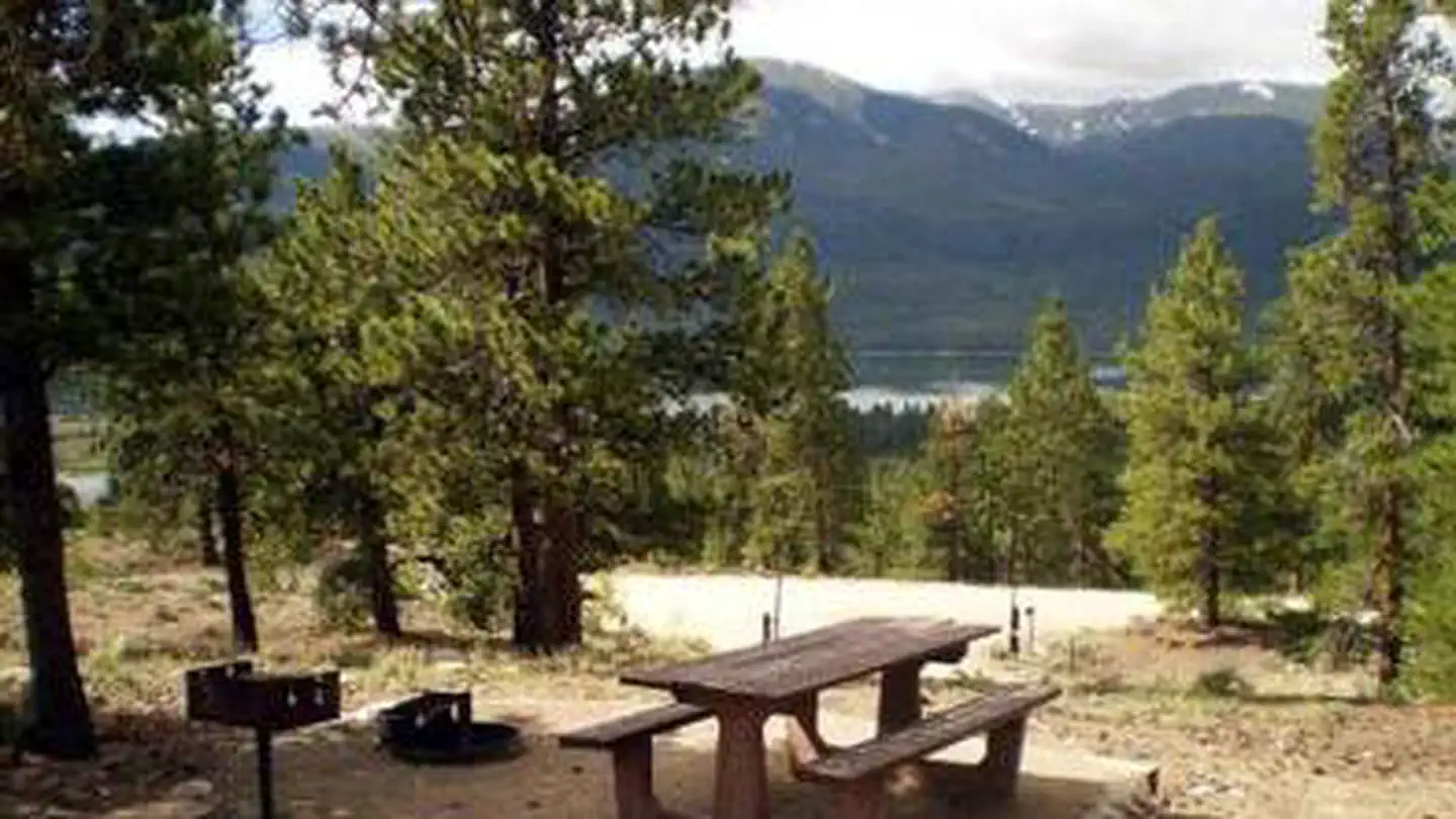
The Antones Trail begins at LEDE Reservoir and ends at Forest Service Road 414. The trail begins as an old jeep road, then enters aspen forest as a gradual uphill climb until it comes to the top of a ridge into a small open meadow where it might become faint. The ridge top meadow is the perfect spot for a summer picnic with good views. From the ridge it descends through aspen, spruce, fir, and meadows and the trail again becomes hard to find because of cattle trails leading to the water. The trail follows the drainage to the Powerline Road Forest Service Road 414 near Sylvan Lake. The ridge top meadow is the perfect spot for a summer picnic. Scenic views of the mountain peaks of the Sawatch Range are breath-taking from this vantage point.View a printable Recreation Quicksheet for this trail which is complete with directions, a map, details, and other information about this trail.
Local outfitters
- Glenwood Canyon Resort28 mi away
- Hanging Lake Adventure Co-op30 mi away
Not on Roamze yet. Their page has how to reach them.
- Lost LakeHiking1.2 mi
- West Brush Creek TrailHiking2.1 mi
- Sneve GulchLake fishing2.5 mi
- Yeoman Park CampgroundCamping5.8 mi
- East Brush CreekCanoeing5.8 mi
- Little Maud CampgroundCamping6.5 mi
- North WallRock climbing7.6 mi
- Team WallRock climbing7.6 mi
Source: Roamze catalog (indexable pages within 10 miles, PostGIS distance)
- Sneve GulchLake fishing · ~4 min drive
- Fryingpan RiverRiver fishing · ~16 min drive
- Roaring Fork RiverRiver fishing · ~27 min drive
- Beaver LakeRiver fishing · ~28 min drive
- Lost LakeLake fishing · ~5 min drive
- Beaver Creek Ski ResortRiver fishing · ~29 min drive
- Lake CharlesLake fishing · ~11 min drive
- Missouri LakesRiver fishing · ~29 min drive
- Ruedi ReservoirLake fishing · ~12 min drive
- Horse Pasture SiteRiver fishing · ~29 min drive
Best time to visit Antones
Best months: June–August. Best months have typical highs of 55–85 °F, lows of 30 °F or warmer (32 °F where the station doesn't record snow), at most one snowy day and no more than 12 wet days.
Jan
31° / 3°
8 wet
Feb
33° / 3°
8 wet
Mar
39° / 9°
8 wet
Apr
44° / 18°
8 wet
May
55° / 27°
9 wet
Jun
68° / 34°
9 wet
Jul
73° / 39°
12 wet
Aug
70° / 38°
12 wet
Sep
62° / 31°
8 wet
Oct
51° / 23°
6 wet
Nov
39° / 14°
7 wet
Dec
31° / 6°
7 wet
Typical high / low (°F) and days with rain or snow, 1991–2020. Measured at Sugarloaf Rsvr, CO, 26.4 mi away at 9,738 ft. This station doesn't record snowfall. Source: NOAA NCEI U.S. Climate Normals 1991–2020.