Sugar Loafin' RV Park
Campground
Campground · < 0.1 mi from the trail
Caution at last check
A fire perimeter is near this location; weather is marginal · nifc_wfigs, OpenWeather · checked 15 h ago
Sugar Loafin' RV Park is a Bureau of Land Management campground in Colorado, sitting within the Arkansas River Segment 1 of the BLM's land on the Colorado side of the Arkansas River. It is a place for an overnight stay on public land, and it sits right beside several other spots in the river corridor. Summer is the most comfortable time to visit. Typical averages from a nearby weather station show July highs around 73°F with lows near 39°F, while winter highs stay near freezing, with January highs around 31°F and lows around 3°F. The Bodfish hike and the mountain biking on County Road 9D are both about 0.4 miles away. Matchless Campground and the Matchless Boating Site are each about 0.7 miles off, and Silver Dollar campground is about 0.9 miles away.
Sugar Loafin' RV Park
Campground
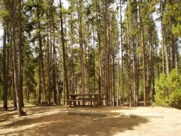
 If it rainsCraig Talbert, CC BY 3.0 · Wikimedia Commons
Places © OpenStreetMap contributors, Places © Overture Maps Foundation · Photos: Craig Talbert, CC BY 3.0 (commons)
More in LeadvilleNot on Roamze yet. Their page has how to reach them.
 BodfishHikingPhoto: markbyzewski, CC BY 2.0 (via Flickr)0.4 mi
 Silver DollarCampingPhoto: Recreation.gov (RIDB) / public domain0.9 mi
Source: Roamze catalog (indexable pages within 10 miles, PostGIS distance)
Also worth it near here
Best months: June–August. Best months have typical highs of 55–85 °F, lows of 30 °F or warmer (32 °F where the station doesn't record snow), at most one snowy day and no more than 12 wet days.
Jan
31° / 3°
8 wet
Feb
33° / 3°
8 wet
Mar
39° / 9°
8 wet
Apr
44° / 18°
8 wet
May
55° / 27°
9 wet
Jun
68° / 34°
9 wet
Jul
73° / 39°
12 wet
Aug
70° / 38°
12 wet
Sep
62° / 31°
8 wet
Oct
51° / 23°
6 wet
Nov
39° / 14°
7 wet
Dec
31° / 6°
7 wet
Typical high / low (°F) and days with rain or snow, 1991–2020. Measured at Sugarloaf Rsvr, CO, 1 mi away at 9,738 ft. This station doesn't record snowfall. Source: NOAA NCEI U.S. Climate Normals 1991–2020.
Map and trail data © OpenStreetMap contributors

