Silver Creek Dispersed Campground
- Jun–Aug
- best months
Is Silver Creek Dispersed Campground open right now?
Alert in the area
The Forest Service lists 7 alerts for Pike and San Isabel National Forests.
FSR 286, Radical Hill, is closed due to washouts and unsafe conditions
Agency alert covering Pike and San Isabel National Forests · USFS · Pike and San Isabel National Forests
Interlaken Hotel Tree Hazards
Agency alert covering Pike and San Isabel National Forests · USFS · Pike and San Isabel National Forests
Sharpe Fire Update
Agency alert covering Pike and San Isabel National Forests · USFS · Pike and San Isabel National Forests
Turquoise Lake Road (County Road 4) Closure
Agency alert covering Pike and San Isabel National Forests · USFS · Pike and San Isabel National Forests
Food Storage Prohibitions on Pike-San Isabel National Forests
Agency alert covering Pike and San Isabel National Forests · Order 02-12-00-23-07 · USFS · Pike and San Isabel National Forests
As of · Source: USFS · Pike and San Isabel National Forests. Agencies don't list every closure — check before you go.
- At 8,812 ftHigh camp: expect cold nights, even in summer
- Salida Ranger DistrictPike and San Isabel National Forests
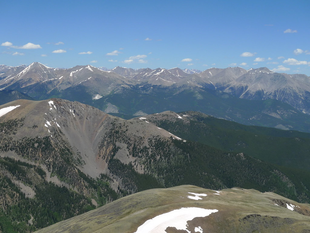
Silver Creek Dispersed Campground is a Forest Service dispersed camping site in the Salida Ranger District of the Pike and San Isabel National Forests in Colorado. It sits within the national forest's ranger district, and the Forest Service manages the land. Summer is the most comfortable time to visit. Typical averages from a nearby weather station at Sargents, CO, show July highs around 82°F with lows near 39°F, while winter brings highs in the low 30s and regular snow days from December through February. Several other destinations lie close by. Marshall Pass Road, a mountain biking route, is about a mile away, and Mount Ouray is a hike roughly a mile off. Ohaver Lake and O'Haver Campground are both about 1.9 miles away.
Local outfitters
- Riverside RV Park10 mi away
- Monarch Spur RV Park11 mi away
Not on Roamze yet. Their page has how to reach them.
- marshall pass roadMountain biking1 mi
- Mount OurayHiking1.1 mi
- Ohaver LakePier fishing1.9 mi
 O'Haver CampgroundCampingPhoto: Jeffrey Beall, CC BY 4.0 (via Wikimedia Commons)1.9 mi
- Starvation CreekHiking3 mi
- Brewery Creek Guard StationCamping8.3 mi
- Brewery Creek CabinCamping8.4 mi
 South Arkansas RiverCanoeingPhoto: Jeffrey Beall, CC BY 4.0 (via Wikimedia Commons)8.9 mi
Source: Roamze catalog (indexable pages within 10 miles, PostGIS distance)
- O'Haver CampgroundCamping · ~3 min drivePhoto: Jeffrey Beall, CC BY 4.0 (via Wikimedia Commons)
 Four Seasons RV ParkCamping · ~19 min drivePhoto: Ken Lund from Reno, Nevada, USA, CC BY-SA 2.0 (via Wikimedia Commons)
- Salida EastCamping · ~20 min drivePhoto: Ken Lund from Reno, Nevada, USA, CC BY-SA 2.0 (via Wikimedia Commons)
 Vallie BridgeCamping · ~33 min drivePhoto: LeeAnne Adams from Washington, DC, CC BY 2.0 (via Wikimedia Commons)
 Middle Quartz Creek CampgroundCamping · ~38 min drivePhoto: Bull dd-780, CC BY 3.0 (via Wikimedia Commons)
 Valley View Hot SpringsCamping · ~38 min drivePhoto: Dan Nevill, CC BY 2.0 (via Wikimedia Commons)
 Chalk Creek Campground and RV ParkCamping · ~40 min drivePhoto: Roy Luck, CC BY 2.0 (via Wikimedia Commons)
- Monarch ParkCamping · ~23 min drive
- Marshall Pass Dispersed CampgroundCamping · ~2 min drive
- Poncha Pass Dispersed CampgroundCamping · ~3 min drive
Also worth it near here
Best time to visit Silver Creek Dispersed Campground
Best months: June–August. Best months have typical highs of 55–85 °F, lows of 30 °F or warmer (32 °F where the station doesn't record snow), at most one snowy day and no more than 12 wet days.
Jan
33° / -5°
7 wet · 7 snow
Feb
37° / -3°
7 wet · 7 snow
Mar
45° / 9°
7 wet · 6 snow
Apr
54° / 20°
7 wet · 4 snow
May
65° / 26°
7 wet · 1 snow
Jun
76° / 32°
6 wet
Jul
82° / 39°
11 wet
Aug
79° / 37°
11 wet
Sep
73° / 28°
8 wet
Oct
61° / 17°
6 wet · 2 snow
Nov
46° / 8°
6 wet · 5 snow
Dec
34° / -4°
7 wet · 7 snow
Typical high / low (°F) and days with rain or snow, 1991–2020. Measured at Sargents, CO, 16.1 mi away at 8,460 ft. Source: NOAA NCEI U.S. Climate Normals 1991–2020.

Map and trail data © OpenStreetMap contributors
