Rattlesnake
Campground
Campground · 2.7 mi from the trail
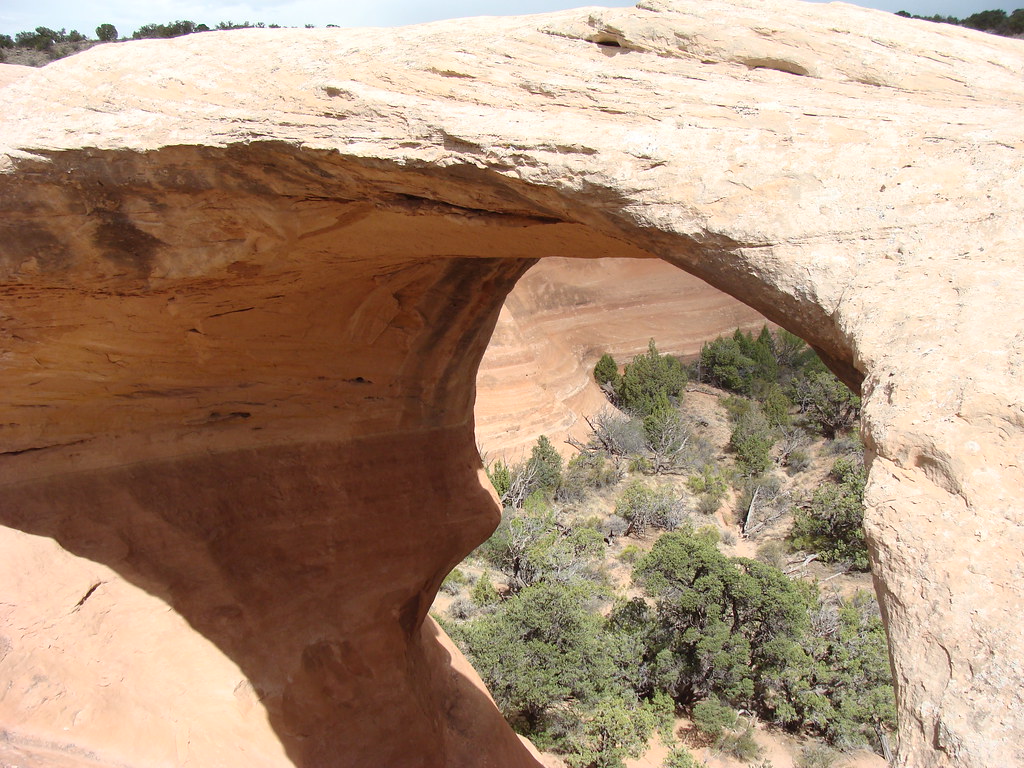
Finger Arch is a natural arch in the Black Ridge Canyons Wilderness, on Bureau of Land Management land within the Grand Junction Field Office in western Colorado. It sits at about 5,688 feet, roughly 6 miles from the town of Loma. Spring and fall are the most comfortable times to visit. Typical averages from a nearby weather station show May highs around 74°F and October highs around 66°F, while July averages about 93°F and winter brings highs near 39°F with a few snowy days each month. The Rattlesnake Arches Upper Trail and Rattlesnake Arches Upper Rim Trail both start about a mile away. Mee Canyon Trail is about 2 miles off, and Rattlesnake campground is about 2.7 miles away.
Rattlesnake
Campground
 If it rainsJeffrey Beall, CC BY-SA 3.0 · Wikimedia Commons
Places © OpenStreetMap contributors · Photos: Jeffrey Beall, CC BY-SA 3.0 (commons)
More in CliftonElevation from USGS 3D Elevation Program terrain data (about 10 m resolution).
 Rattlesnake Arches Upper TrailHikingPhoto: iagoarchangel, CC BY-SA 2.0 (via Flickr)0.9 mi
 Rattlesnake Arches Upper Rim TrailHikingPhoto: iagoarchangel, CC BY-SA 2.0 (via Flickr)0.9 mi
 RattlesnakeCampingPhoto: jimmy thomas from Seattle, CC BY-SA 2.0 (via Wikimedia Commons)2.7 miBeaver Tail 1CampingPhoto: jimmy thomas from Seattle, CC BY-SA 2.0 (via Wikimedia Commons)3 mi
 Slab BoulderRock climbingPhoto: iagoarchangel, CC BY-SA 2.0 (via Flickr)4.2 mi
Source: Roamze catalog (indexable pages within 10 miles, PostGIS distance)
 Delicate ArchNatural arch · ~1h 15m drivePhoto: W. Bulach, CC BY-SA 4.0 (via Wikimedia Commons)
 Tapestry ArchNatural arch · ~1h 20m drivePhoto: Chris Wonderly, Public domain (via Wikimedia Commons)
 Broken ArchNatural arch · ~1h 20m drivePhoto: SBirdsell, CC BY-SA 4.0 (via Wikimedia Commons)
 Skyline ArchNatural arch · ~1h 20m drivePhoto: Thomas Wolf, www.foto-tw.de, CC BY-SA 3.0 (via Wikimedia Commons)
 Black Cave ArchNatural arch · ~1h 21m drivePhoto: The Dye Clan, CC BY-SA 3.0 (via Wikimedia Commons)
 Landscape ArchNatural arch · ~1h 21m drivePhoto: Thomas Wolf, www.foto-tw.de, CC BY-SA 3.0 (via Wikimedia Commons)
Also worth it near here
Rattlesnake Arches Upper TrailHiking · ~2 min drivePhoto: iagoarchangel, CC BY-SA 2.0 (via Flickr)RattlesnakeCamping · ~5 min drivePhoto: jimmy thomas from Seattle, CC BY-SA 2.0 (via Wikimedia Commons) Rustler's LoopMountain biking · ~5 min drivePhoto: jimmy thomas from Seattle, CC BY-SA 2.0 (via Wikimedia Commons)
Best months: April–May and September–October. Best months have typical highs of 55–85 °F, lows of 30 °F or warmer (32 °F where the station doesn't record snow), at most one snowy day and no more than 12 wet days.
Jan
39° / 21°
6 wet · 4 snow
Feb
45° / 25°
5 wet · 3 snow
Mar
56° / 34°
6 wet · 2 snow
Apr
63° / 39°
6 wet · 1 snow
May
74° / 49°
6 wet
Jun
87° / 58°
4 wet
Jul
93° / 65°
6 wet
Aug
90° / 62°
7 wet
Sep
80° / 54°
7 wet
Oct
66° / 41°
6 wet
Nov
50° / 31°
6 wet · 2 snow
Dec
39° / 22°
6 wet · 4 snow
Typical high / low (°F) and days with rain or snow, 1991–2020. Measured at Colorado Nm, CO, 6.2 mi away at 5,781 ft. Source: NOAA NCEI U.S. Climate Normals 1991–2020.
