Mountain · 1 route
Mitchell Peak
10,364 ft · California
- Summit
- 10,364 ft
- Routes
- 1 way up
Route up Mitchell Peak
About Mitchell Peak
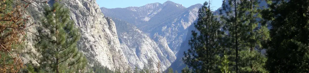
Mitchell Peak is a summit in California at 10,364 feet elevation. It is reached by the MITCHELL PEAK trail, a 1.94-mile public trail with 1,174 feet of elevation gain.
Forecast on Mitchell Peak
Daily highs and lows, wind and the chance of precipitation at the summit and route start for the next 7 days, from the Open-Meteo model.
Questions about Mitchell Peak
How tall is Mitchell Peak?
10,364 ft (3,159 m).
How many routes go to the summit of Mitchell Peak?
One: MITCHELL PEAK.
Mountains nearby
- Lookout Peak8,518 ft · California2 routes2.8 mi away
- Little Baldy8,043 ft · California1 route9.5 mi away
- Big Baldy8,208 ft · California1 route10 mi away
 Alta Peak11,195 ft · California1 route10 mi awayPhoto: Bryan Siders, CC BY 2.0 (via Wikimedia Commons)
- Buena Vista Peak7,613 ft · California1 route10 mi away
- Sunset Rock6,401 ft · California1 route11 mi away
Facts about this place
Where it is
- Sequoia-Kings Canyon Wilderness · Wilderness
- Kings Canyon National Park · National Park Service
- Nearest town
- Wilsonia, California · 13 mi
Source: Wilderness.net boundaries; NPS Land Resources boundaries; USGS GNIS populated places
Nearby
- Kanawyer GapHiking1.1 mi
- Marvin PassHiking1.1 mi
- Sequoia & Kings Canyon NPRock climbing4.3 mi
- Sentinel CampgroundSaltwater fishing4.7 mi
 Canyon View Group SitesCampingPhoto: Recreation.gov (RIDB) / public domain4.7 mi
 South Fork Kings RiverCanoeingPhoto: Daniel Mayer (mav), CC BY-SA 3.0 (via Wikimedia Commons)4.8 mi
- Kings CanyonRock climbing5 mi
- Big Meadow CampgroundCamping5.9 mi
Source: Roamze catalog (indexable pages within 10 miles, PostGIS distance)
Is Mitchell Peak open right now?
No closures listed
The National Park Service lists no closures for Kings Canyon National Park.
As of · Source: NPS · Kings Canyon National Park. Agencies don't list every closure — check before you go.
