Henry W. Coe State Park
- State Park and Recreation
- managed by
- Sep–Jun
- best months
Henry W. Coe State Park is a California state park managed by State Park and Recreation, about 10 miles from the town of San Martin. The park holds a network of hiking trails, several of which begin within about a mile of one another, making it a base for anything from a short walk to a longer day linking routes together. Spring brings the most comfortable conditions, with typical April highs around 72°F and lows near 44°F, based on averages from a nearby weather station in Gilroy. That station sits at just 194 feet, so temperatures at higher points in the park run cooler, while summer highs in the valley average in the upper 80s. Among the closest trails are Eagle Pines Trail, less than half a mile away, along with Rat Spring Trail, Canteen Trail and Hoover Lake Trail, all within about a mile.
 Eagle Pines TrailHikingPhoto: ilya_ktsn, CC BY 2.0 (via Flickr)0.4 mi
 Rat Spring TrailHikingPhoto: ilya_ktsn, CC BY 2.0 (via Flickr)0.7 mi
- Canteen TrailHiking0.8 mi
- 4th TrailHiking0.9 mi
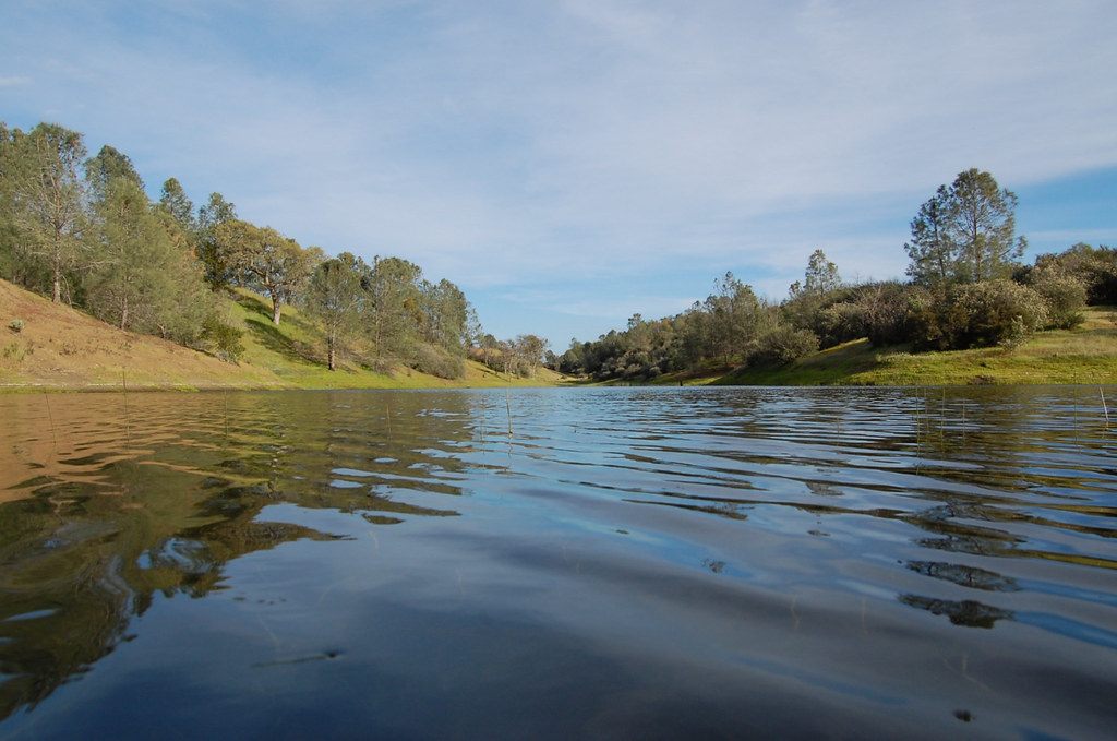 Mudd Spring TrailHikingPhoto: ilya_ktsn, CC BY 2.0 (via Flickr)1 mi
 Hoover Lake TrailHikingPhoto: ilya_ktsn, CC BY 2.0 (via Flickr)1.1 mi
- Laurel TrailHiking1.1 mi
- Heritage TrailHiking1.2 mi
Source: Roamze catalog (indexable pages within 10 miles, PostGIS distance)
 Pacheco State ParkState park · ~28 min drivePhoto: Jason Jenkins, CC BY-SA 2.0 (via Wikimedia Commons)
 San Juan Bautista State Historic ParkState park · ~39 min drivePhoto: Pma03, CC BY-SA 3.0 (via Wikimedia Commons)
 Manresa State BeachState park · ~48 min drivePhoto: Dg251273, CC BY-SA 4.0 (via Wikimedia Commons)
 Fremont Peak State ParkState park · ~48 min drivePhoto: Brocken Inaglory, CC BY-SA 3.0 (via Wikimedia Commons)
 Sunset State BeachState park · ~49 min drivePhoto: Davide D'Amico from London, United Kingdom, CC BY-SA 2.0 (via Wikimedia Commons)
 Twin Lakes State BeachState park · ~57 min drivePhoto: Don DeBold from San Jose, CA, USA, CC BY 2.0 (via Wikimedia Commons)
 Salinas River State BeachState park · ~57 min drivePhoto: Mr. Brendel, CC BY 3.0 (via Wikimedia Commons)
 Henry Cowell Redwoods State ParkState park · ~60 min drivePhoto: Bmp713, Public domain (via Wikimedia Commons)
 Lighthouse Field State BeachState park · ~1h drivePhoto: Brucetopp, Public domain (via Wikimedia Commons)
 Natural Bridges State BeachState park · ~1h 3m drivePhoto: Eugene Zelenko, CC BY-SA 4.0 (via Wikimedia Commons)
Best time to visit Henry W. Coe State Park
Best months: September–June. Best months have typical highs of 55–85 °F, lows of 30 °F or warmer (32 °F where the station doesn't record snow), at most one snowy day and no more than 12 wet days.
Jan
61° / 38°
10 wet
Feb
64° / 40°
10 wet
Mar
68° / 43°
8 wet
Apr
72° / 44°
5 wet
May
77° / 49°
3 wet
Jun
83° / 52°
1 wet
Jul
87° / 54°
0 wet
Aug
87° / 54°
0 wet
Sep
85° / 53°
1 wet
Oct
79° / 48°
3 wet
Nov
68° / 42°
6 wet
Dec
60° / 37°
9 wet
Typical high / low (°F) and days with rain or snow, 1991–2020. Measured at Gilroy, CA, 12.9 mi away at 194 ft. We don't have this place's elevation, so higher spots nearby can run cooler. Source: NOAA NCEI U.S. Climate Normals 1991–2020.

