Kyburz
- 4.0 mi
- round trip
- 89 ft
- climb
- 6,439 ft
- high point
- Out and back
- route
- Jun–Aug
- best months
Is Kyburz open right now?
Alert in the area
The Forest Service lists an alert for Tahoe National Forest.
Camping and Campfire Restrictions-Truckee and Sierraville Districts
Agency alert covering Tahoe National Forest · Order 17-25-05 · USFS · Tahoe National Forest
As of · Source: USFS · Tahoe National Forest. Agencies don't list every closure — check before you go.
Kyburz is a cross-country ski route in California's Tahoe National Forest, within the Sierraville Ranger District. The Forest Service manages the land, and the route is an out-and-back that covers about 4 miles with a total elevation gain of 89 feet, from a low point of 6,354 feet to a high of 6,439 feet. It is a moderate route, and the climb is gentle, with the high point reached about halfway through the trip. Winter is the natural season for this ski route. Typical averages from the nearby Sagehen Creek weather station show January and February highs around 40°F with lows near 15°F, while summer brings highs in the low 80s. The station sits at nearly the same elevation as the route, so its figures are a fair guide to conditions on the trail. Wheeler Loop, another cross-country ski route, lies about a mile away. Upper Little Truckee and Lower Little Truckee campgrounds are both within 2 miles, and the Treasure Mountain Loop hike is about 2 miles off.
Local outfitters
- Alpenglow Expeditions21 mi away
Not on Roamze yet. Their page has how to reach them.
- Wheeler LoopCross-country skiing0.9 mi
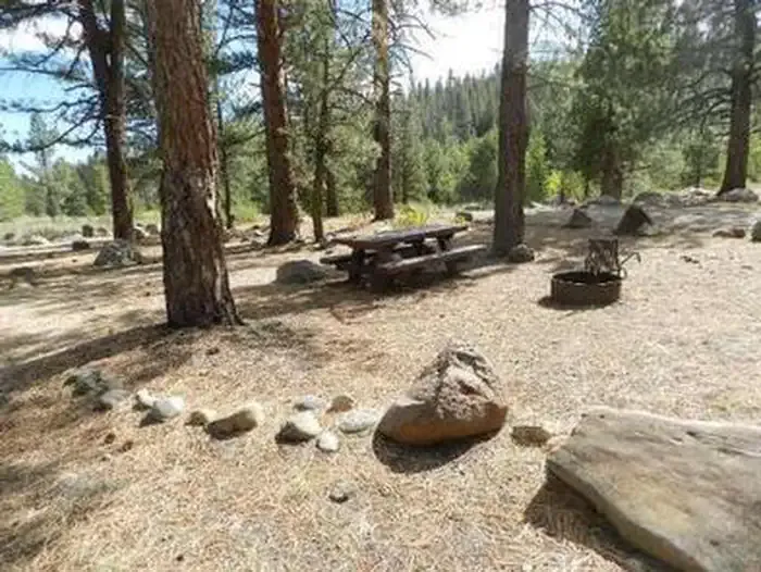 Upper Little TruckeeCampingPhoto: Recreation.gov (RIDB) / public domain1.2 mi
- Lower Little TruckeeCamping1.7 mi
- TREASURE MOUNTAIN LOOPHiking2 mi
- INDEPENDENCE LAKE LOOPHiking2.4 mi
- Independence CreekCanoeing2.6 mi
 Little Truckee RiverCanoeingPhoto: tomhilton, CC BY 2.0 (via Wikimedia Commons)3.8 mi
- Prosser HillRock climbing9.7 mi
Source: Roamze catalog (indexable pages within 10 miles, PostGIS distance)
 Mount Rose Ski TahoeDownhill skiing · ~40 min drivePhoto: Beesmill, CC BY-SA 4.0 (via Wikimedia Commons)
- Wheeler LoopCross-country skiing · ~2 min drive
- Sagehen Nordic LoopCross-country skiing · ~8 min drive
- Castle Valley NordicCross-country skiing · ~21 min drive
- Bear Trap MeadowCross-country skiing · ~27 min drive
- Tahoe Donner Downhill Ski AreaDownhill skiing · ~19 min drive
- Hobart LoopCross-country skiing · ~10 min drive
- Castle Valley NordicCross-country skiing · ~22 min drive
- Last Chance NordicCross-country skiing · ~48 min drive
- Last Chance NordicCross-country skiing · ~48 min drive
Best time to visit Kyburz
Best months: June–August. Best months have typical highs of 55–85 °F, lows of 30 °F or warmer (32 °F where the station doesn't record snow), at most one snowy day and no more than 12 wet days.
Jan
40° / 15°
Feb
41° / 15°
Mar
48° / 19°
Apr
53° / 22°
May
62° / 28°
Jun
72° / 32°
Jul
80° / 37°
Aug
79° / 35°
Sep
73° / 31°
Oct
61° / 24°
Nov
49° / 20°
Dec
39° / 14°
Typical high / low (°F) and days with rain or snow, 1991–2020. Measured at Sagehen Creek, CA, 5.3 mi away at 6,337 ft. This station doesn't record snowfall. Source: NOAA NCEI U.S. Climate Normals 1991–2020.
