That Scary Looking Buttress
That Scary Looking Buttress is a California climbing area with 6 routes.
- 6 routes
- 5.7 – 5.9+
- Alpine
Is That Scary Looking Buttress open right now?
No closures listed
The National Park Service lists no closures for Yosemite National Park.
As of · Source: NPS · Yosemite National Park. Agencies don't list every closure — check before you go.
Best time to visit That Scary Looking Buttress
Best months: June–September. Best months have typical highs of 55–85 °F, lows of 30 °F or warmer (32 °F where the station doesn't record snow), at most one snowy day and no more than 12 wet days.
Jan
41° / 13°
Feb
38° / 12°
Mar
42° / 15°
Apr
45° / 22°
May
54° / 27°
Jun
65° / 33°
Jul
71° / 38°
Aug
70° / 36°
Sep
65° / 32°
Oct
57° / 26°
Nov
47° / 20°
Dec
40° / 12°
Typical high / low (°F) and days with rain or snow, 1991–2020. Measured at Tuolumne Meadows Rs, CA, 8.1 mi away at 8,694 ft. The station sits about 1,400 ft lower than this place, so expect it a little cooler here. This station doesn't record snowfall. Source: NOAA NCEI U.S. Climate Normals 1991–2020.
That Scary Looking Buttress is a climbing area in Yosemite National Park, within the Yosemite Wilderness in California, managed by the National Park Service. It sits in the high country, and a fee is charged for access. The climbing here is all alpine, with six routes ranging from 5.7 to 5.9+. Taphophobia and The Astraphobia Treatment are both 5.7, and Fear No Evil is 5.8. Fear of Flying and Fear of Fun are 5.9, and Wet My Pants is 5.9+. Summer is the most comfortable time to climb. Typical averages from a nearby weather station at Tuolumne Meadows run to highs around 71°F in July and 70°F in August, with lows in the upper 30s. That station sits about 1,400 feet lower than the buttress, so temperatures up high run cooler. May Lake - Battle Tanks is 0.7 miles away, and East Face and Tuolumne Peak are each about a mile off. The Mount Hoffman Trail starts about 1.2 miles away.
Routes (6)
Facts about this crag
Keep exploring — more climbs worth the drive
 Photo: scorpio-tiger, CC BY-SA 2.0 (via Flickr)
May Lake Area
~2 min drive
May Lake Area in California has 9 climbing routes across 7 grades.
 Photo: jimmyharris, CC BY 2.0 (via Flickr)
* Tuolumne Bouldering
~4 min drive
Tuolumne Bouldering in California has 45 bouldering routes.
 Photo: jimmyharris, CC BY 2.0 (via Flickr)
Harlequin Dome
~4 min drive
Harlequin Dome in California has 10 climbing routes across 7 grades, offering sport and trad options.
Photo: jimmyharris, CC BY 2.0 (via Flickr)Tenaya Lake Area
~4 min drive
Tenaya Lake Area is a climbing crag in California with 5 routes.
 Photo: derlandsknecht, CC BY-SA 2.0 (via Flickr)
Phobos/Deimos Cliff
~4 min drive
Phobos/Deimos Cliff in California has 6 climbing routes with sport and trad options.
 Photo: Jarek Tuszyński, CC BY 4.0 (via Wikimedia Commons)
Stately Pleasure Dome
~4 min drive
Stately Pleasure Dome in California has 39 climbing routes with 14 difficulty grades.
Photo: jimmyharris, CC BY 2.0 (via Flickr)Guppie Wall
~4 min drive
Guppie Wall in California has 6 climbing routes across 4 grades.
 Photo: Jrmichae, CC BY-SA 4.0 (via Wikimedia Commons)
The Cube
~4 min drive
Cube, The in California has 7 climbing routes on 5 difficulty grades.
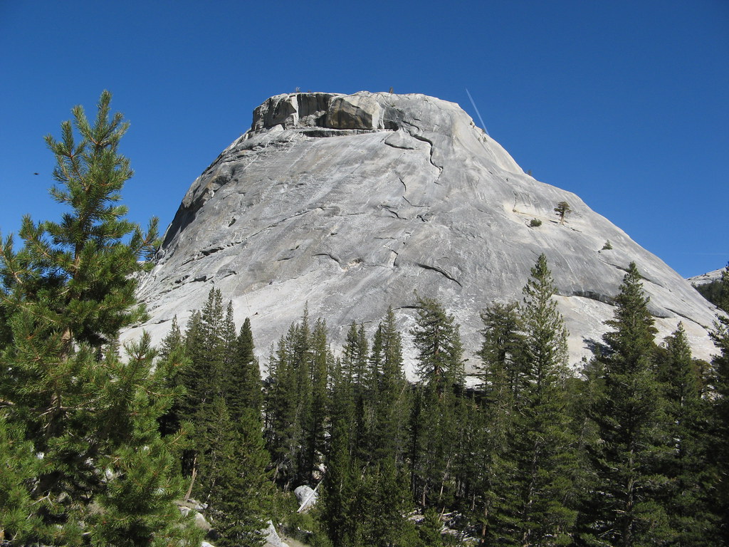 Photo: Olivier Bruchez, CC BY-SA 2.0 (via Flickr)
Bunny Slopes
~4 min drive
Bunny Slopes in California has 8 climbing routes with 4 difficulty grades.
Photo: Jrmichae, CC BY-SA 4.0 (via Wikimedia Commons)Tenaya East Boulders
~4 min drive
Tenaya East Boulders in California has 3 bouldering routes.


