High Peaks Trail
6-route climbing area in California with sport and trad options.
 Photo: lamblukas, CC BY 2.0 (via Flickr)
- 6 routes
- 5.4 – 5.10b
- Sport · Trad
Is High Peaks Trail open right now?
Alert in the area
The National Park Service lists an alert for Pinnacles National Park.
Fire Danger HIGH
Park alert covering Pinnacles National Park · NPS · Pinnacles National Park
As of · Source: NPS · Pinnacles National Park. Agencies don't list every closure — check before you go.
Best time to visit High Peaks Trail
Best months: October–May. Best months have typical highs of 55–85 °F, lows of 30 °F or warmer (32 °F where the station doesn't record snow), at most one snowy day and no more than 12 wet days.
Jan
63° / 34°
12 wet
Feb
64° / 36°
11 wet
Mar
68° / 38°
10 wet
Apr
72° / 39°
6 wet
May
80° / 43°
3 wet
Jun
89° / 47°
1 wet
Jul
96° / 50°
0 wet
Aug
96° / 50°
0 wet
Sep
92° / 48°
1 wet
Oct
82° / 43°
3 wet
Nov
70° / 37°
7 wet
Dec
62° / 33°
11 wet
Typical high / low (°F) and days with rain or snow, 1991–2020. Measured at Pinnacles Nm, CA, 0.6 mi away at 1,307 ft. The station sits about 600 ft lower than this place, so expect it a little cooler here. Source: NOAA NCEI U.S. Climate Normals 1991–2020.
High Peaks Trail is a climbing area in Pinnacles National Park, California, within the Hain Wilderness. The National Park Service manages the land, and the area sits about 0.3 miles from the Rim Trail and the Voyeur Wall climbing area. The climbing here is a mix of sport and trad routes, with six routes in total. The grades run from 5.4 to 5.10b, and the hardest is Carousel at 5.10b. The Regular Route is a sport climb at 5.4, and The Unmentionable is a trad climb at 5.6. Spring and fall are the most comfortable times to visit. Typical averages from a nearby weather station show May highs around 80°F and October highs around 82°F, while July and August average about 96°F. The station sits about 600 feet lower than the trail, so temperatures on the route run cooler. Nearby, the Teaching Rock and Discovery Wall climbing areas are also about 0.3 miles away, and the Chalone Peak Trail is about 0.4 miles off.
Routes (6)
Anvil, The(1)
Carousel, The(1)
Pipsqueak Pinnacle(2)
Unmentionable, The(2)
Facts about this crag
Keep exploring — more climbs worth the drive
Photo: lamblukas, CC BY 2.0 (via Flickr)Voyeur Wall
~1 min drive
Voyeur Wall in California has 5 climbing routes with sport and trad options.
 Photo: lamblukas, CC BY 2.0 (via Flickr)
Teaching Rock
~1 min drive
Teaching Rock in California has 5 sport climbing routes ranging from 5.7 to 5.11a.
 Photo: ray_explores, CC BY 2.0 (via Flickr)
Discovery Wall
~1 min drive
Discovery Wall is a climbing crag in California with 37 routes.
 Photo: ray_explores, CC BY 2.0 (via Flickr)
Tourist Trap
~1 min drive
Tourist Trap is a climbing crag in California with 11 routes.
Photo: lamblukas, CC BY 2.0 (via Flickr)East Side
~1 min drive
East Side in California has 32 climbing routes with 15 difficulty grades.
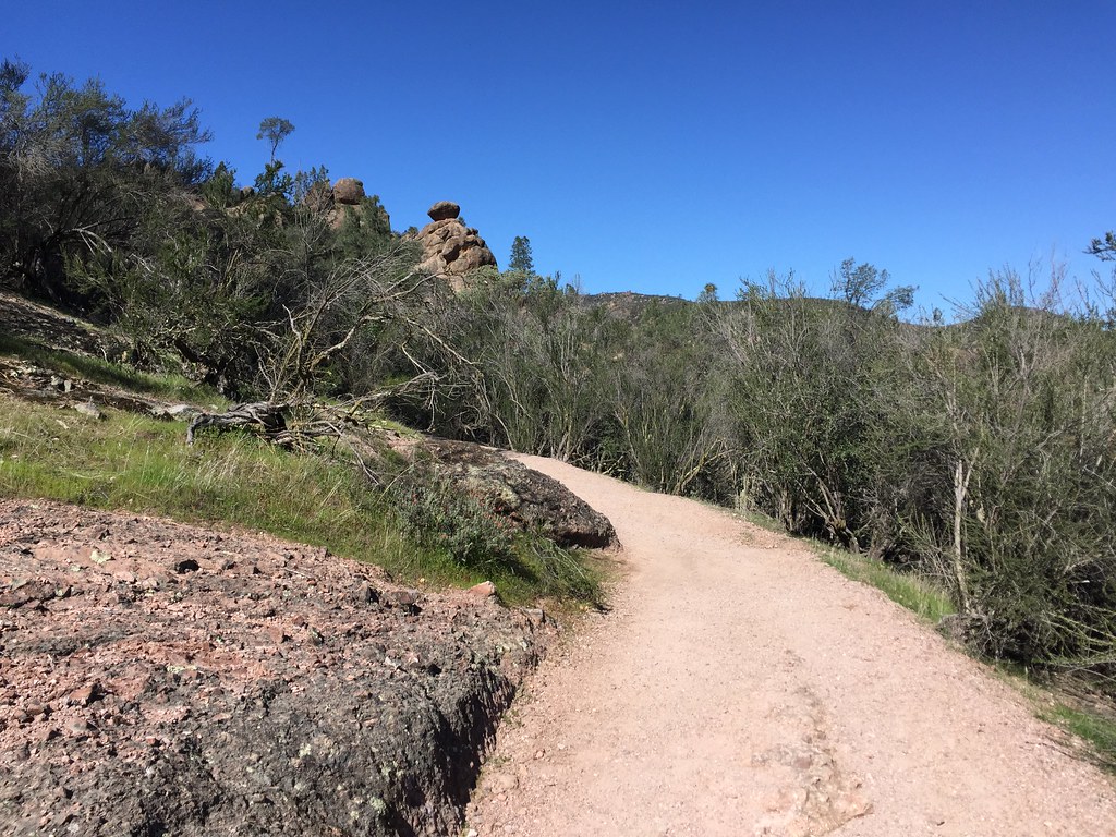 Photo: ray_explores, CC BY 2.0 (via Flickr)
North Face
~1 min drive
North Face in California has 5 sport climbing routes across 4 grades.
 Photo: btwashburn, CC BY 2.0 (via Flickr)
Monolith
~1 min drive
Monolith in California has 6 sport climbing routes across 6 difficulty grades.
Photo: btwashburn, CC BY 2.0 (via Flickr)East Face
~1 min drive
East Face in California has 18 climbing routes across 14 grades, featuring sport and trad options.
 Photo: chaircrusher, CC BY 2.0 (via Flickr)
The Back Door
~1 min drive
7-route climbing area in California with sport and trad options.
Photo: btwashburn, CC BY 2.0 (via Flickr)Upper Crust
~1 min drive
Upper Crust in California has 12 climbing routes across 10 grades.


