Rock Creek
- 9.7 mi
- distance
- 5,078 ft
- high point
- May–Oct
- best months
Caution today
Agency alerts are in effect for this area; weather is good · USFS, OpenWeather · checked just now
Is Rock Creek open right now?
Closure in the area
There's a closure order in Lassen National Forest. It doesn't name Rock Creek, so check the source for the area it covers (3 listed).
Harmful Algal Blooms
Agency closure covering Lassen National Forest · USFS · Lassen National Forest
Forest Road Closure Order
Agency closure covering Lassen National Forest · Order 06-26-01 · USFS · Lassen National Forest
SAFETY ALERT - South Antelope Bridge out, Do Not Cross
Agency closure covering Lassen National Forest · USFS · Lassen National Forest
As of · Source: USFS · Lassen National Forest. Agencies don't list every closure — check before you go.
Rock Creek is a paddling destination in California's Lassen National Forest, within the Hat Creek Ranger District. The Forest Service manages the land, and the nearest town is Burney, about 9.7 miles away. Summer is the most comfortable season to visit. Typical averages from the nearby Manzanita Lake weather station show July highs around 79°F and lows near 46°F, while winter highs sit in the low 40s. Several other paddling and hiking spots lie within about 6 miles. Burney Creek Trail and Rim Trail are both about 5.3 miles away, Ruling Creek Campground is about 5.4 miles off, and Nelson Creek offers more canoeing about 5.8 miles from Rock Creek.
Local outfitters
- Headwaters Adventure Co46 mi away
Not on Roamze yet. Their page has how to reach them.
 Burney Creek TrailHikingPhoto: Don Graham from Redlands, CA, USA - God bless it!, CC BY-SA 2.0 (via Wikimedia Commons)5.3 mi
- Rim TrailHikingPhoto: Don Graham from Redlands, CA, USA - God bless it!, CC BY-SA 2.0 (via Wikimedia Commons)5.3 mi
- Ruling Creek CampgroundCamping5.4 mi
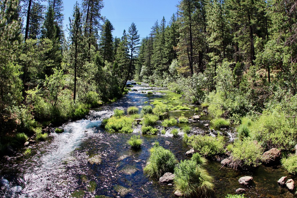 Headwaters TrailHikingPhoto: daveynin, CC BY 2.0 (via Flickr)5.8 mi
- Nelson CreekCanoeing5.8 mi
- Pioneer Cemetery TrailHikingPhoto: Don Graham from Redlands, CA, USA - God bless it!, CC BY-SA 2.0 (via Wikimedia Commons)5.9 mi
- Kosk CreekCanoeing7.7 mi
- Bear CreekCanoeing9.1 mi
Source: Roamze catalog (indexable pages within 10 miles, PostGIS distance)
 McCloud RiverCanoeing · ~26 min drivePhoto: Public domain (via Wikimedia Commons)
- Hirz Bay Public Boat RampBoat launch · ~51 min drive
 Pit RiverCanoeing · ~36 min drivePhoto: Robert F. Ettner, Natural Resources Staff Officer, Siskiyou National Forest, US Forest Service, Public domain (via Wikimedia Commons)
- Lake Mccloud RampBoat launch · ~33 min drive
- Nelson CreekCanoeing · ~10 min drive
- Kosk CreekCanoeing · ~13 min drive
- Bear CreekCanoeing · ~16 min drive
- Roaring CreekCanoeing · ~22 min drive
- Burney CreekCanoeing · ~24 min drive
- Little Roaring CreekCanoeing · ~24 min drive
Also worth it near here
- Burney Creek TrailHiking · ~9 min drivePhoto: Don Graham from Redlands, CA, USA - God bless it!, CC BY-SA 2.0 (via Wikimedia Commons)
 Burney FallsWaterfall · ~10 min drivePhoto: Dvortygirl, CC BY-SA 3.0 (via Wikimedia Commons)
- Pit River CampgroundPier fishing · ~23 min drive
- Camp 4 Group CampgroundCamping · ~30 min drive
Best time to visit Rock Creek
Best months: May–October. Best months have typical highs of 55–85 °F, lows of 30 °F or warmer (32 °F where the station doesn't record snow), at most one snowy day and no more than 12 wet days.
Jan
41° / 22°
Feb
42° / 22°
Mar
46° / 24°
Apr
50° / 27°
May
61° / 35°
Jun
70° / 41°
Jul
79° / 46°
Aug
78° / 45°
Sep
72° / 41°
Oct
59° / 33°
Nov
47° / 26°
Dec
39° / 22°
Typical high / low (°F) and days with rain or snow, 1991–2020. Measured at Manzanita Lake, CA, 36.6 mi away at 5,750 ft. The station sits about 700 ft higher than this place, so expect it a little warmer here. This station doesn't record snowfall. Source: NOAA NCEI U.S. Climate Normals 1991–2020.
