Pilot Creek
- 17.1 mi
- distance
- 5,561 ft
- high point
- May–Oct
- best months
Caution at last check
Agency alerts are in effect for this area; weather is good · USFS, OpenWeather · checked 15 h ago
Is Pilot Creek open right now?
Alert in the area
The Forest Service lists 2 alerts for Eldorado National Forest.
Help Halt Golden Mussel Invasion
Agency alert covering Eldorado National Forest · USFS · Eldorado National Forest
Deer Valley Trail (19E01) & Meadow Lake Road (09N01)
Agency alert covering Eldorado National Forest · Order 03-24-05 · USFS · Eldorado National Forest
As of · Source: USFS · Eldorado National Forest. Agencies don't list every closure — check before you go.
Pilot Creek is a 17-mile paddling stretch near Foresthill, California, flowing through the Georgetown Ranger District of Eldorado National Forest. The land along it is managed by the U.S. Forest Service. This is a steep, small creek. Its gradient averages about 232 feet per mile, and its modeled average flow is about 88 cfs. The creek is intermittent and may run dry in some seasons, so water levels can't be counted on year-round. The driest, warmest stretch of the year runs from June through September. Typical averages from Blue Canyon, a weather station at about 5,300 feet, show July highs near 78°F and only about one wet day that month. Winter there averages highs in the mid-40s with 12 or 13 wet days a month. Black Oak and Stumpy Meadows campgrounds are both within about a mile and a half. The Stumpy Meadows Trail and the West Shoreline Trail are close by too, and Slab Creek offers another paddling run about 6 miles away.
Local outfitters
- Obexer's Boat Company25 mi away
- West Shore Sports27 mi away
Not on Roamze yet. Their page has how to reach them.
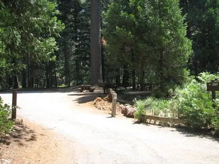 Black OakCampingPhoto: Recreation.gov (RIDB) / public domain1.3 mi
- Black Oak G.C.G.Camping1.4 mi
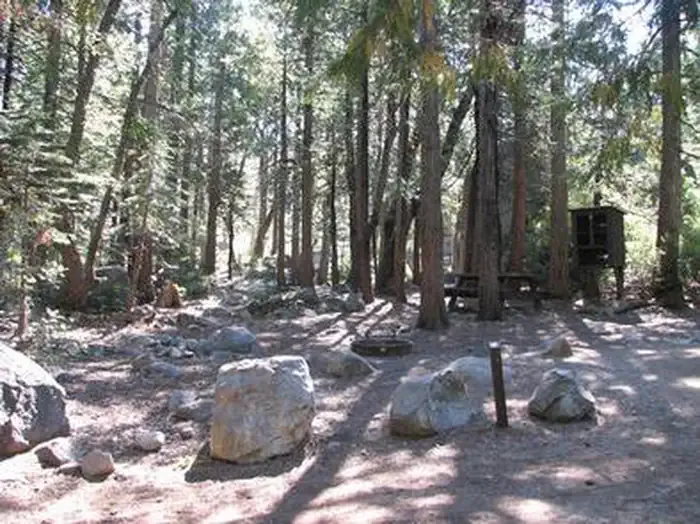 Stumpy MeadowsCampingPhoto: Recreation.gov (RIDB) / public domain1.4 mi
 Stumpy Meadows TrailHikingPhoto: Pacific Southwest Region 5, Public domain (via Wikimedia Commons)1.4 mi
- West Shoreline TrailHikingPhoto: Pacific Southwest Region 5, Public domain (via Wikimedia Commons)1.9 mi
- BelixHiking4.2 mi
- Slab CreekCanoeing6.2 mi
- Little Silver CreekCanoeing7.8 mi
Source: Roamze catalog (indexable pages within 10 miles, PostGIS distance)
- Slab CreekCanoeing · ~11 min drive
- Oxbow Put-InBoat launch · ~18 min drive
- Otter CreekCanoeing · ~19 min drive
- Sunset Boat RampBoat launch · ~19 min drive
- Bear CreekCanoeing · ~20 min drive
- Loon Lake Boat RampBoat launch · ~25 min drive
- South Fork Rubicon RiverCanoeing · ~21 min drive
- French Meadows Boating SiteBoat launch · ~26 min drive
- Eldorado CreekCanoeing · ~22 min drive
- McGuire Boat RampBoat launch · ~28 min drive
Best time to visit Pilot Creek
Best months: May–October. Best months have typical highs of 55–85 °F, lows of 30 °F or warmer (32 °F where the station doesn't record snow), at most one snowy day and no more than 12 wet days.
Jan
47° / 34°
12 wet
Feb
45° / 33°
12 wet
Mar
48° / 35°
13 wet
Apr
52° / 37°
11 wet
May
61° / 46°
8 wet
Jun
70° / 54°
3 wet
Jul
78° / 63°
1 wet
Aug
77° / 62°
1 wet
Sep
73° / 57°
2 wet
Oct
63° / 48°
5 wet
Nov
51° / 39°
9 wet
Dec
45° / 34°
13 wet
Typical high / low (°F) and days with rain or snow, 1991–2020. Measured at Blue Canyon Ap, CA, 25.4 mi away at 5,276 ft. This station doesn't record snowfall. Source: NOAA NCEI U.S. Climate Normals 1991–2020.
Closures we've recorded since August 2026
Fire Restrictions are in Effect Forest Wide
Eldorado National Forest · Order dated September 22, 2026; seen Aug 23, 2026 → lifted Nov 2, 2026 · Forest Service
