

Mammoth Lakes Pack Outfit
Hiking business nearby (~30 mi away) — hasn't claimed their Roamze page yet
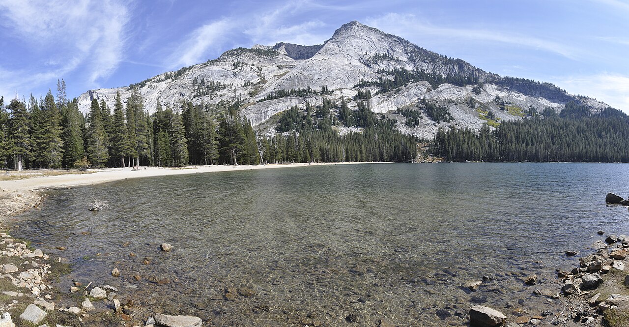
1.12-mile out-and-back trail around Tenaya Lake in California.
 Photo: Jeffrey Pang from Berkeley, CA, USA, CC BY 2.0 (via Wikimedia Commons)
No closures listed
The National Park Service lists no closures for Yosemite National Park.
As of · Source: NPS · Yosemite National Park. Agencies don't list every closure — check before you go.
Best months: June–September. Best months have typical highs of 55–85 °F, lows of 30 °F or warmer (32 °F where the station doesn't record snow), at most one snowy day and no more than 12 wet days.
Jan
41° / 13°
Feb
38° / 12°
Mar
42° / 15°
Apr
45° / 22°
May
54° / 27°
Jun
65° / 33°
Jul
71° / 38°
Aug
70° / 36°
Sep
65° / 32°
Oct
57° / 26°
Nov
47° / 20°
Dec
40° / 12°
Typical high / low (°F) and days with rain or snow, 1991–2020. Measured at Tuolumne Meadows Rs, CA, 7.3 mi away at 8,694 ft. The station sits about 500 ft higher than this place, so expect it a little warmer here. This station doesn't record snowfall. Source: NOAA NCEI U.S. Climate Normals 1991–2020.
Tenaya Lake Sidewalk is a short out-and-back trail in California's national park system, covering 1.12 miles with a maximum elevation of 8,165 feet. The route follows a sidewalk around Tenaya Lake.
Sunrise Lakes Trailhead
~1 min drive
Sunrise Lakes Indeed, a beautiful place to see sunrise, the lakes at Sunrise reflect the colors in the sky as well as the domed peaks that surround it. A short distance from the lakes, the Sunrise High Sierra Camp faces east for sunrise views. Reservations are required for…
 Photo: Alvarock Garcia, CC BY 3.0 (via Wikimedia Commons)
May Lake Trail
~3 min drive
1.12-mile out-and-back hike in California's national park system with 463 ft of elevation gain.
Photo: Alvarock Garcia, CC BY 3.0 (via Wikimedia Commons)Mount Hoffman Trail
~3 min drive
1.68-mile out-and-back hike in California's national park system, gaining 1,489 ft to 10,835 ft.
 Photo: Richard Wood, CC BY-SA 3.0 (via Wikimedia Commons)
Clouds Rest Trail
~4 min drive
18.8-mile out-and-back trail in California with 5,563 ft elevation gain and 9,751 ft max elevation.
 Photo: Jeffrey Pang from Berkeley, CA, USA, CC BY 2.0 (via Wikimedia Commons)
Tenaya Lake Trail
~1 min drive
2.24-mile out-and-back hike to Tenaya Lake in California with 1,732 ft gain
 Photo: derlandsknecht, CC BY-SA 2.0 (via Flickr)
Polly Dome Lakes Trail
~4 min drive
0.72-mile out-and-back hike to Polly Dome Lakes in California
 Photo: ilya_ktsn, CC BY 2.0 (via Flickr)
Tenaya Lake Trail
~5 min drive
12.1-mile out-and-back hike to Tenaya Lake in California with 2,265 ft elevation gain
 Photo: Richard E. Ellis (talk · contribs), CC BY 3.0 (via Wikimedia Commons)
Glen Aulin - May Lake Trail
~10 min drive
15.16-mile out-and-back hike in California with 2,731 ft elevation gain and loss.
 Photo: Richard Wood, CC BY-SA 3.0 (via Wikimedia Commons)
Forsyth Trail
~7 min drive
4.76-mile out-and-back hike in California with 1,272 ft elevation gain and loss.
 Photo: dbaron, CC BY-SA 2.0 (via Flickr)
Lower Cathedral Lake Trail
~5 min drive
1.18-mile out-and-back trail in California with 243 ft elevation gain
Also worth it near here
Outfitters and businesses. They haven’t set up their Roamze page yet.
Mammoth Lakes Pack Outfit
Hiking business nearby (~30 mi away) — hasn't claimed their Roamze page yet
