Goose Meadows
Campground
Campground · 2.1 mi from the trail
Alert in the area
The Forest Service lists an alert for Tahoe National Forest.
Camping and Campfire Restrictions-Truckee and Sierraville Districts
Agency alert covering Tahoe National Forest · Order 17-25-05 · USFS · Tahoe National Forest
As of · Source: USFS · Tahoe National Forest. Agencies don't list every closure — check before you go.
Schaeffer Creek Trail is a 1.5-mile hike in California's Tahoe National Forest, within the Truckee Ranger District. It is an out-and-back route that climbs about 572 feet from a starting point at roughly 6,241 feet to a high point of about 6,757 feet. The climb is front-loaded, with the steepest stretch at about 0.18 miles from the trailhead, where the grade reaches about 13 percent. The most comfortable months for a visit are typically June and September. Typical averages from a nearby weather station at Truckee-Tahoe run to highs around 76°F in June and 78°F in September, with July the warmest month at about 85°F. That station sits roughly 857 feet below the trail, so temperatures on the trail run cooler. The Perimeter Trail starts about 0.3 miles away, and the 2 Bridges mountain biking route is about 0.8 miles off. Climbers can head to Sawtooth Ridge, about 1.3 miles away, and Goose Meadows campground is about 2.1 miles away.
Goose Meadows
Campground
Places © OpenStreetMap contributors
More in Sunnyside-Tahoe CityNot on Roamze yet. Their page has how to reach them.
 Martis CreekCanoeingPhoto: Schmiebel, CC BY-SA 3.0 (via Wikimedia Commons)1.6 mi
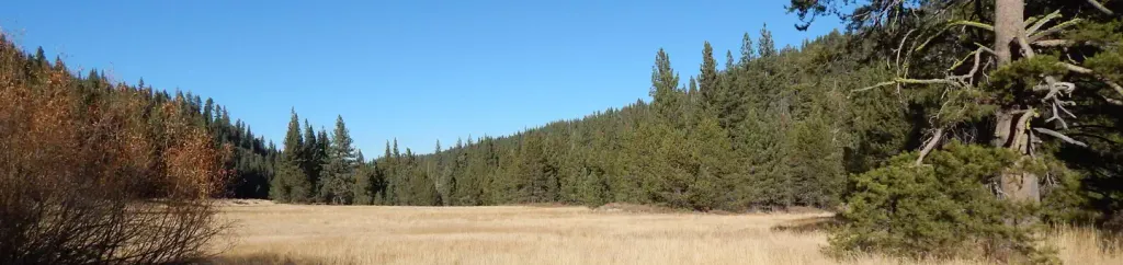 Goose MeadowsCampingPhoto: Recreation.gov (RIDB) / public domain2.1 mi
Source: Roamze catalog (indexable pages within 10 miles, PostGIS distance)
 Cena Lar TrailHiking · ~2 min drivePhoto: Ken Lund, CC BY-SA 2.0 (via Flickr)
 Upper Deer CreekHiking · ~4 min drivePhoto: MojoYogi, CC BY-SA 4.0 (via Wikimedia Commons)
 POLE CREEK NORDICHiking · ~5 min drivePhoto: mangtronix, CC BY-SA 2.0 (via Flickr)Western States TrailHiking · ~5 min drivePhoto: mangtronix, CC BY-SA 2.0 (via Flickr)
 Tompkins TrailHiking · ~4 min drivePhoto: danboarder, CC BY 2.0 (via Flickr)
 Martis Valley TrailHiking · ~6 min drivePhoto: kbakar, CC BY 2.0 (via Flickr)Tompkins TrailHiking · ~4 min drivePhoto: danboarder, CC BY 2.0 (via Flickr)
Best months: June–September. Best months have typical highs of 55–85 °F, lows of 30 °F or warmer (32 °F where the station doesn't record snow), at most one snowy day and no more than 12 wet days.
Jan
42° / 13°
Feb
44° / 14°
Mar
49° / 19°
Apr
56° / 22°
May
65° / 29°
Jun
76° / 36°
Jul
85° / 40°
Aug
84° / 37°
Sep
78° / 32°
Oct
65° / 25°
Nov
52° / 18°
Dec
41° / 14°
Typical high / low (°F) and days with rain or snow, 1991–2020. Measured at Truckee-Tahoe Ap, CA, 3.8 mi away at 5,900 ft. The station sits about 900 ft lower than this place, so expect it a little cooler here. This station doesn't record snowfall. Source: NOAA NCEI U.S. Climate Normals 1991–2020.
Map and trail data © OpenStreetMap contributors
