Pianobox
- 1.9 mi
- round trip
- 99 ft
- climb
- 2,144 ft
- high point
- Out and back
- route
- Oct–May
- best months
Is Pianobox open right now?
Alert in the area
The Forest Service lists 7 alerts for Angeles National Forest.
Rincon-Redbox Road (2N24) Closure
Agency alert covering Angeles National Forest · Order 05-01-26-13 · USFS · Angeles National Forest
Fire Danger Level Elevated to "Very High"
Agency alert covering Angeles National Forest · USFS · Angeles National Forest
San Gabriel Canyon OHV Area Prohibitions
Agency alert covering Angeles National Forest · Order 05-01-26-09 · USFS · Angeles National Forest
San Dimas Experimental Forest Closure
Agency alert covering Angeles National Forest · USFS · Angeles National Forest
Eaton Fire Area Closure
Agency alert covering Angeles National Forest · Order 05-01-26-04 · USFS · Angeles National Forest
As of · Source: USFS · Angeles National Forest. Agencies don't list every closure — check before you go.
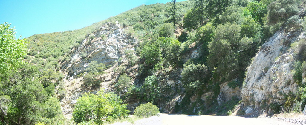
Pianobox is a short, easy hike in the Los Angeles Gateway Ranger District of Angeles National Forest, managed by the Forest Service. The trail is about 1.9 miles long and rises roughly 100 feet from a low point of 2,034 feet to a high of 2,144 feet, making it an out-and-back with a gentle climb. Spring and fall are the most comfortable times to go. Typical averages from a nearby weather station show April highs around 74°F and October highs around 81°F, while July and August average in the low 90s. The trail is natural-surfaced and allows bikes. It is open year-round, and the closest parking is at the trailhead. Castaic Creek, a canoeing spot, is about 1.7 miles away. The Alleheny Trail and Warm Springs Necktie Trail are both within about 4 miles. Oak Flat campground is about 5 miles off.
 Castaic CreekCanoeingPhoto: Albaum at English Wikipedia, Public domain (via Wikimedia Commons)1.7 mi
- Alleheny TrailHiking2.3 mi
- Warm Springs Necktie TrailHiking3.7 mi
- Oak FlatCamping5.1 mi
- Roadside BouldersRock climbing5.7 mi
- BearCamping6.4 mi
- Conglomerate Boulders (Templin boulders) - misc problemsRock climbing6.5 mi
- Pyramid Lake - Emigrant Landing Day Use AreaPier fishing7.7 mi
Source: Roamze catalog (indexable pages within 10 miles, PostGIS distance)
 Warm Springs TrailHiking · ~8 min drivePhoto: tkksummers, CC BY-SA 2.0 (via Flickr)
 CreekbedHiking · ~17 min drivePhoto: tkksummers, CC BY-SA 2.0 (via Flickr)
- Alleheny TrailHiking · ~4 min drive
 Beartrail TrailHiking · ~15 min drivePhoto: Clotee Pridgen Alloc…, CC BY-SA 3.0 (via Wikimedia Commons)
- Coyote RidgeHiking · ~18 min drivePhoto: tkksummers, CC BY-SA 2.0 (via Flickr)
- FrenchmenHiking · ~11 min drive
 Sandberg TrailHiking · ~16 min drivePhoto: Joe Decruyenaere, CC BY-SA 2.0 (via Wikimedia Commons)
- Atmore MeadowsHiking · ~8 min drive
- Piru Creek TrailHiking · ~11 min drive
- Fish Canyon TrailHiking · ~8 min drive
Also worth it near here
Best time to visit Pianobox
Best months: October–May. Best months have typical highs of 55–85 °F, lows of 30 °F or warmer (32 °F where the station doesn't record snow), at most one snowy day and no more than 12 wet days.
Jan
63° / 47°
5 wet
Feb
65° / 45°
6 wet
Mar
70° / 47°
5 wet
Apr
74° / 49°
3 wet
May
81° / 53°
1 wet
Jun
87° / 57°
0 wet
Jul
94° / 63°
0 wet
Aug
96° / 64°
0 wet
Sep
91° / 62°
1 wet
Oct
81° / 56°
2 wet
Nov
71° / 49°
3 wet
Dec
62° / 44°
5 wet
Typical high / low (°F) and days with rain or snow, 1991–2020. Measured at Newhall 5nw, CA, 15.8 mi away at 1,765 ft. Source: NOAA NCEI U.S. Climate Normals 1991–2020.

