Mt. Eddy
- 2.5 mi
- round trip
- 1,013 ft
- climb
- 9,008 ft
- high point
- Out and back
- route
Is Mt. Eddy open right now?
Closure in the area
There's a closure order in Shasta-Trinity National Forest. It doesn't name Mt. Eddy, so check the source for the area it covers (2 listed).
Mud and Ash Creek Area and Road Closure
Agency closure covering Shasta-Trinity National Forest · Order 14-26-13 · USFS · Shasta-Trinity National Forest
Road Closure on Wild Mad Road
Agency closure covering Shasta-Trinity National Forest · Order 14-25-09 · USFS · Shasta-Trinity National Forest
Bailey Cove Road Closure Order
Agency alert covering Shasta-Trinity National Forest · Order 14-25-11 · USFS · Shasta-Trinity National Forest
Trout Creek Bridge Closure Order
Agency alert covering Shasta-Trinity National Forest · Order 14-26-02 · USFS · Shasta-Trinity National Forest
South Fork Suspension Bridge Closure
Agency alert covering Shasta-Trinity National Forest · Order 14-25-30 · USFS · Shasta-Trinity National Forest
As of · Source: USFS · Shasta-Trinity National Forest. Agencies don't list every closure — check before you go.
Mt. Eddy is an easy out-and-back hike in the Mt. Shasta Ranger District of Shasta-Trinity National Forest in California. The route is about 2.5 miles long, with a one-way climb of 1,013 feet from a low point near 7,974 feet to a high point of about 9,000 feet. The trail has a natural surface and is managed by the Forest Service. Bikes are not allowed. Two trails sit within about a mile: the Sisson Callahan Trail and the Deadfall Lakes Trail. Toad Lake Campground is about 2.2 miles away. Paddlers can head to the South Fork Sacramento River, roughly 5.6 miles off.
Keep exploring — more trails worth the drive
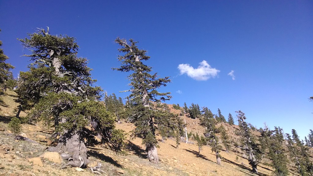 Photo: theforestprimeval, CC BY-SA 2.0 (via Flickr)
Sisson Callahan Trail
~1 min drive
1.22-mile out-and-back trail in California with 289 ft gain and 6,837 ft max elevation.
Photo: theforestprimeval, CC BY-SA 2.0 (via Flickr)Toad Lake
~2 min drive
9.73-mile out-and-back trail to Toad Lake in California with 1,838 ft gain.
 Photo: theforestprimeval, CC BY-SA 2.0 (via Flickr)
Pacific Crest Trail
~5 min drive
22.16-mile out-and-back trail in California with 3,913 ft elevation gain
 Photo: theforestprimeval, CC BY-SA 2.0 (via Flickr)
Houston Creek
~12 min drive
3.20-mile out-and-back trail in California with 1,632 ft gain.
Photo: theforestprimeval, CC BY-SA 2.0 (via Flickr)Sisson-Callahan (Historic)
~2 min drive
2.60-mile out-and-back trail in California with 982 ft gain.
HIKE
Sisson Callahan Trail
~6 min drive
5.72-mile out-and-back hike in California with 2,128 ft gain/loss.
 Photo: randomduck, CC BY-SA 2.0 (via Flickr)
Pacific Crest Trail
~12 min drive
32.18-mile out-and-back trail in California with 4,411 ft elevation gain and loss.
HIKE
Sisson Callahan Trail (Historic Route)
~2 min drive
2.22-mile out-and-back trail in California with 1,515 ft gain/loss.
 Photo: theforestprimeval, CC BY-SA 2.0 (via Flickr)
Eddy Creek
~6 min drive
1.91-mile out-and-back trail in California with 804 ft elevation gain.
HIKE
Pacific Crest National Scenic Trail #2000
~9 min drive
13.52-mile out-and-back trail on the Pacific Crest National Scenic Trail in California with 3,495 ft elevation gain/loss.

Route details
- Distance
- 2.5 mi round trip
- Climbing
- About 1,013 ft
- Summit
- 9,031 ft
- Difficulty
- Moderate
Season
Season: Year-round.
Questions about this route
How long is the Mt. Eddy on Mount Eddy?
About 2.5 mi round trip.
How much elevation gain is on the Mt. Eddy?
About 1,013 ft of climbing round trip.
How hard is the Mt. Eddy?
It is rated moderate.
When is the best time for the Mt. Eddy?
Year-round.
Conditions and forecast on Mount Eddy
Daily highs and lows, wind and the chance of precipitation at the summit and route start for the next 7 days, from the Open-Meteo model.
