Loading…

Free — you'll pick up right here.
Watch this trail
Sign up to watch it — saving subscribes you to gate, closure and report changes.
California
17 ft
Gain
We won't guess. Here is exactly what we do and don't know.
What we do know
Inside Lassen Volcanic National Park
2 managing-area boundaries mapped — agency alerts for them feed this page automatically.
Boundary data
What's missing
No access route mapped
We don't yet know which road reaches this trailhead, so we can't tell you if it's gated.
Nobody's filed a report here yet — be the first.
Why you'll love it
Mount Harkness Fire Lookout
AI-suggested draft · review before you go
No permit or access details on file for this trail — check with the local land manager before you go.
<p>Perched atop Mt. Harkness in the southeast corner of Lassen Volcanic National Park, Mount Harkness Fire Lookout has served as an active fire lookout and visitor destination since its construction in 1930. The rustic style two-story wood and stone structure sits at 8,046 feet elevation on the summit of an ancient shield volcano topped by a cinder cone. Visitors are able to access the summit and lookout by trail from either Juniper Lake or Warner Valley. The shortest and <a href="https://www.nps.gov/lavo/planyourvisit/hiking_mount_harkness.htm">most popular trail</a> climbs 1.9 miles and 1,250 feet from Juniper Lake Campground to the summit. The sweeping vistas from the lookout span from the Three Sisters peaks in Oregon to the north, the Sierra Nevada Mountains to the south, and the Coast Range to the west. Fire staff reside in the lookout in the summer months and share information on the lookout and operations with visitors.<br /> <br /> <strong><span style="color:#c0392b;">Mt. Harkness Fire Lookout was destroyed in the Dixie Fire in August 2021.</span></strong></p> <h2>A Model of NPS Rustic Architecture</h2> <p>Mount Harkness Fire Lookout and accompanying pit toilet were constructed primarily of local stone and wood in a style typical for National Park structures built in the 1920s and 1930s. The design philosophy centered on the use of local materials to make structures compatible with their environment and to achieve visual unity among different facilities. The lookout is unusual in comparison to the vast majority of fire lookouts and associated pit toilets in the United States, which are either of wood frame or steel construction. The top level is comprised of a single-room cabin, surrounded on four sides by a wooden catwalk and topped by a pitched wood shingle roof. A wooden staircase climbs the 12 feet to the catwalk and masonry of battered native stone extends from the ground to the windows on the upper floor. </p> <h2>A Classic Fire Lookout</h2> <p>Mount Harkness Fire Lookout continues to use many of the station's original technology and systems. A report to the Director of the National Park Service described the newly constructed facility the year following its construction: </p> <p style="margin-left: 40px;">"A fire-lookout station constructed during the season on top of Mount Harkness in Lassen Volcanic National Park is among the finest and best equipped in northern California. In addition to the usual maps and compasses, it contains an <a href="3a1b676c-13df-43af-b4b1-d8b9e17f5695">Osborne fire finder</a> and a panoramic photograph mounted so that the location of the fire will be shown simultaneously on the photograph and the map when detected by the fire finder. This station serves a triple purpose. In addition to its importance in the fire prevention program of Lassen, it affords visitors, who may easily reach it by trail, an opportunity to view the country through powerful glasses, and it also contains a seismograph, which, in connection with two others, hourly records the slightest quivers of the earth."</p> <p>While some systems like the seismograph have since been replaced by <a href="https://www.nps.gov/lavo/learn/nature/seismic-activity.htm">digital seismic monitoring</a>, the fire observation tools have remained the same. Adopted in the 1850s, classic fire monitoring systems using maps and a compass function without electricity or Internet access (the lookout has neither). The building itself has seen a few upgrades over its many decades of service, including the addition of a weather monitoring station and radio repeater (powered by solar panels) and conversion from a wood to propane stove.</p> <h2>Maintaining a Historic Lookout</h2> <p>Extreme winters, rugged terrain, and regular use leave the Mount Harkness Fire Lookout in regular need of maintenance. In recent years, park staff and partners have replaced the roof and rehabilitated the original wooden doors and windows. In 2019, the park began a new rehabilitation project in partnership with <a href="https://historicorps.org/harkness-lookout-ca-2019/">HistoriCorps</a>, a nonprofit dedicated to engaging volunteers on the rehabilitation of historic structures on publicly accessible lands. Between September 15 and 27 a group of HistoriCorps volunteers will work with park staff to remove and repoint failing mortar, replace deteriorated boards on the catwalk, and repair deteriorated window trim and door frames.<span style="font-size:11.0pt"><span style="background:white"><span style="font-family:"Calibri",sans-serif"><span style="color:black"> </span></span></span></span>The HistoriCorps crew will camp at Juniper Lake Campground and then hike up to the project site daily.<br /> </p> <p> </p> <p> </p>
Warner Valley Day Use Area
~8 min drive
<p><strong>Season:</strong> June through October; road closed winter/spring<br /> <a href="https://www.nps.gov/places/www.nps.gov/lavo/planyourvisit/gettingaround.htm#jl">Access</a><strong>:</strong> Dirt road not recommended for trailers<br /> <a href="https://www.nps.gov/lav…
Hidden Lakes Caribou
~9 min drive
Easy alpine lake hike with scenic views and modest elevation gain.
Indian Meadow
~10 min drive
Easy 1.92-mile meadow hike with 427 ft elevation gain and scenic views.
Mud Creek Rim
~12 min drive
Remote 26-mile rim trail with expansive desert views and moderate elevation gain.
Drakesbad Guest Ranch
~9 min drive
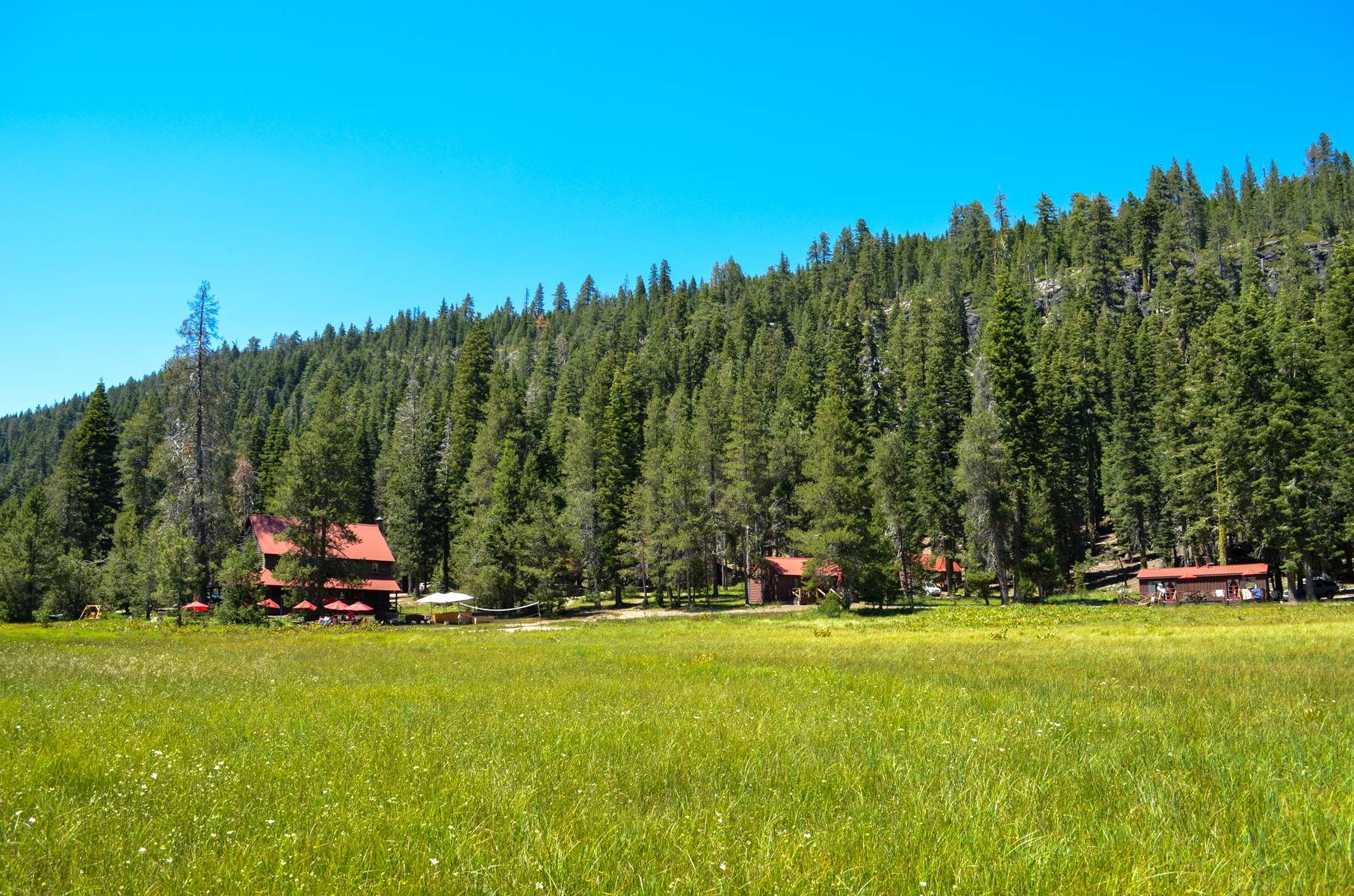
<p>Drakesbad Guest Ranch is a secluded lodge nestled in Warner Valley, in the southeast corner of Lassen Volcanic National Park. The ranch includes a lodge, dining hall, and bungalow units. Initially homesteaded by Edward Drake in the 1880s, Drakesbad Guest Ranch continues to…
Emerald-Cypress Caribou
~13 min drive
Scenic 4.12-mile trail with 456 ft gain through California forest and meadow.
Trail Lake
~12 min drive
Easy 1.6-mile lake hike with minimal elevation gain and scenic water views.
Bond Valley
~12 min drive
A 16.99-mile valley trail with 1,172 ft elevation gain through scenic California backcountry.
Kings Creek Meadow Viewpoint
~15 min drive
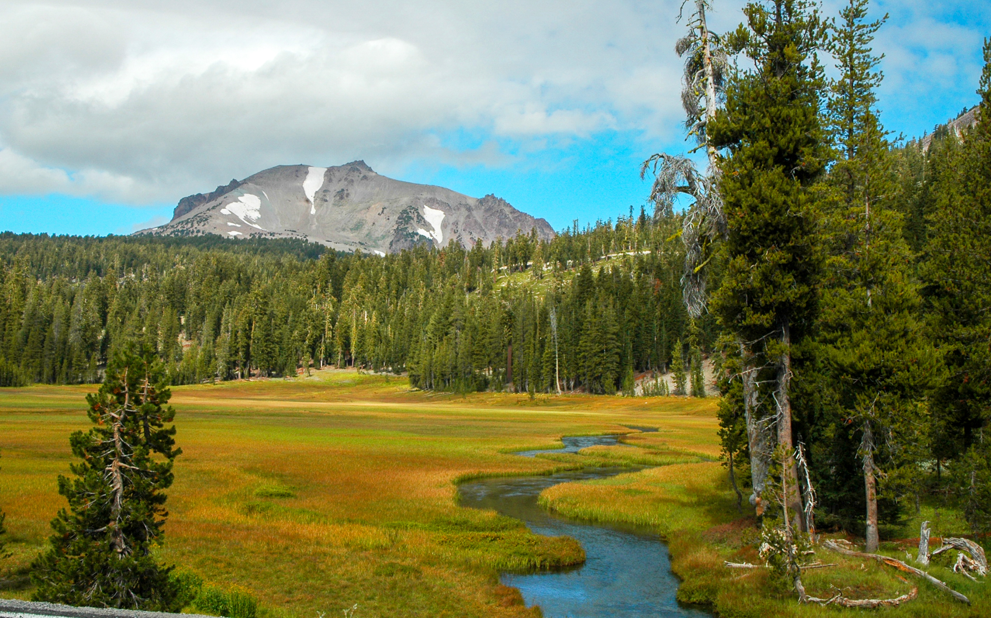
<p>Outstanding views of Lassen Peak are visible from highway turnouts near Kings Creek Upper Meadow. This meadow is frequently photographed in its vibrant seasonal colors from the snowy white of spring to the golden hues of fall. Non-native trout species including brown and br…
Triangle-Lvnp Caribou
~14 min drive
Easy 3.5-mile trail with minimal elevation gain in Triangle-Lvnp area.