Montgomery Trail
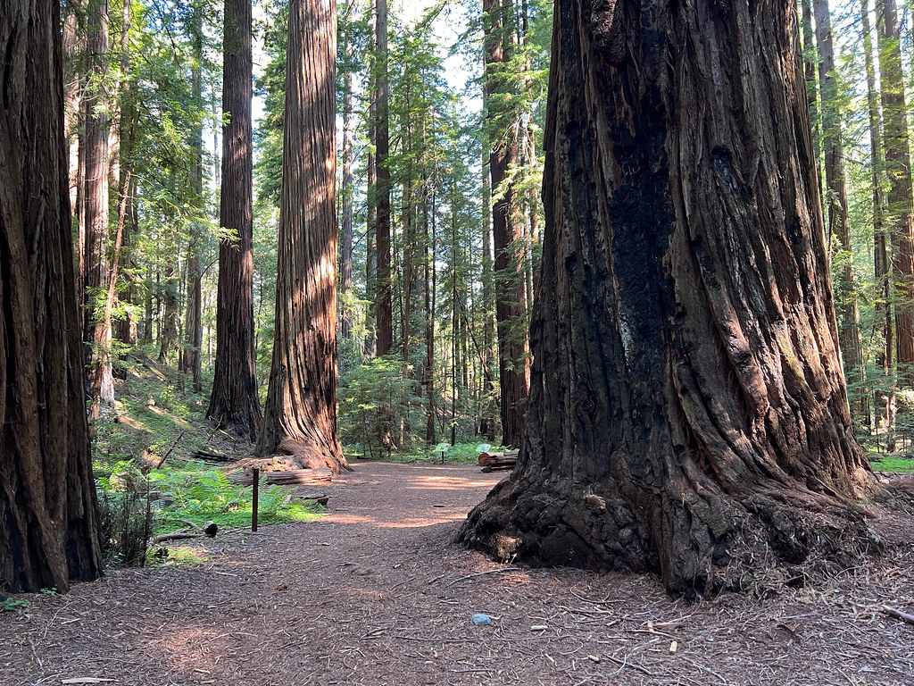 Photo: daveynin, CC BY 2.0 (via Flickr)
- 1.0 mi
- loop
- 152 ft
- climb
- 1,193 ft
- high point
- Loop
- route
- Apr–Nov
- best months
Montgomery Trail is a short, easy loop in Montgomery Woods State Natural Reserve in California, managed by State Park and Recreation. The trail is about a mile long, with a total elevation gain of 152 feet, and it makes a steady climb from a low point of 1,101 feet to a high of 1,193 feet before returning to nearly the same level. The steepest stretch comes at about 0.59 miles in, with a grade of about 5%. Late spring and early fall are the most comfortable times to go. Typical averages from a nearby weather station in Willits show May highs around 69°F and October highs around 72°F, while July and August average about 83°F with almost no wet days. Paddlers can find the South Fork Big River about 4.4 miles away and Ackerman Creek about 6.9 miles away. Hikers can extend the outing with the Sheep Trail, about 7.4 miles off, or the Canyon Creek Trail, about 10 miles away.
- South Fork Big RiverCanoeing4.4 mi
- Ackerman CreekCanoeing6.9 mi
- Sheep TrailHiking7.4 mi
- Forsythe CreekCanoeing7.6 mi
- North Fork Indian CreekCanoeing8.6 mi
- Canyon Creek TrailHiking10 mi
Source: Roamze catalog (indexable pages within 10 miles, PostGIS distance)
 Concrete Tank TrailHiking · ~21 min drivePhoto: V31S70, CC BY 2.0 (via Flickr)
 Gooseberry TrailHiking · ~26 min drivePhoto: rivenexus, CC BY 2.0 (via Flickr)
- Rockefeller TrailHiking · ~24 min drivePhoto: rivenexus, CC BY 2.0 (via Flickr)
- Sheep TrailHiking · ~13 min drive
- Robie TrailHiking · ~25 min drivePhoto: rivenexus, CC BY 2.0 (via Flickr)
- Rockefeller TrailHiking · ~24 min drive
- Dutch Henry TrailHiking · ~26 min drivePhoto: rivenexus, CC BY 2.0 (via Flickr)
- Last Chance TrailHiking · ~27 min drivePhoto: rivenexus, CC BY 2.0 (via Flickr)
- Canyon Creek TrailHiking · ~17 min drive
- Jerry Cook TrailHiking · ~17 min drive
Best time to visit Montgomery Trail
Best months: April–November. Best months have typical highs of 55–85 °F, lows of 30 °F or warmer (32 °F where the station doesn't record snow), at most one snowy day and no more than 12 wet days.
Jan
54° / 33°
15 wet
Feb
56° / 34°
13 wet
Mar
59° / 36°
14 wet
Apr
62° / 37°
11 wet
May
69° / 40°
6 wet
Jun
76° / 44°
2 wet
Jul
83° / 48°
0 wet
Aug
83° / 46°
0 wet
Sep
82° / 42°
2 wet
Oct
72° / 37°
6 wet
Nov
60° / 35°
12 wet
Dec
53° / 32°
14 wet
Typical high / low (°F) and days with rain or snow, 1991–2020. Measured at Willits 1 Ne, CA, 13.3 mi away at 1,353 ft. This station doesn't record snowfall. Source: NOAA NCEI U.S. Climate Normals 1991–2020.

Map and trail data © OpenStreetMap contributors
