Clover Meadow
Campground
Campground · 2.7 mi from the trail
Caution today
Agency alerts are in effect for this area; weather is marginal · USFS, OpenWeather · checked just now
Closure in the area
There's a closure order in Sierra National Forest. It doesn't name Miller's Crossing Trail, so check the source for the area it covers (3 listed).
Safety Tips for Burned Areas: Garnet Fire Area
Agency closure covering Sierra National Forest · USFS · Sierra National Forest
Wilderness Food and Refuse Storage
Agency closure covering Sierra National Forest · Order 05-15-00-26-03 · USFS · Sierra National Forest
Food and Refuse Storage
Agency closure covering Sierra National Forest · Order 05-15-00-26-02 · USFS · Sierra National Forest
Forest Order removes Fish Camp, Soda Springs, and Little Jackass from closure list
Agency alert covering Sierra National Forest · Order 05-15-00-26-11 · USFS · Sierra National Forest
Ansel Adams and John Muir Wilderness Campfire Restrictions
Agency alert covering Sierra National Forest · Order 05-15-00-26-09 · USFS · Sierra National Forest
As of · Source: USFS · Sierra National Forest. Agencies don't list every closure — check before you go.
Miller's Crossing Trail is an expert-level out-and-back hike in California's Sierra National Forest, within the Bass Lake Ranger District, about 5 miles from the trailhead. The route is 10.4 miles long, with a total elevation gain and loss of 5,727 feet, and it climbs to a high point of 7,281 feet. The steepest section comes at about 2.8 miles, with a grade of 58 percent. The most comfortable months for a visit are typically July and August, when typical averages from the nearby Huntington Lake weather station run around 74°F for highs and 49°F for lows, with only one or two wet days a month. Winter is much colder, with January highs averaging about 43°F. The trip takes about 6.5 hours, and the trail starts at a low point of 4,582 feet. The Cassidy Trail lies just 0.1 mile away, and Granite Creek, a canoeing spot, is about 0.6 mile off. Mammoth Pool, a climbing area, is 3.1 miles away, and Bowler campground is 4.8 miles away.
Clover Meadow
Campground
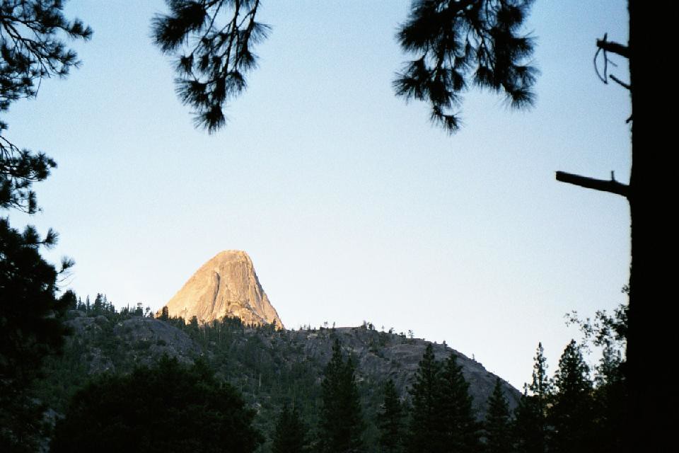
 If it rainsKevin R Foote, CC BY-SA 3.0 · Wikimedia Commons
Mariposa Grove Museum
Museum
Places © OpenStreetMap contributors, Places © Overture Maps Foundation · Photos: Kevin R Foote, CC BY-SA 3.0 (commons)
More in Mammoth LakesNot on Roamze yet. Their page has how to reach them.
Source: Roamze catalog (indexable pages within 10 miles, PostGIS distance)
 Cassidy MeadowHiking · ~5 min drivePhoto: Tom Hilton, CC BY 2.0 (via Flickr)California Riding and Hiking TrailHiking · ~5 min drivePhoto: Tom Hilton, CC BY 2.0 (via Flickr)Rattlesnake LakeHiking · ~5 min drivePhoto: Tom Hilton, CC BY 2.0 (via Flickr)
Best months: May–October. Best months have typical highs of 55–85 °F, lows of 30 °F or warmer (32 °F where the station doesn't record snow), at most one snowy day and no more than 12 wet days.
Jan
43° / 24°
11 wet
Feb
44° / 23°
11 wet
Mar
46° / 26°
10 wet
Apr
50° / 29°
8 wet
May
56° / 36°
6 wet
Jun
66° / 42°
3 wet
Jul
74° / 49°
2 wet
Aug
74° / 49°
1 wet
Sep
68° / 44°
2 wet
Oct
58° / 37°
4 wet
Nov
49° / 31°
8 wet
Dec
44° / 25°
10 wet
Typical high / low (°F) and days with rain or snow, 1991–2020. Measured at Huntington Lake, CA, 19.1 mi away at 7,020 ft. This station doesn't record snowfall. Source: NOAA NCEI U.S. Climate Normals 1991–2020.
Map and trail data © OpenStreetMap contributors

