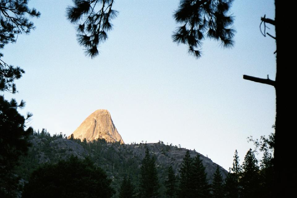
Mammoth Pool
Mammoth Pool is a California climbing crag with 8 routes.
- 8 routes
- 5.8 – 5.11c
- Trad
Is Mammoth Pool open right now?
Closure in the area
There's a closure order in Sierra National Forest. It doesn't name Mammoth Pool, so check the source for the area it covers (3 listed).
Safety Tips for Burned Areas: Garnet Fire Area
Agency closure covering Sierra National Forest · USFS · Sierra National Forest
Wilderness Food and Refuse Storage
Agency closure covering Sierra National Forest · Order 05-15-00-26-03 · USFS · Sierra National Forest
Food and Refuse Storage
Agency closure covering Sierra National Forest · Order 05-15-00-26-02 · USFS · Sierra National Forest
Forest Order removes Fish Camp, Soda Springs, and Little Jackass from closure list
Agency alert covering Sierra National Forest · Order 05-15-00-26-11 · USFS · Sierra National Forest
Ansel Adams and John Muir Wilderness Campfire Restrictions
Agency alert covering Sierra National Forest · Order 05-15-00-26-09 · USFS · Sierra National Forest
As of · Source: USFS · Sierra National Forest. Agencies don't list every closure — check before you go.
Best time to visit Mammoth Pool
Best months: May–October. Best months have typical highs of 55–85 °F, lows of 30 °F or warmer (32 °F where the station doesn't record snow), at most one snowy day and no more than 12 wet days.
Jan
43° / 24°
11 wet
Feb
44° / 23°
11 wet
Mar
46° / 26°
10 wet
Apr
50° / 29°
8 wet
May
56° / 36°
6 wet
Jun
66° / 42°
3 wet
Jul
74° / 49°
2 wet
Aug
74° / 49°
1 wet
Sep
68° / 44°
2 wet
Oct
58° / 37°
4 wet
Nov
49° / 31°
8 wet
Dec
44° / 25°
10 wet
Typical high / low (°F) and days with rain or snow, 1991–2020. Measured at Huntington Lake, CA, 16.4 mi away at 7,020 ft. This station doesn't record snowfall. Source: NOAA NCEI U.S. Climate Normals 1991–2020.
Closures we've recorded since August 2026
Mammoth Pool Boat Launch Rehabilitation
Bass Lake Ranger District · Order dated December 31, 2025; seen Aug 23, 2026, no lift recorded · Forest Service
Mammoth Pool is a climbing area in the Bass Lake Ranger District of Sierra National Forest in California, managed by the Forest Service. It sits within the Sierra National Forest, about 16 miles from the Huntington Lake weather station, which records typical averages that help set the tone for planning a visit. Summer is the most comfortable time to go. Typical July and August highs reach about 74°F with lows near 49°F, and those months see only one or two wet days, according to the Huntington Lake station. Winter is cold, with typical January highs around 43°F and lows near 24°F. Several other outings lie within a few miles. The South Fork hike is about 1.3 miles away, and the Hell's Half Acre hike is about 2.3 miles off. Paddlers can head to Jackass Creek, about 2.7 miles away, and Bowler campground is about 4.8 miles away.
Routes (8)
Balloon Dome(1)
Disappearing Dome(3)
North Piyau (Squaw) Dome(1)
Keep exploring — more climbs worth the drive
 Photo: Guywelch2000, CC BY-SA 4.0 (via Wikimedia Commons)
Main Wall - Lower Left
~19 min drive
6 routes at Main Wall - Lower Left in California, ranging from moderate to hard difficulty.
Photo: Guywelch2000, CC BY-SA 4.0 (via Wikimedia Commons)High Eagle
~19 min drive
High Eagle in California has 10 climbing routes with sport and trad options.
Photo: Guywelch2000, CC BY-SA 4.0 (via Wikimedia Commons)Talon
~19 min drive
Talon in California has 10 sport climbing routes across 6 difficulty grades.
 Photo: stevelyon, CC BY-SA 2.0 (via Flickr)
Midway Dome
~20 min drive
Midway Dome in California has 5 climbing routes across 3 grades, offering sport and trad options.
 Photo: stevelyon, CC BY-SA 2.0 (via Flickr)
Gold Eagle
~20 min drive
Gold Eagle in California has 7 climbing routes with 7 difficulty grades, offering sport and trad styles.
Swimming Hole Wall
~18 min drive
Swimming Hole Wall is a climbing area in California with 5 routes.
Gold Block
~18 min drive
6 climbing routes at Gold Block in California, spanning 5 difficulty grades and offering sport and trad styles.
Apron
~18 min drive
Apron in California has 7 climbing routes across 5 grades, offering sport and trad options.
Gray Eagle
~18 min drive
Gray Eagle in California has 8 traditional climbing routes across 7 difficulty grades.
Melting Wall
~18 min drive
6 trad routes at Melting Wall, California, spanning 3 difficulty grades.