Big Tree Flat
Campground
Campground · 7.8 mi from the trail
Caution at last check
Agency alerts are in effect for this area; weather is good · USFS, OpenWeather · checked 17 h ago
Alert in the area
The Forest Service lists 4 alerts for San Bernardino National Forest.
Safety Alert - Falling Rocks at Bonita Falls
Agency alert covering San Bernardino National Forest · USFS · San Bernardino National Forest
Upper Big Falls Area Closure
Agency alert covering Front Country Ranger District · Order 05-12-53-26-03 · USFS · Front Country Ranger District
Fire Restrictions
Agency alert covering San Bernardino National Forest · Order 05-12-00-26-05 · USFS · San Bernardino National Forest
Applewhite Picnic Area Closure
Agency alert covering Front Country Ranger District · Order 05-12-53-26-01 · USFS · Front Country Ranger District
As of · Source: USFS · San Bernardino National Forest. Agencies don't list every closure — check before you go.
Millard Canyon is a hard hike in California's San Bernardino National Forest, within the Front Country Ranger District. It is a 9.7-mile out-and-back route with a one-way elevation gain of 2,480 feet, taking you from a low of about 3,600 feet to a high of about 6,100 feet. The trail is natural and not accessible, and the land is managed by the Forest Service. Late spring and early fall are the most comfortable times to go. Typical averages from a nearby weather station show May highs around 71°F with lows near 41°F, and October highs around 72°F. That station sits about 700 feet below the canyon's high point, so temperatures up top run a little cooler. Several other hikes start within a couple of miles, including Bear Wallow, Tunnel and Kitching Peak. The San Gorgonio River, about 4.4 miles away, offers canoeing.
Big Tree Flat
Campground
 If it rainsVisitor7, CC BY-SA 3.0 · Wikimedia Commons
Places © OpenStreetMap contributors · Photos: Visitor7, CC BY-SA 3.0 (commons)
More in Desert Hot Springs Raywood FlatHikingPhoto: Brück & Sohn Kunstverlag Meißen, CC0 (via Wikimedia Commons)3.7 mi
Source: Roamze catalog (indexable pages within 10 miles, PostGIS distance)
Raywood FlatHiking · ~6 min drivePhoto: Brück & Sohn Kunstverlag Meißen, CC0 (via Wikimedia Commons) PCT-Whitewater Preserve Ranger Station Access TrailHiking · ~10 min drivePhoto: RuggyBearLA, CC BY 2.0 (via Flickr)
 Aspen GroveHiking · ~16 min drivePhoto: Vahe Martirosyan, CC BY-SA 2.0 (via Flickr)
 Wilshire Peak (No SurveyHiking · ~15 min drivePhoto: inkknife_2000 (7.5 million views +), CC BY-SA 2.0 (via Wikimedia Commons)
 San Gorgonio Mountain TrailHiking · ~14 min drivePhoto: simonov, CC BY-SA 2.0 (via Flickr)
 Lodgepole TrailHiking · ~16 min drivePhoto: simonov, CC BY-SA 2.0 (via Flickr)
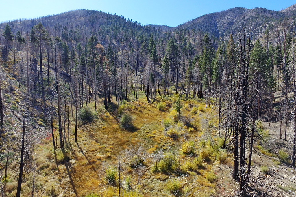 Fish CreekHiking · ~15 min drivePhoto: Vahe Martirosyan, CC BY-SA 2.0 (via Flickr)
 Grinnell MountainHiking · ~15 min drivePhoto: rmceoin, CC BY 2.0 (via Flickr)
 FALLS CREEK SPURHiking · ~18 min drivePhoto: inkknife_2000 (7.5 million views +), CC BY-SA 2.0 (via Wikimedia Commons)
Also worth it near here
 Sky HighMountain biking · ~14 min drivePhoto: Mitch from Costa Mesa, CA, USA, CC BY-SA 2.0 (via Wikimedia Commons)
 San Gorgonio MountainSummit · ~14 min drivePhoto: Doc Searls, CC BY-SA 2.0 (via Wikimedia Commons)
Best months: April–July and September–November. Best months have typical highs of 55–85 °F, lows of 30 °F or warmer (32 °F where the station doesn't record snow), at most one snowy day and no more than 12 wet days.
Jan
55° / 31°
7 wet · 2 snow
Feb
54° / 30°
7 wet · 3 snow
Mar
59° / 32°
6 wet · 2 snow
Apr
64° / 35°
4 wet · 1 snow
May
71° / 41°
2 wet
Jun
80° / 48°
1 wet
Jul
85° / 55°
2 wet
Aug
86° / 55°
3 wet
Sep
81° / 50°
2 wet
Oct
72° / 42°
2 wet
Nov
62° / 35°
4 wet · 1 snow
Dec
54° / 30°
6 wet · 2 snow
Typical high / low (°F) and days with rain or snow, 1991–2020. Measured at Idyllwild Fire Dept, CA, 16.6 mi away at 5,380 ft. The station sits about 700 ft lower than this place, so expect it a little cooler here. Source: NOAA NCEI U.S. Climate Normals 1991–2020.
