McGee Backpacker Cg
Campground
Campground · 0.3 mi from the trail
Alert in the area
The Forest Service lists 3 alerts for Inyo National Forest.
Help Halt Golden Mussel Invasion
Agency alert covering Inyo National Forest · USFS · Inyo National Forest
Ansel Adams and John Muir Wilderness Campfire Restrictions
Agency alert covering Inyo National Forest · Order 05-04-50-25-04 · USFS · Inyo National Forest
Golden Trout and Hoover Wilderness Campfire Restrictions
Agency alert covering Inyo National Forest · Order 05-04-50-25-05 · USFS · Inyo National Forest
As of · Source: USFS · Inyo National Forest. Agencies don't list every closure — check before you go.
McGee Pack Station Trail is a short, easy out-and-back hike in California's Inyo National Forest, within the White Mountain Ranger District. The trail is about 0.7 miles long, with a total elevation gain of 128 feet, and it starts and ends at roughly 7,780 feet. The climb is front-loaded, with the steepest stretch at about 0.08 miles from the start, and the high point reaches about 7,880 feet. Summer is the most comfortable time to go. Typical averages from a nearby weather station at Mammoth Lakes show July highs around 78°F with lows near 49°F, while winter highs sit around 41°F with lows in the teens. The trail makes an easy pairing with other outings in the area. Red Slate Mountain and McGee Backpacker Campground are each about 0.3 miles away, and the McGee Creek to Hilton Creek Trail is about half a mile off. Climbers can find the North Face area about 3.3 miles away.
McGee Backpacker Cg
Campground
The Restaurant at Convict Lake
Restaurant
Hot Spring
Hot spring
Places © OpenStreetMap contributors
More in Mammoth LakesNot on Roamze yet. Their page has how to reach them.
 Red Slate MountainHikingPhoto: Robert Gourley, CC BY 2.0 (via Flickr)0.3 mi
 Mt. MorrisonRock climbingPhoto: jfdervin, CC BY-SA 2.0 (via Flickr)3.6 mi
Source: Roamze catalog (indexable pages within 10 miles, PostGIS distance)
Red Slate MountainHiking · Next doorPhoto: Robert Gourley, CC BY 2.0 (via Flickr)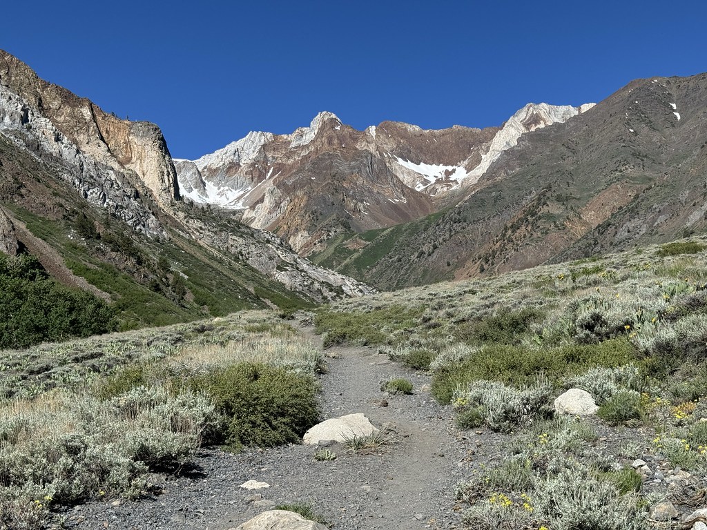 McGee Creek SpurHiking · ~1 min drivePhoto: Seth Tisue, CC BY-SA 2.0 (via Flickr)
 Mcgee PassHiking · ~2 min drivePhoto: Seth Tisue, CC BY-SA 2.0 (via Flickr)
 Mcgee MountainHiking · ~2 min drivePhoto: GSEC, CC BY 2.0 (via Flickr)
 McGee Creek to Hilton Creek TrailHiking · ~2 min drivePhoto: Dcrjsr, CC BY 4.0 (via Wikimedia Commons)MCGEE CREEK TO HILTON CREEKHiking · ~3 min drivePhoto: Dcrjsr, CC BY 4.0 (via Wikimedia Commons)Hilton CreekHiking · ~3 min drivePhoto: Dcrjsr, CC BY 4.0 (via Wikimedia Commons)
 Convict CreekHiking · ~7 min drivePhoto: Hike395 (talk · contribs), CC BY-SA 3.0 (via Wikimedia Commons)
 Steelhead LakeHiking · ~6 min drivePhoto: Miguel Vieira from Redwood City, CA, USA, CC BY 2.0 (via Wikimedia Commons)BALDWIN CANYONHiking · ~6 min drivePhoto: Miguel Vieira from Redwood City, CA, USA, CC BY 2.0 (via Wikimedia Commons)
Best months: May–September. Best months have typical highs of 55–85 °F, lows of 30 °F or warmer (32 °F where the station doesn't record snow), at most one snowy day and no more than 12 wet days.
Jan
41° / 17°
Feb
41° / 18°
Mar
45° / 22°
Apr
51° / 27°
May
60° / 35°
Jun
70° / 42°
Jul
78° / 49°
Aug
77° / 47°
Sep
71° / 40°
Oct
61° / 30°
Nov
49° / 23°
Dec
41° / 17°
Typical high / low (°F) and days with rain or snow, 1991–2020. Measured at Mammoth Lakes Rs, CA, 11 mi away at 7,804 ft. This station doesn't record snowfall. Source: NOAA NCEI U.S. Climate Normals 1991–2020.
Map and trail data © OpenStreetMap contributors

