Mammoth Lakes Pack Outfit
Hiking business nearby (~34 mi away) — hasn't claimed their Roamze page yet

California
Free — you'll pick up right here.
1.4 mi
Distance
26 ft
Gain
We won't guess. Here is exactly what we do and don't know.
What we do know
Inside Yosemite National Park
National Park unit boundary is mapped — agency alerts for it feed this page automatically.
Boundary data
What's missing
No access route mapped
We don't yet know which road reaches this trailhead, so we can't tell you if it's gated.
Nobody's filed a report here yet — be the first.
Why you'll love it
Lower Yosemite Fall Trail
Suggested plan · check conditions before you go
Lower Yosemite Fall Trail is a short out-and-back hike in Yosemite National Park, California, covering 1.37 miles with 26 feet of elevation gain. The trail reaches a maximum elevation of 4,020 feet.
Lower Yosemite Fall Trailhead
~0 min drive
This short, easy walk rewards visitors with spectacular views of both Upper and Lower Yosemite Falls. This paved loop trail offers different vantage points of Yosemite Falls and Yosemite Creek. Numerous exhibits along the trail discuss the natural and cultural history of the…
Cook's Meadow Loop Trailhead
~0 min drive
This short, easy walk offers stunning views of Yosemite Falls, Half Dome, and Sentinel Rock as well as a vibrant example of the rich biodiversity in Yosemite's meadows. From Yosemite Village, walk west along the bicycle path toward Lower Yosemite Fall or take the Valleywide…
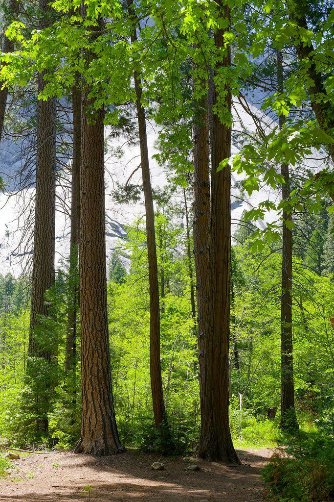 Photo: mlcastle, CC BY-SA 2.0 (via Flickr)
Bike Path
~3 min drive
7.12-mile out-and-back bike path in California with 33 ft of elevation gain
 Photo: Richard Wood, CC BY-SA 3.0 (via Wikimedia Commons)
John Muir Trail
~6 min drive
24.06-mile out-and-back trail in California with 6,836 ft elevation gain
 Photo: mlcastle, CC BY-SA 2.0 (via Flickr)
Yosemite Falls Trail
~1 min drive
3.01-mile out-and-back hike in Yosemite National Park, California, gaining 2,761 ft.
Photo: mlcastle, CC BY-SA 2.0 (via Flickr)Camp 4 West
~1 min drive
0.38-mile loop trail at Camp 4 West with 12 ft gain and 3,994 ft max elevation
 Photo: Sebastien Lovcoffee, CC BY-SA 3.0 (via Wikimedia Commons)
Panorama Trail
~3 min drive
4.86-mile out-and-back hike in California with 2,717 ft gain/loss and 7,314 ft max elevation.
 Photo: Justin.Johnsen, CC BY-SA 3.0 (via Wikimedia Commons)
Merced Pass Trail
~10 min drive
23.6-mile out-and-back trail in California with 3,928 ft elevation gain/loss.
Valley Shuttle Stop 11: Four Mile Trailhead
~2 min drive
This shuttle stop is served by the Valleywide Shuttle route only. There is no covered shelter or benches at this shuttle stop. Yosemite Valley shuttles are free and operate from 7 am to 10 pm daily. During hours of operation, the Valleywide Shuttle runs approximately every…
 Photo: Moo.The.Cow, CC BY 2.0 (via Flickr)
Sentinel Dome Trail
~3 min drive
0.41-mile out-and-back hike to Sentinel Dome in California's national park.
Also worth it near here
Restroom
~0 min drive
 Photo: lamblukas, CC BY 2.0 (via Flickr)
First Tier
~0 min drive
 Photo: Diliff, CC BY-SA 3.0 (via Wikimedia Commons)
Camp 4
~1 min drive
 Photo: King of Hearts, CC BY-SA 4.0 (via Wikimedia Commons)
Yosemite Falls
~1 min drive
 Photo: Glenn Scofield Williams, CC BY 2.0 (via Wikimedia Commons)
Eagle Peak
~2 min drive
Local operatorsoffering guided trips. You book directly with them — Roamze doesn’t take a cut.
Mammoth Lakes Pack Outfit
Hiking business nearby (~34 mi away) — hasn't claimed their Roamze page yet
