Hike and Bike Campsites
Campground
Campground · 2.3 mi from the trail
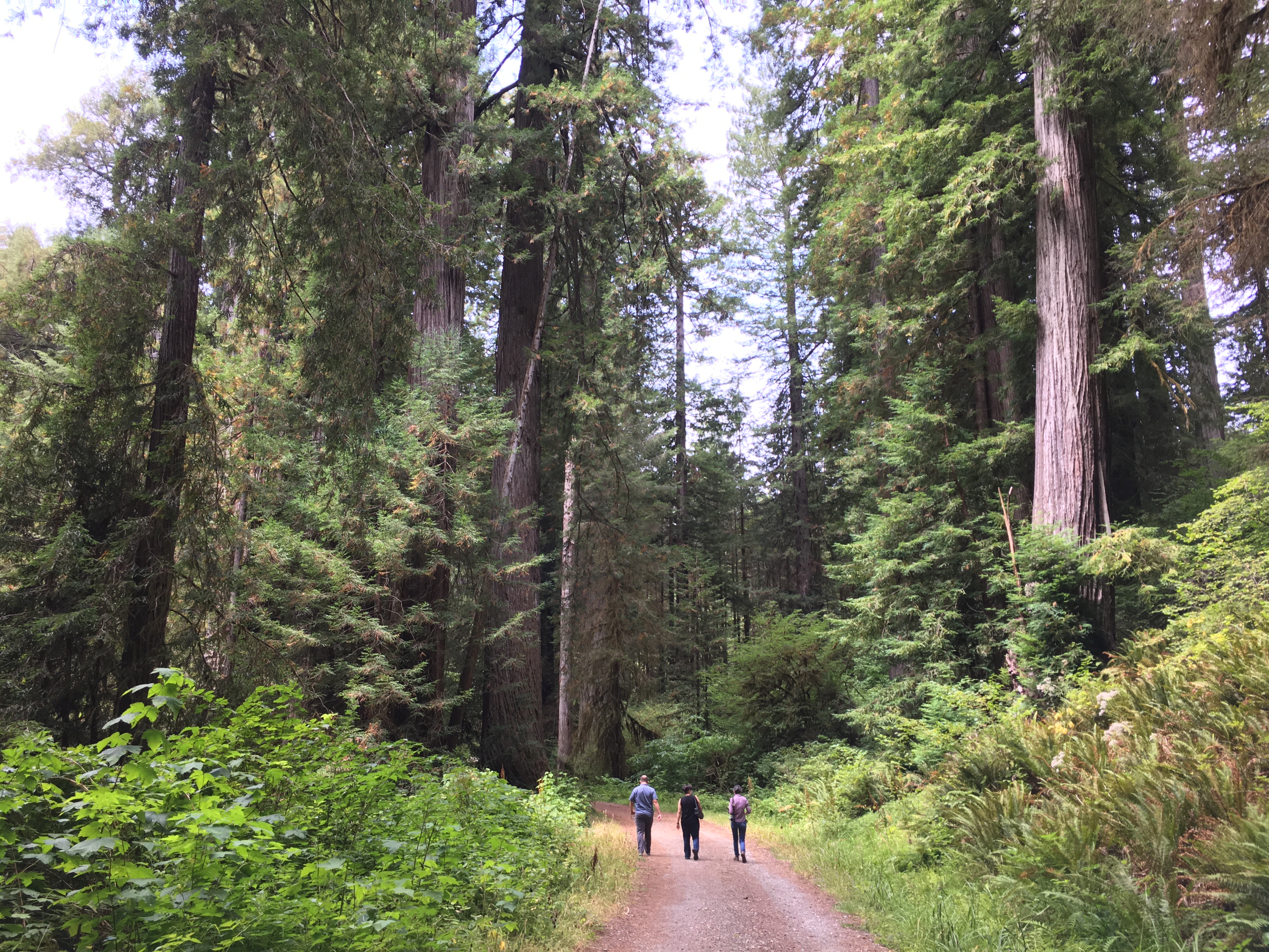 Photo: NPS Photo / G Litten
Alert in the area
The National Park Service lists an alert for Redwood National Park.
Delays along Highway 101
Park alert covering Redwood National Park · NPS · Redwood National Park
As of · Source: NPS · Redwood National Park. Agencies don't list every closure — check before you go.
An Opportunity To Ride (Or Stroll) Through A Landscape In Recovery. Lost Man Creek flows through a landscape greatly changed from the 1960s when much of this area was clearcut logged. What used to be a logging road has been converted into a hike and bike trail. Lost Man Creek trail is not a narrow single-track mountain-biking trail, and only the first couple of miles is in old-growth redwood groves. This trail can be completed as a 22-mile ride that loops back to the Lost Man Creek parking lot. Many bike riders want to avoid riding on HWY101 to complete the loop, and turning around at the Bald Hills Road is a preferred option. Heading east from the trailhead, visitors will soon pass an interpretive sign showing the location where in 1980 Redwood National Park was formally designated as a United Nations World Heritage Site. The first mile of the trail is gentle as it follows a fork of Lost Man Creek. Visitors will walk and ride over several salmon-friendly bridges that were installed in the 1990s. These bridges are part of ongoing riparian restoration efforts to allow damaged river and stream habitats to recover from the impacts of being buried for decades by logging debris. The trail then enters second-growth forests and it starts it's 3,000 foot climb up to Holter Ridge where it then connects to the Bald Hills Road. In recent years, lots of forest restoration work was completed in the second-growth forests along Holter Ridge. In the decades to come, these once unhealthy forests will be able to grow into vibrant redwood forests. Safety Tips • We recommend you purchase and use a good map and trail guide for your adventures in Redwood National and State Parks. Don’t rely on online maps when you are here. • To protect the habitats, leave no trace also means staying on the developed trail. Please don’t go off-trail and make any new trails. These forests grow by the inch, and will die by your foot. • To protect the wildlife (and you and other visitors), pets are not allowed on park trails. • Cell coverage is very limited and cannot be relied on in an emergency. Have a plan for checking in and checking out with a friend when you are here.
Hike and Bike Campsites
Campground
EdeBee's Snack Shack
Burger restaurant
Patrick's Point Visitor Center
Museum
Places © OpenStreetMap contributors, Places © Overture Maps Foundation
More in Hoopa Lady Bird Johnson Nature Trail Stop #11HikingPhoto: Dave Van de Mark1.3 mi
 Lady Bird Johnson Nature Trail Stop #10HikingPhoto: Dave Van de Mark1.3 mi
 Lady Bird Johnson Nature Trail Stop #9HikingPhoto: Dave Van de Mark1.3 mi
 Prairie CreekCanoeingPhoto: Thewellman, CC0 (via Wikimedia Commons)2.1 mi
Source: Roamze catalog (indexable pages within 10 miles, PostGIS distance)
 Berry Glen TrailHiking · ~2 min drivePhoto: Aleksandr Zykov, CC BY-SA 2.0 (via Flickr)Davidson TrailHiking · ~3 min drivePhoto: Aleksandr Zykov, CC BY-SA 2.0 (via Flickr)
 Ridge LoopHiking · ~4 min drivePhoto: Wsiegmund, CC BY 2.5 (via Wikimedia Commons)
 Streelow Creek TrailHiking · ~3 min drivePhoto: Robert Ashworth from Bellingham, WA., USA, CC BY 2.0 (via Wikimedia Commons)
Also worth it near here
Prairie CreekCanoeing · ~4 min drivePhoto: Thewellman, CC0 (via Wikimedia Commons) Elk Prairie CampgroundCamping · ~4 min drivePhoto: Redwood National and State Parks — Public Domain Mark 1.0 (via Flickr)
 Cormorant Rock and Awkward TurtleRock climbing · ~15 min drivePhoto: lamblukas, CC BY 2.0 (via Flickr)
Best months: March–November. Best months have typical highs of 55–85 °F, lows of 30 °F or warmer (32 °F where the station doesn't record snow), at most one snowy day and no more than 12 wet days.
Jan
52° / 36°
Feb
54° / 37°
Mar
56° / 37°
Apr
58° / 39°
May
61° / 43°
Jun
64° / 46°
Jul
67° / 49°
Aug
69° / 49°
Sep
69° / 45°
Oct
65° / 42°
Nov
56° / 39°
Dec
51° / 36°
Typical high / low (°F) and days with rain or snow, 1991–2020. Measured at Orick Prairie Creek Park, CA, 2.4 mi away at 160 ft. This station doesn't record snowfall. Source: NOAA NCEI U.S. Climate Normals 1991–2020.
