Hatton Trail
 Photo: Ken Lund, CC BY-SA 2.0 (via Flickr)
- 0.4 mi
- round trip
- 320 ft
- climb
- 432 ft
- high point
- Out and back
- route
- May–Oct
- best months
Is Hatton Trail open right now?
Closure in the area
There's a closure order in Redwood National Park. It doesn't name Hatton Trail, so check the source for the area it covers.
Closure: Newton B. Drury Scenic Parkway
Park closure covering Redwood National Park · NPS · Redwood National Park
Delays along Highway 101
Park alert covering Redwood National Park · NPS · Redwood National Park
As of · Source: NPS · Redwood National Park. Agencies don't list every closure — check before you go.
Hatton Trail is a short, easy out-and-back hike in California's Redwood National Park, within Jedediah Smith Redwoods State Park. The trail is about 0.4 miles long, with a total climb of about 320 feet, and it starts at Hatton Trailhead. The route is front-loaded, with the steepest stretch at about 0.2 miles, and the high point reaches about 432 feet. Summer is the most comfortable time to go. Typical averages from a nearby weather station in Crescent City show July and August highs around 65 to 66°F with only three or four wet days a month, while winter months bring highs in the mid-50s and rain on more than half the days. Simpson-Reed Grove is just 0.1 mile away, and the Lieffer Loop Trail and Ellsworth Loop Trail are within a mile. For paddling, the Smith River is about 3.4 miles off.
Local outfitters
- Turtle Rock RV Resort43 mi away
Not on Roamze yet. Their page has how to reach them.
 Simpson-Reed GroveHikingPhoto: Photo / Steve Olson0.1 mi
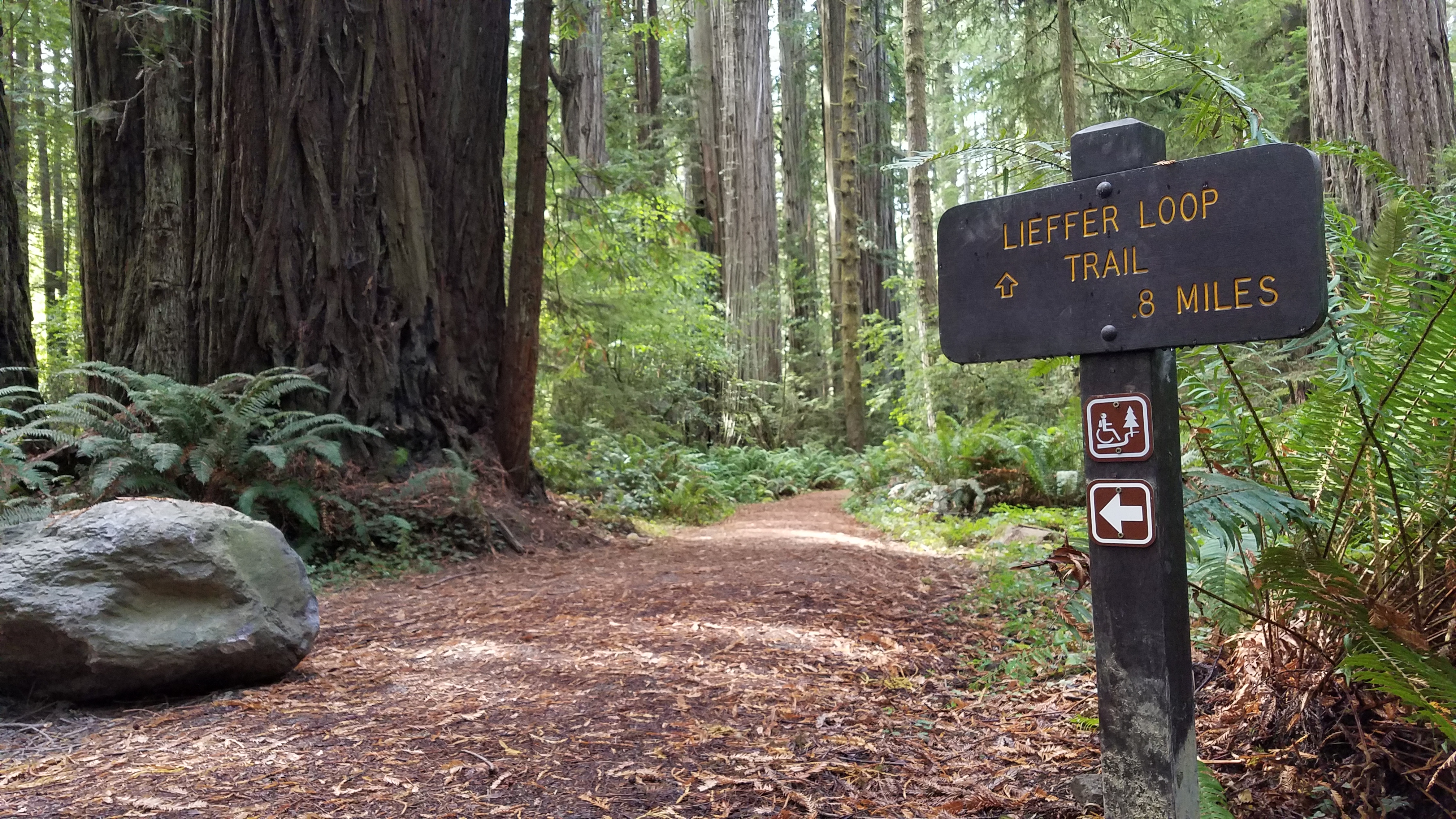 Lieffer Loop TrailHikingPhoto: NPS Photo / B. Marciniec.0.5 mi
 Ellsworth Loop TrailHikingPhoto: Ken Lund, CC BY-SA 2.0 (via Flickr)0.8 mi
- Lohse Grove TrailHiking1 mi
- Mill CreekCanoeing3.3 mi
 Smith RiverCanoeingPhoto: BigT67, CC BY-SA 3.0 (via Wikimedia Commons)3.4 mi
- Hardscrabble CreekCanoeing5.9 mi
 Panther Flat CampgroundCampingPhoto: Recreation.gov (RIDB) / public domain9.3 mi
Source: Roamze catalog (indexable pages within 10 miles, PostGIS distance)
- Simpson-Reed GroveHiking · Next door
- Hatton TrailHiking · Next doorPhoto: Ken Lund, CC BY-SA 2.0 (via Flickr)
- Lieffer Loop TrailHiking · Next door
 Craigs Creek TrailHiking · ~5 min drivePhoto: Ken Lund, CC BY-SA 2.0 (via Flickr)
 Adams TrailHiking · Next doorPhoto: Ken Lund, CC BY-SA 2.0 (via Flickr)
 Mill Creek TrailHiking · ~3 min drivePhoto: Tori Sloane, CC BY-SA 3.0 (via Wikimedia Commons)
- Hiouchi TrailHiking · ~2 min drive
- Ellsworth Loop TrailHiking · ~1 min drivePhoto: Ken Lund, CC BY-SA 2.0 (via Flickr)
 Boy Scout Tree TrailHiking · ~4 min drivePhoto: Šarūnas Burdulis from USA, CC BY-SA 2.0 (via Wikimedia Commons)
 Self Guided Nature TrailHiking · ~2 min drivePhoto: PunkToad, CC BY 2.0 (via Flickr)
Best time to visit Hatton Trail
Best months: May–October. Best months have typical highs of 55–85 °F, lows of 30 °F or warmer (32 °F where the station doesn't record snow), at most one snowy day and no more than 12 wet days.
Jan
54° / 40°
16 wet
Feb
55° / 40°
14 wet
Mar
56° / 41°
16 wet
Apr
58° / 43°
13 wet
May
61° / 46°
9 wet
Jun
63° / 48°
5 wet
Jul
65° / 51°
3 wet
Aug
66° / 52°
3 wet
Sep
66° / 48°
4 wet
Oct
62° / 46°
9 wet
Nov
57° / 42°
15 wet
Dec
53° / 39°
17 wet
Typical high / low (°F) and days with rain or snow, 1991–2020. Measured at Crescent City 3 Nnw, CA, 5.7 mi away at 43 ft. Source: NOAA NCEI U.S. Climate Normals 1991–2020.
Map and trail data © OpenStreetMap contributors
