Horse Packer Connector Trail
- 0.5 mi
- round trip
- 232 ft
- climb
- 6,621 ft
- high point
- Out and back
- route
Is Horse Packer Connector Trail open right now?
Alert in the area
The Forest Service lists 20 alerts for Mendocino National Forest.
Prescribed burning in Upper Lake Ranger District
Agency alert covering Mendocino National Forest · USFS · Mendocino National Forest
Pile burning on M5 Road in western Colusa County
Agency alert covering Mendocino National Forest · USFS · Mendocino National Forest
Heavy equipment in Three Prong Campground
Agency alert covering Mendocino National Forest · USFS · Mendocino National Forest
Chico Seed Orchard Public Use and Access Closure
Agency alert covering Mendocino National Forest · Order 08-26-02 · USFS · Mendocino National Forest
M10 Road Status - closure in place Mondays-Fridays
Agency alert covering Mendocino National Forest · USFS · Mendocino National Forest
As of · Source: USFS · Mendocino National Forest. Agencies don't list every closure — check before you go.
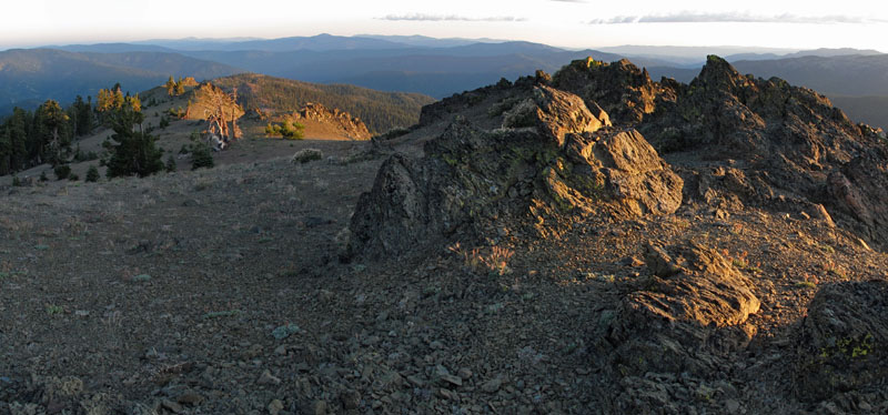
The Horse Packer Connector Trail is a short, easy hike in the Grindstone Ranger District of Mendocino National Forest in California, managed by the Forest Service. The trail is about 0.47 miles long, and the round trip adds up to roughly 0.94 miles with a total elevation gain of about 232 feet. The climb is front-loaded, with the steepest stretch at about 0.29 miles in, and the trail reaches a high point of about 6,621 feet. The trail makes a quick addition to a day spent exploring the surrounding area. The Ides Cove Loop lies about 0.3 miles away, and the Old Cottonwood Trail is about 0.8 miles off. Cottonwood Trail is about 1.7 miles away, and Fish Creek, a canoeing spot, is about 4 miles away.
- IDES COVE LOOPHiking0.3 mi
- Old Cottonwood TrailHiking0.8 mi
- Cottonwood TrailHiking1.7 mi
- Fish CreekCanoeing4 mi
- Buck CreekCanoeing5.5 mi
- Tomhead Saddle Cg-FCamping6.9 mi
- Green Springs CampgroundCamping7.3 mi
- North Fork Elder CreekCanoeing8.1 mi
Source: Roamze catalog (indexable pages within 10 miles, PostGIS distance)
- IDES COVE LOOPHiking · Next door
- Horse Packer Connector TrailHiking · ~1 min drive
- Old Cottonwood TrailHiking · ~1 min drive
- South Yolla Bolly TrailHiking · ~4 min drive
- Cottonwood TrailHiking · ~3 min drive
- Burnt Camp Loop Connector TrailHiking · ~3 min drive
- Thomas Pocket TrailHiking · ~7 min drive
- Lazyman ButteHiking · ~11 min drive
- Ides Cove Loop TrailHiking · ~3 min drive
- Scorpion Camp TrailHiking · ~6 min drive
Map and trail data © OpenStreetMap contributors
