Boat Camp
Campground
Campground · 2.4 mi from the trail
 Photo: Don Graham from Redlands, CA, USA - God bless it!, CC BY-SA 2.0 (via Wikimedia Commons)
Closure in the area
There's a closure order in Lake Tahoe Basin Management Unit. It doesn't name Eagle Meadows Trail, so check the source for the area it covers.
Harmful Algal Blooms
Agency closure covering Lake Tahoe Basin Management Unit · USFS · Lake Tahoe Basin Management Unit
Desolation Wilderness Food and Refuse Storage (Bear Canister) Restriction
Agency alert covering Lake Tahoe Basin Management Unit · Order 19-25-06 · USFS · Lake Tahoe Basin Management Unit
Meyers Landfill Area Closure
Agency alert covering Lake Tahoe Basin Management Unit · Order 19-25-01 · USFS · Lake Tahoe Basin Management Unit
Campfire Restrictions
Agency alert covering Lake Tahoe Basin Management Unit · Order 19-24-04 · USFS · Lake Tahoe Basin Management Unit
Camping/Overnight Stay Restriction
Agency alert covering Lake Tahoe Basin Management Unit · Order 19-24-05 · USFS · Lake Tahoe Basin Management Unit
As of · Source: USFS · Lake Tahoe Basin Management Unit. Agencies don't list every closure — check before you go.
Eagle Meadows Trail is a 2-mile out-and-back hike in California's Desolation Wilderness, within the Lake Tahoe Basin Management Unit. The Forest Service manages the land, and the trail rises from about 8,160 feet to about 8,780 feet, a climb of 609 feet, on a route rated easy. Summer is the most comfortable time to go. Typical averages from a nearby weather station at Dagget Pass, Nevada, show July highs around 75°F with lows near 49°F, and the trail sits higher than that station, so temperatures on the ridge run cooler. Phipps Lake Trail starts just 0.1 mile away. Eagle Lake Buttress and Eagle's Nest offer climbing within about a mile and a quarter, and Bayview Campground is about 2.5 miles off.
Boat Camp
Campground
Places © OpenStreetMap contributors
More in Sunnyside-Tahoe CityNot on Roamze yet. Their page has how to reach them.
Best months: May–October. Best months have typical highs of 55–85 °F, lows of 30 °F or warmer (32 °F where the station doesn't record snow), at most one snowy day and no more than 12 wet days.
Jan
36° / 23°
9 wet
Feb
37° / 23°
8 wet
Mar
42° / 26°
7 wet
Apr
48° / 29°
5 wet
May
56° / 35°
4 wet
Jun
66° / 42°
2 wet
Jul
75° / 49°
2 wet
Aug
74° / 49°
1 wet
Sep
67° / 44°
2 wet
Oct
55° / 36°
3 wet
Nov
43° / 28°
5 wet
Dec
35° / 23°
7 wet
Typical high / low (°F) and days with rain or snow, 1991–2020. Measured at Dagget Pass, NV, 13.5 mi away at 7,334 ft. The station sits about 1,400 ft lower than this place, so expect it a little cooler here. This station doesn't record snowfall. Source: NOAA NCEI U.S. Climate Normals 1991–2020.
Photo: Don Graham from Redlands, CA, USA - God bless it!, CC BY-SA 2.0 (via Wikimedia Commons)Phipps Lake Trail
Next door
0.40-mile out-and-back trail to Phipps Lake in California with 39 ft of elevation gain.
 Photo: Adrian Farwell, CC BY 3.0 (via Wikimedia Commons)
Climbers Trail to Eagle Lake Buttress
~3 min drive
1.46-mile out-and-back to Eagle Lake Buttress with 1,351 ft gain
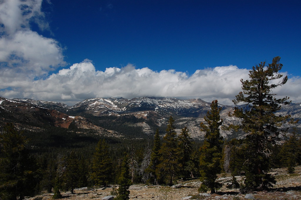 Photo: ilya_ktsn, CC BY 2.0 (via Flickr)
PACIFIC CREST TRAIL
~3 min drive
20.9-mile out-and-back on the Pacific Crest Trail in California with 3,094 ft gain/loss.
 Photo: ray_explores, CC BY 2.0 (via Flickr)
Rubicon Trail
~6 min drive
8.48-mile out-and-back hike in California with 3,280 ft elevation gain
Photo: Adrian Farwell, CC BY 3.0 (via Wikimedia Commons)Eagle Lake Trail
~3 min drive
0.20-mile out-and-back hike with 123 ft gain at Eagle Lake Trail, California
 Photo: radicalespresso, Public Domain Mark (via Flickr)
Vikingsholm Trail
~3 min drive
1.26-mile out-and-back trail in California with 1,101 ft elevation gain
 Photo: radicalespresso, Public Domain Mark (via Flickr)
EAGLE FALLS TRAIL
~3 min drive
16.1-mile out-and-back hike in California with 4,668 ft elevation gain and loss.
 Photo: simonov, CC BY-SA 2.0 (via Flickr)
Pacific Crest Trail
~9 min drive
9.1-mile out-and-back trail in California with 3,761 ft gain/loss and 9,372 ft max elevation.
 Photo: Seth Tisue, CC BY-SA 2.0 (via Flickr)
Azure Lake trail
~4 min drive
1.54-mile out-and-back hike in California with 765 ft elevation gain
 Photo: MARELBU, CC BY 3.0 (via Wikimedia Commons)
BAYVIEW TRAIL
~4 min drive
4.31-mile loop in California with 1,782 ft gain and 8,448 ft max elevation


