Deadfall Lake
- 3.5 mi
- round trip
- 770 ft
- climb
- 7,221 ft
- high point
- Out and back
- route
Is Deadfall Lake open right now?
Closure in the area
There's a closure order in Shasta-Trinity National Forest. It doesn't name Deadfall Lake, so check the source for the area it covers (2 listed).
Mud and Ash Creek Area and Road Closure
Agency closure covering Shasta-Trinity National Forest · Order 14-26-13 · USFS · Shasta-Trinity National Forest
Road Closure on Wild Mad Road
Agency closure covering Shasta-Trinity National Forest · Order 14-25-09 · USFS · Shasta-Trinity National Forest
Bailey Cove Road Closure Order
Agency alert covering Shasta-Trinity National Forest · Order 14-25-11 · USFS · Shasta-Trinity National Forest
Trout Creek Bridge Closure Order
Agency alert covering Shasta-Trinity National Forest · Order 14-26-02 · USFS · Shasta-Trinity National Forest
South Fork Suspension Bridge Closure
Agency alert covering Shasta-Trinity National Forest · Order 14-25-30 · USFS · Shasta-Trinity National Forest
As of · Source: USFS · Shasta-Trinity National Forest. Agencies don't list every closure — check before you go.
Deadfall Lake is a moderate out-and-back hike in the Mt. Shasta Ranger District of Shasta-Trinity National Forest in California, about 3.5 miles long with a total elevation gain of 770 feet. The trail rises from a low point of about 6,424 feet to a high of about 7,221 feet, and the Forest Service manages the land. The route is natural-surfaced and allows both horses and bikes, so it works for riders and pack animals as well as hikers. It stays open year-round, and the Pacific Crest Trail passes about a mile away, with the Deadfall Lakes Trail about 1.3 miles off. Toad Lake Campground sits about 3.8 miles away, and Kangaroo is about 5.9 miles away. Paddlers can reach the South Fork Sacramento River, roughly 7.6 miles out, and climbers will find The Cube about 8.1 miles away.
Keep exploring — more trails worth the drive
 Photo: theforestprimeval, CC BY-SA 2.0 (via Flickr)
Pacific Crest Trail
~2 min drive
22.16-mile out-and-back trail in California with 3,913 ft elevation gain
 Photo: theforestprimeval, CC BY-SA 2.0 (via Flickr)
Eddy Creek
~2 min drive
1.91-mile out-and-back trail in California with 804 ft elevation gain.
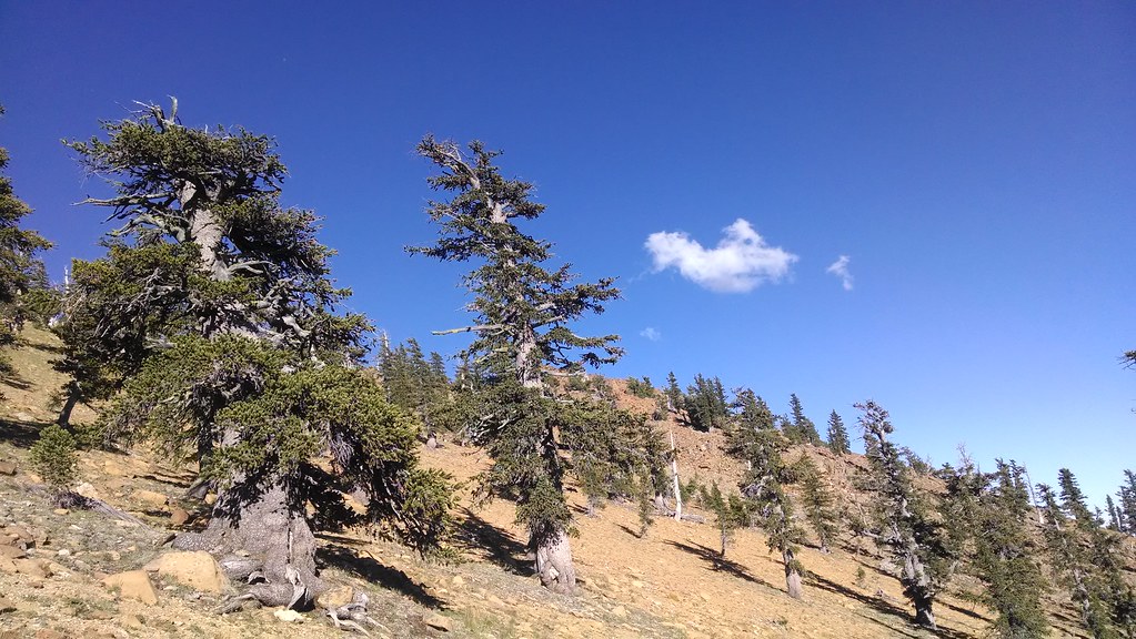 Photo: theforestprimeval, CC BY-SA 2.0 (via Flickr)
Toad Lake
~6 min drive
9.73-mile out-and-back trail to Toad Lake in California with 1,838 ft gain.
 Photo: theforestprimeval, CC BY-SA 2.0 (via Flickr)
Houston Creek
~8 min drive
3.20-mile out-and-back trail in California with 1,632 ft gain.
 Photo: Curt Kline, CC BY 3.0 (via Wikimedia Commons)
Pacific Crest National Scenic Trail #2000
~12 min drive
19.36-mile out-and-back on the Pacific Crest Trail with 3,680 ft gain/loss
Photo: theforestprimeval, CC BY-SA 2.0 (via Flickr)Sisson Callahan Trail
~5 min drive
1.22-mile out-and-back trail in California with 289 ft gain and 6,837 ft max elevation.
HIKE
Sisson Callahan Trail
~3 min drive
5.72-mile out-and-back hike in California with 2,128 ft gain/loss.
Photo: Curt Kline, CC BY 3.0 (via Wikimedia Commons)Fen Nature Trail (Sisson)
~11 min drive
3.00-mile out-and-back trail in California with 640 ft elevation gain.
 Photo: randomduck, CC BY-SA 2.0 (via Flickr)
Pacific Crest Trail
~14 min drive
32.18-mile out-and-back trail in California with 4,411 ft elevation gain and loss.
Photo: theforestprimeval, CC BY-SA 2.0 (via Flickr)Sisson-Callahan (Historic)
~5 min drive
2.60-mile out-and-back trail in California with 982 ft gain.

