Tuolumne Meadows Campground
Campground
Campground · 0.8 mi from the trail
Yosemite Wilderness (overnight trips) · overnight
Reserve on Recreation.govClosure in the area
There's a closure order in Yosemite National Park. It doesn't name Cathedral Lakes Trailhead, so check the source for the area it covers.
Tioga Road and Glacier Point Road are temporarily closed due to snow
Park closure covering Yosemite National Park · NPS · Yosemite National Park
As of · Source: NPS · Yosemite National Park. Agencies don't list every closure — check before you go.
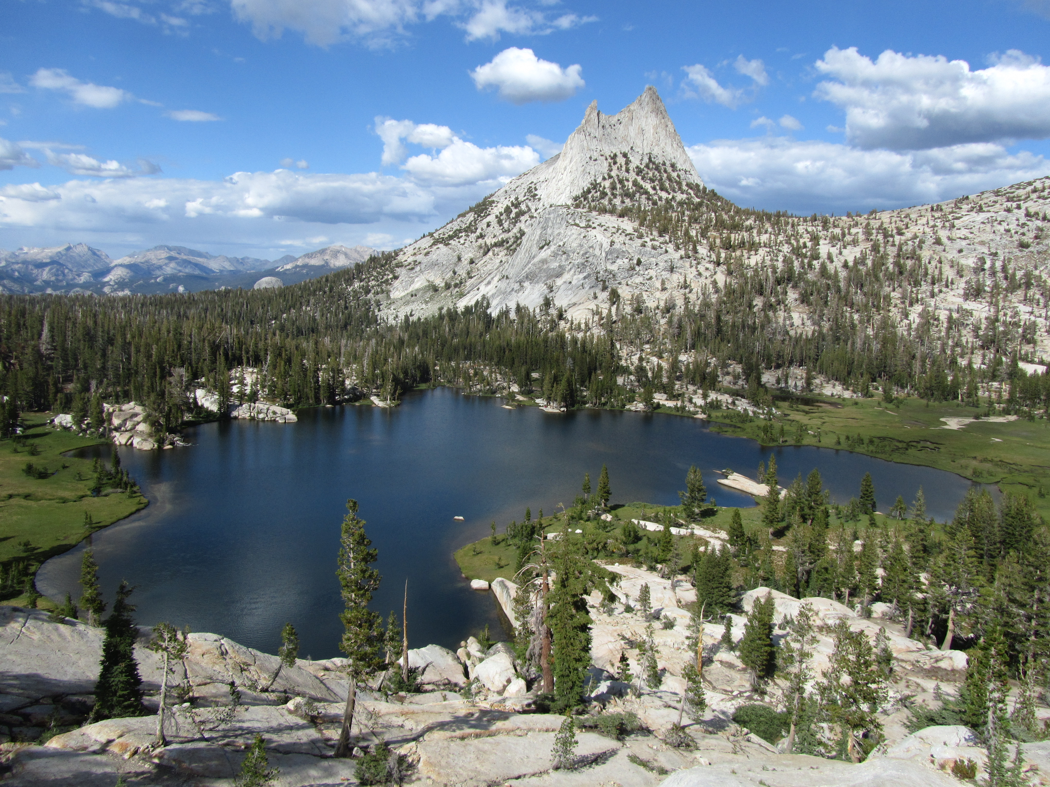
Cathedral Lakes are nestled at the foot of Cathedral Peak. In addition to the lakes themselves, hikers will enjoy views of Cathedral Peak and Echo Peak. The trail through this area is part of the John Muir Trail, which sees high traffic all season. The area is also popular with rock climbers. Beginning from the Tuolumne Meadows Visitor Center parking, the trail climbs steadily to Upper Cathedral Lake. Near the top of the climb, a spur trail leads to Lower Cathedral Lake (0.7 mile one-way to the lake). Distance: 7.6 miles (12 km) round-trip Elevation gain: 1,000 ft (300 m) Time estimate: 6-7 hours Tips & Seasonal Information Pets and bicycles are not allowed on hiking trails. This trailhead is only reachable by vehicle when Tioga Road is open, typically late May or early June to sometime in October or November. Tioga Road closes after the first significant snowfall. Overnight parking on this road, including this trailhead, ends October 15. For current road and weather information, please call 209/372-0200 (press 1, then 1).
Tuolumne Meadows Campground
Campground
Tuolumne Meadows Grill
Fast food
 If it rainsEeekster, CC BY 3.0 · Wikimedia Commons
Sierra Point
Viewpoint
Point in Yosemite National Park at the eastern end of the valley
Places © OpenStreetMap contributors · Photos: Eeekster, CC BY 3.0 (commons)
More in Yosemite ValleyNot on Roamze yet. Their page has how to reach them.
Best months: June–September. Best months have typical highs of 55–85 °F, lows of 30 °F or warmer (32 °F where the station doesn't record snow), at most one snowy day and no more than 12 wet days.
Jan
41° / 13°
Feb
38° / 12°
Mar
42° / 15°
Apr
45° / 22°
May
54° / 27°
Jun
65° / 33°
Jul
71° / 38°
Aug
70° / 36°
Sep
65° / 32°
Oct
57° / 26°
Nov
47° / 20°
Dec
40° / 12°
Typical high / low (°F) and days with rain or snow, 1991–2020. Measured at Tuolumne Meadows Rs, CA, 1.7 mi away at 8,694 ft. This station doesn't record snowfall. Source: NOAA NCEI U.S. Climate Normals 1991–2020.
HIKE
Elizabeth Lake Trailhead
~2 min drive
The trail climbs steadily to a glacier-carved lake at the base of Unicorn Peak in the heart of the Cathedral Range. A one-mile trail circles the lake. The trail begins at the back of the B loop in the Tuolumne Meadows Campground. Distance: 4.8 miles (11 km) round-trip…
 Photo: BOB PERRY, CC BY 3.0 (via Wikimedia Commons)
Young Lakes Trail
~2 min drive
9.84-mile out-and-back trail in California with 2,097 ft elevation gain and loss.
 Photo: Tom Hilton, CC BY 2.0 (via Flickr)
Nelson Lake Use Trail
~3 min drive
6.84-mile out-and-back trail in California with 2,054 ft elevation gain/loss.
 Photo: swat671, CC BY-SA 2.0 (via Flickr)
Rafferty Creek Trail
~5 min drive
9.78-mile out-and-back hike in California with 1,454 ft gain and 9,999 ft max elevation.
 Photo: aerugino, CC BY 2.0 (via Flickr)
Cathedral Peak Climber's Approach
~3 min drive
1.62-mile out-and-back approach to Cathedral Peak in California.
 Photo: BOB PERRY, CC BY 3.0 (via Wikimedia Commons)
Pacific Crest Trail
~4 min drive
56.18-mile point-to-point trail in California with 12,862 ft elevation gain
 Photo: thomas pix, CC BY 2.0 (via Flickr)
Elizabeth Lake Trail
~3 min drive
2.09-mile out-and-back hike to Elizabeth Lake in California's National Park Service area.
 Photo: ilya_ktsn, CC BY 2.0 (via Flickr)
Tenaya Lake Trail
~5 min drive
12.1-mile out-and-back hike to Tenaya Lake in California with 2,265 ft elevation gain
Photo: Tom Hilton, CC BY 2.0 (via Flickr)Elizabeth Lake Trail
~3 min drive
1.06-mile loop at 9,527 ft with 102 ft elevation gain
 Photo: Richard E. Ellis (talk · contribs), CC BY 3.0 (via Wikimedia Commons)
Glen Aulin - May Lake Trail
~6 min drive
15.16-mile out-and-back hike in California with 2,731 ft elevation gain and loss.


