Burra Burra Trail
- 1.2 mi
- round trip
- 977 ft
- climb
- 2,188 ft
- high point
- Out and back
- route
Burra Burra Trail is a moderate out-and-back hike in Henry W. Coe State Park in California, managed by State Park and Recreation. The trail is about 2.3 miles long, and the round trip adds up to about 977 feet of elevation gain. The route starts at roughly 1,995 feet and climbs steadily to a high point of about 2,188 feet, with the steepest stretch around the 0.4-mile mark. The trail is a short, steady climb rather than a steep one, and the most comfortable time to go is typically spring or fall. Those are the seasons when the weather station at the park records the mildest averages, though the station sits lower than the trail's high point, so temperatures on the summit run cooler. Several other short trails lie within a mile, including Jack Sturla Spring Trail at about half a mile away and Hersman Pond Trail at about 0.6 miles. Pacheco Creek, a paddling route, is about 8.5 miles away.
Conditions and forecast on Burra Burra Peak
Daily highs and lows, wind and the chance of precipitation at the summit and route start for the next 7 days, from the Open-Meteo model.
- Jack Sturla Spring TrailHiking0.5 mi
- Hersman Pond TrailHiking0.6 mi
- Mack's Corral TrailHiking0.7 mi
- Seven Oaks TrailHiking0.7 mi
- Tie Down TrailHiking1.1 mi
- Dormida TrailHiking1.2 mi
- Scherrer TrailHiking1.2 mi
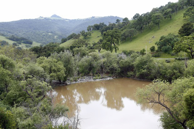 Pacheco CreekCanoeingPhoto: Gary Reyes, CC BY-SA 4.0 (via Wikimedia Commons)8.5 mi
Source: Roamze catalog (indexable pages within 10 miles, PostGIS distance)
 Drift Fence TrailHiking · ~4 min drivePhoto: ilya_ktsn, CC BY 2.0 (via Flickr)
 Gunsight TrailHiking · ~5 min drivePhoto: ilya_ktsn, CC BY 2.0 (via Flickr)
- Crest TrailHiking · ~5 min drivePhoto: ilya_ktsn, CC BY 2.0 (via Flickr)
 Serpentine TrailHiking · ~5 min drivePhoto: ilya_ktsn, CC BY 2.0 (via Flickr)
- Fish & Game TrailHiking · ~5 min drivePhoto: ilya_ktsn, CC BY 2.0 (via Flickr)
- Pacheco Falls TrailHiking · ~6 min drivePhoto: ilya_ktsn, CC BY 2.0 (via Flickr)
- Live Oak Spring TrailHiking · ~5 min drivePhoto: ilya_ktsn, CC BY 2.0 (via Flickr)
- Lyman Willson Ridge TrailHiking · ~6 min drivePhoto: ilya_ktsn, CC BY 2.0 (via Flickr)
- Deer Logic TrailHiking · ~5 min drivePhoto: ilya_ktsn, CC BY 2.0 (via Flickr)
 Willson Peak TrailHiking · ~6 min drivePhoto: ilya_ktsn, CC BY 2.0 (via Flickr)
Route details
- Distance
- 1.2 mi round trip
- Climbing
- About 977 ft
- Summit
- 2,282 ft
- Difficulty
- Moderate
- Time
- About 0.5 hours
Questions about this route
How long is the Burra Burra Trail on Burra Burra Peak?
About 1.2 mi round trip.
How much elevation gain is on the Burra Burra Trail?
About 977 ft of climbing round trip.
How hard is the Burra Burra Trail?
It is rated moderate.
How long does the Burra Burra Trail take?
About 0.5 hours round trip.
Map and trail data © OpenStreetMap contributors
