Backbone Trail - Etz Meloy Motorway
1.22-mile out-and-back trail in California with 146 ft of elevation gain.
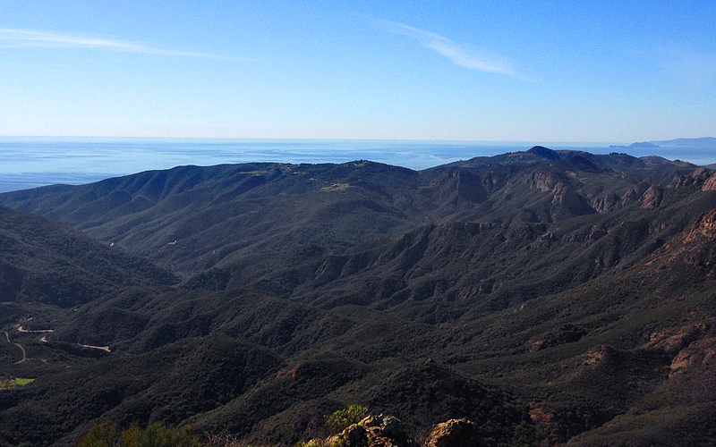 Photo: Perfect Zero, CC BY 2.0 (via Flickr)
- 0.6 mi
- round trip
- 146 ft
- climb
- Out and back
- route
- Easy
- difficulty
Is Backbone Trail - Etz Meloy Motorway open right now?
No closures listed
The National Park Service lists no closures for Santa Monica Mountains National Recreation Area.
As of · Source: NPS · Santa Monica Mountains National Recreation Area. Agencies don't list every closure — check before you go.
Best time to visit Backbone Trail - Etz Meloy Motorway
Best months: Year-round. Best months have typical highs of 55–85 °F, lows of 30 °F or warmer (32 °F where the station doesn't record snow), at most one snowy day and no more than 12 wet days.
Jan
66° / 46°
6 wet
Feb
65° / 46°
6 wet
Mar
66° / 48°
5 wet
Apr
67° / 48°
2 wet
May
67° / 52°
1 wet
Jun
70° / 55°
1 wet
Jul
73° / 58°
0 wet
Aug
74° / 58°
0 wet
Sep
73° / 57°
1 wet
Oct
73° / 54°
2 wet
Nov
71° / 48°
3 wet
Dec
66° / 44°
5 wet
Typical high / low (°F) and days with rain or snow, 1991–2020. Measured at Point Mugu Nf, CA, 13.9 mi away at 13 ft. We don't have this place's elevation, so higher spots nearby can run cooler. This station doesn't record snowfall. Source: NOAA NCEI U.S. Climate Normals 1991–2020.
Backbone Trail - Etz Meloy Motorway is a 1.22-mile out-and-back trail in California managed by the National Park Service. The route gains 146 feet of elevation.
Keep exploring — more trails worth the drive
Arroyo Sequit
~2 min drive
Accessed from Mulholland Highway, Arroyo Sequit features an intermittent stream, a loop trail, and meadows that are blanketed with wildflowers in the Spring. Arroyo Sequit is a small site that may be easy to overlook, but provides for intimate, relaxing strolls. It is also a f…
 Photo: mjhbower, CC BY-SA 2.0 (via Flickr)
Backbone Trail
~5 min drive
10.16-mile out-and-back hike in California with 3,505 ft gain/loss
Photo: mjhbower, CC BY-SA 2.0 (via Flickr)Mishe Mokwa Trail (Backbone Trail)
~5 min drive
0.72-mile out-and-back trail in California with 250 ft elevation gain
 Photo: mjhbower, CC BY-SA 2.0 (via Flickr)
Backbone Trail
~5 min drive
4.02-mile out-and-back hike in California with 2,075 ft gain/loss
Rocky Oaks
~6 min drive
Hidden amid houses, roads, and other signs of modern life, Rocky Oaks features a seasonal human made pond and a variety of plant communities that provide habitat for wildlife. While taking a gentle hike along our loop trails, enjoy vistas of the pond. Once used as a watering…
 Photo: claumoho, CC BY 2.0 (via Flickr)
Three Park Trail
~5 min drive
0.62-mile out-and-back hike in California with 133 ft elevation gain.
 Photo: sergei.gussev, CC BY 2.0 (via Flickr)
Backbone Trail - Zuma Canyon
~5 min drive
5.06-mile out-and-back trail in California with 1,675 ft gain
Circle X Ranch
~6 min drive
Tucked in the canyons above Malibu and nestled below majestic Boney Mountain, you will find Circle X Ranch. This former Boy Scout camp offers many opportunities for exploration and leisure. Hike one of the many trails that wind through this rare coastal Mediterranean…
 Photo: Seanydelight, CC BY-SA 3.0 (via Wikimedia Commons)
Nicholas Flat ADA Trail
~5 min drive
0.74-mile out-and-back hike in California with 145 ft elevation gain
Photo: Seanydelight, CC BY-SA 3.0 (via Wikimedia Commons)Nicholas Ridge Trail
~6 min drive
1.94-mile out-and-back hike in California with 844 ft gain/loss.


